


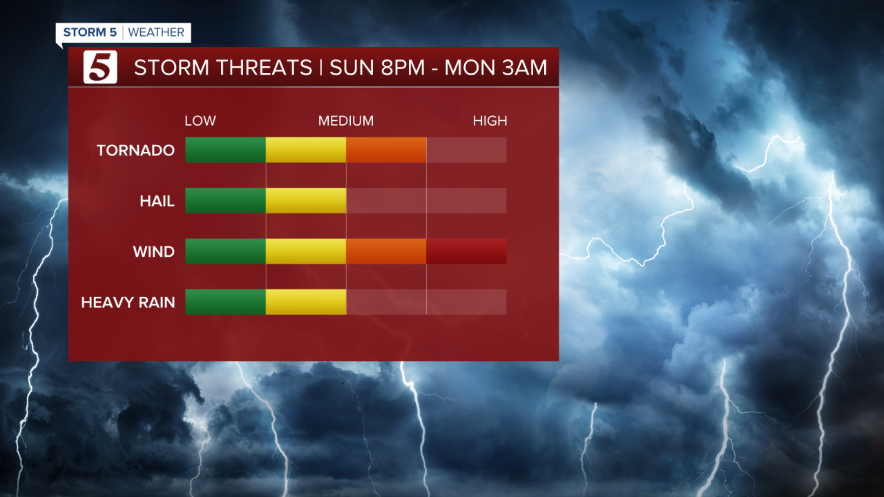
NASHVILLE, Tenn. (WTVF) — All eyes remain on Sunday night into Monday morning with the threat of severe storms in the forecast. All of the NewsChannel 5 coverage area is under a threat for severe weather. Tornado Watch in place for most of our region until 3 AM tonight.

The timing for our Storm 5 Alert is 8 PM Sunday to 3 AM Monday. Damaging winds with gusts of 70 mph are the main threat. The possibility of a few tornadoes also can't be ruled out. Large hail and heavy rain leading to flooding are on the lower end of risks.
Make sure you have multiple ways to receive weather alerts Sunday night into Monday morning!

A slip-and-slide for seniors?! Who knew it could stir laughter and tears. Photojournalist Angie Dones captures a story filled with so much joy and one that will tug at your heartstrings.
- Carrie Sharp
