


NASHVILLE, Tenn. (WTVF) — Monday, a strong cold front will make its way across our area and bring rain and thunderstorms back into the forecast.
Damaging wind will be the main concern with any strong storms that develop. However, while the tornado threat is low, it can't be totally ruled out, especially in our Northeast Kentucky counties.
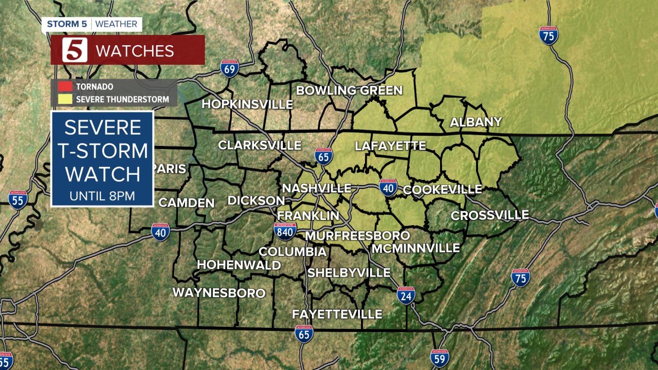
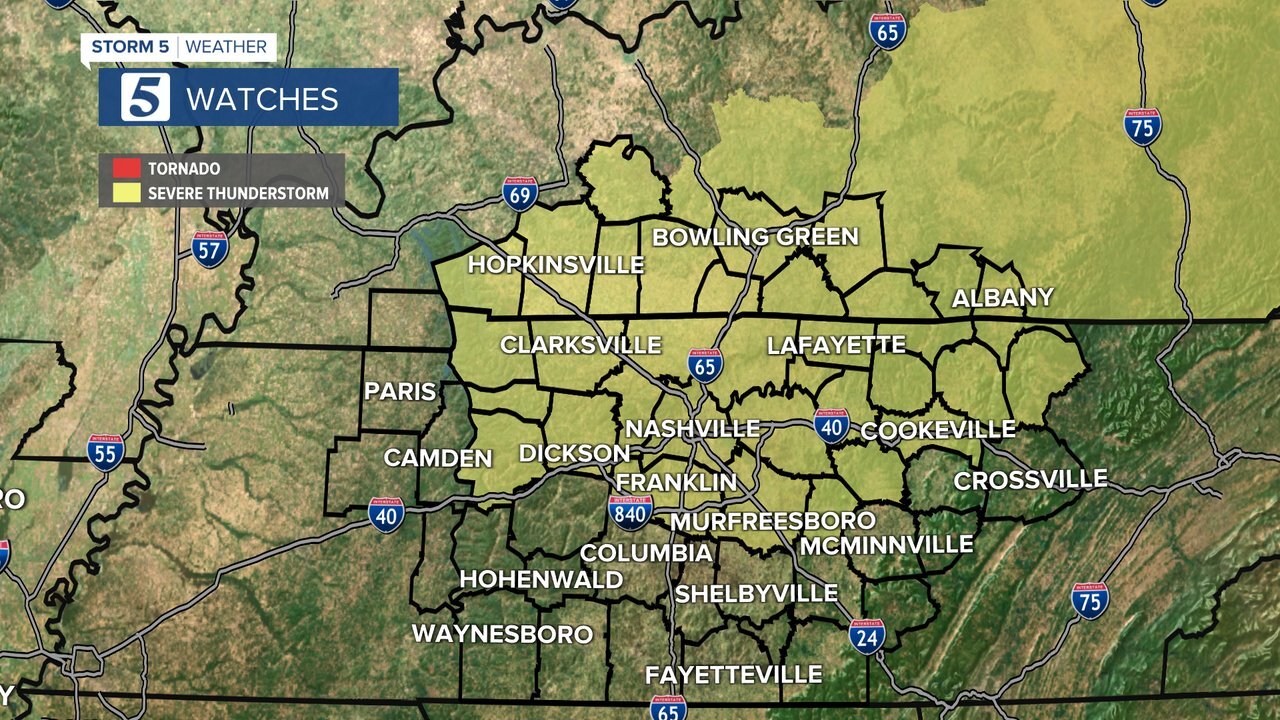
A Severe Thunderstorm Watch is in effect for the counties in yellow below until 8 p.m.
TIMING: 1 P.M. Monday- 4 A.M. Tuesday
THREATS/IMPACTS: Damaging wind, heavy rain, localized flooding
The Storm Prediction Center (SPC) has also upgraded the risk for strong to severe storms for most of Middle Tennessee, including Nashville.
The Storm Prediction Center has upgraded the risk for strong to severe storms in the @NC5 area this afternoon. Storms have already started to fire up across part of the area. Stay Weather Aware! @NC5_BreeSmith will have the latest on @NC5 at 4/5/6p #tnwx #kyw #Storm5Weather pic.twitter.com/dmXWIJLwry
— Lelan Statom (@NC5_LelanStatom) June 21, 2021
A Severe Thunderstorm Watch has been issued until 8 p.m. for Northern Middle Tennessee and South Central Kentucky. Strong storms with heavy downpours have already developed in part of the area, and more are expected as a cold front arrives.
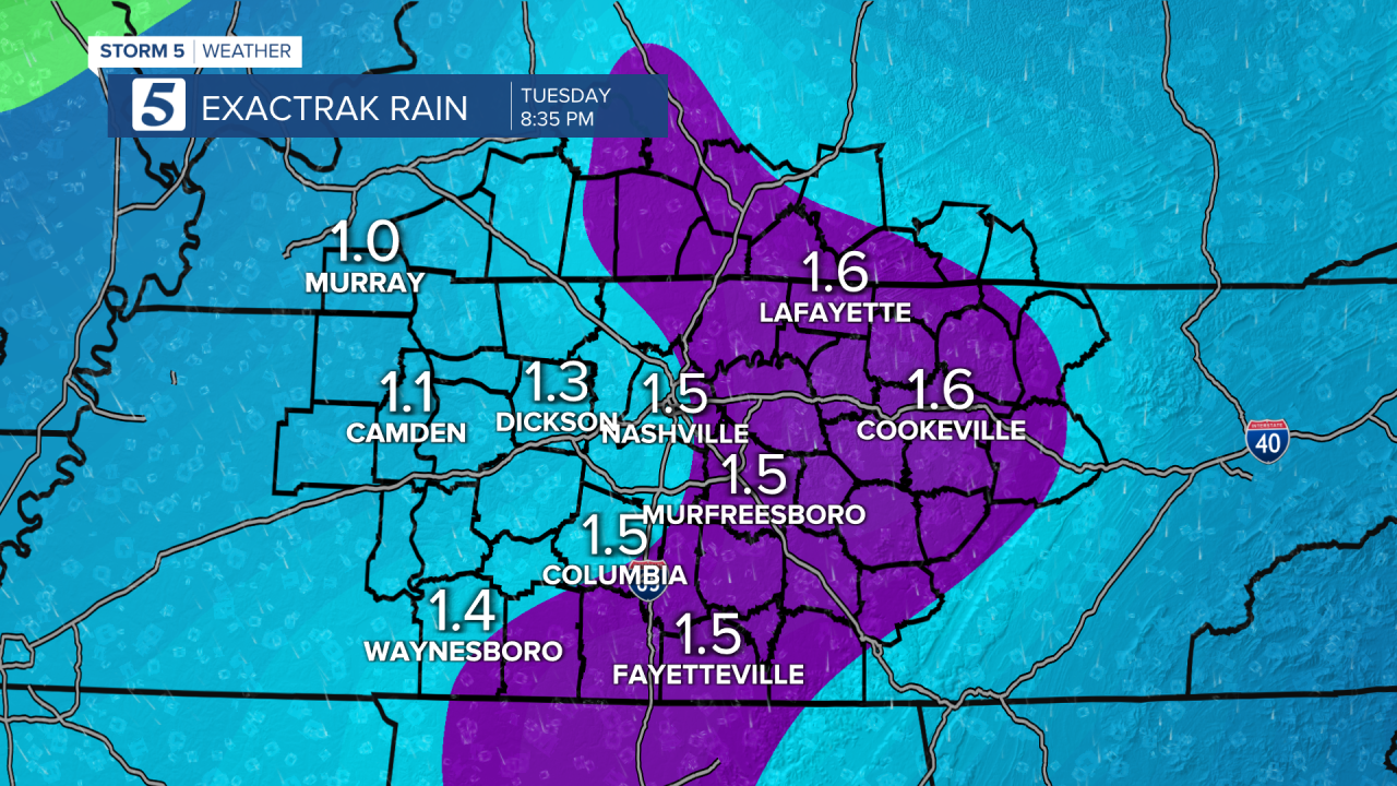
One-to-3" of rain looks possible, with locally higher amounts. The timing as of tonight's models has our first round between 1 p.m. and 7 p.m. These storms could have blinding rainfall which will also make it difficult on the roads for the PM commute.
Our northwest counties could see storms developing into the early afternoon while our East/Southeast counties will have storms into the early hours of Tuesday.
A second-round line could move in overnight from 10 p.m.- 5 a.m. This round has less severe potential, however heavy rain could irritate any flooding issues we see from the afternoon/evening.

