


NASHVILLE, Tenn. (WTVF) — Here we 'snow' again. Don't panic. This won't be as impactful as the last two winter systems that came through, but it will likely cause patchy icing early Thursday which may impact your morning commute.
Tonight's mischief maker is an arctic cold front that will have all of us shivering by daybreak Thursday.

A brief wintry mix of sleet, freezing rain, and snow may leave a light coating of wintry weather for some by daybreak Thursday. The National Weather Service has issued a Winter Weather Advisory for our Kentucky counties through daybreak Thursday due to the expected wintry accumulations overnight.
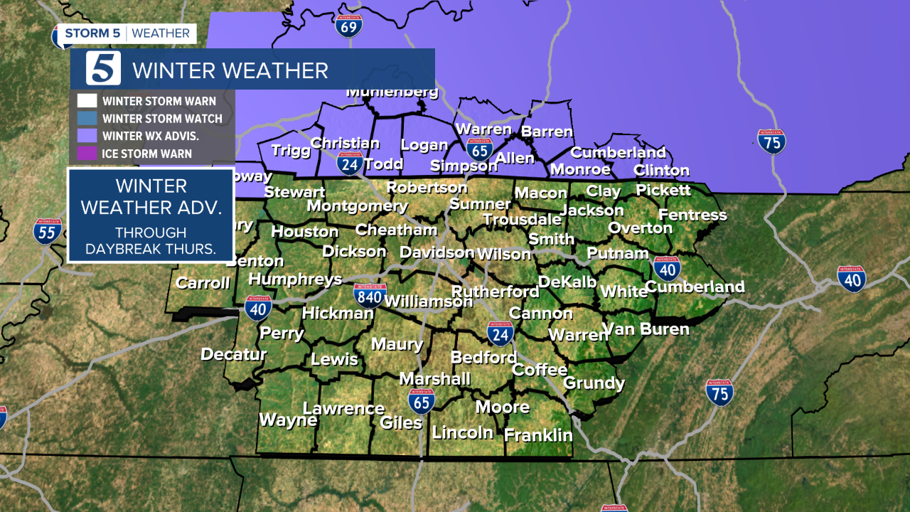
In general, accumulations tonight will be spotty and light and mainly confined to areas North of I-40.

Wind is expected to increase tonight with gusts as high as 25-30mph. This will help to dry out the roads and reduce the risk of widespread icing, but it'll come at the cost of bitter cold wind chills Thursday morning. Temperatures Thursday morning will be down in the teens and twenties, with the wind chill values dipping down into the single digits.


Thursday will be quite cold and brisk with temperatures only rising into the lower 30s. Thankfully, a long dry stretch is expected after this, with the next chance for a rain/snow mix arriving next Tuesday.

