

NASHVILLE, Tenn. (WTVF) — Raise your hand if you’re over winter! It's been a tough couple of days of wintry weather, and unfortunately, we've got a few more coming so be ready to stay in this tundra for the rest of the week.
Temperatures didn't make it out of the teens in most locations today and will drop down into the lower teens tonight keeping icy roads icy.

Our second winter storm of the week arrives Wednesday and looks to bring a slushy mix of snow, sleet, freezing rain, and rain to our area. It's a slow mover that will come in waves starting mid-morning on Wednesday and won't wrap up until mid-morning Thursday.
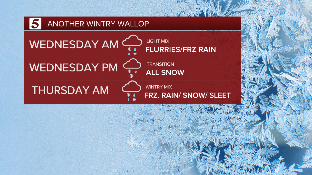
Early in the day on Wednesday, we'll have a spotty mix of flurries, sleet, and freezing rain. Late day Wednesday, we'll transition to all snow. And late Wednesday night into early Thursday morning, it will transition back to a wintry mix of snow, sleet and freezing rain.
Measuring accumulations from this event will be tricky because of the slushy frozen mess that's out there now. In general, 1”-3” of snow/sleet is possible late Wednesday with some folks seeing as much as 4”. Freezing rain will cause additional ice accumulations as well, with a glaze up to .10" expected. By Friday, our poor roads will look like a weird wintry icy plate of tiramisu.


Be ready. Be patient. Be safe! We’ll start to thaw out this weekend.

