NASHVILLE, Tenn. (WTVF/AP) — A Humphreys County community was pummeled with over 17 inches of rain in less than 24 hours over the weekend, shattering the state record for one-day rainfall by more than 3 inches.
It led to flash flooding that killed more than 20 people and destroyed dozens of homes and businesses.
The hardest-hit areas were inundated with nearly twice the amount of rain the region had seen in the previous worst-case flooding scenario, meteorologists told the Associated Press.
Lines of storms moved over the area around the small town of Waverly for hours, bringing a record amount of moisture — a situation scientists have warned may be more common because of global warming, according to the AP.
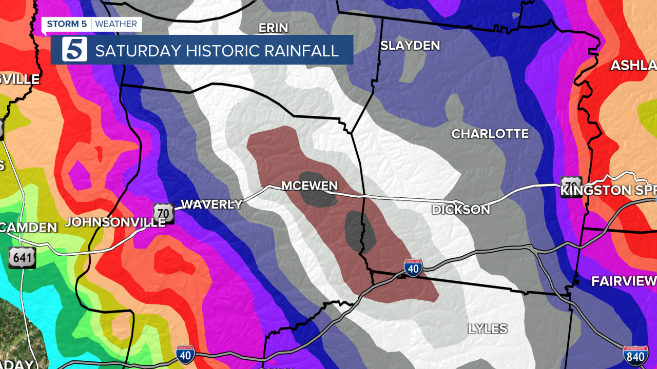
The record rainfall in McEwen turned Trace Creek into a raging river. Because of Waverly's topography, the large amounts of rain that fell also ran downhill into Trace Creek flooding the rural community.

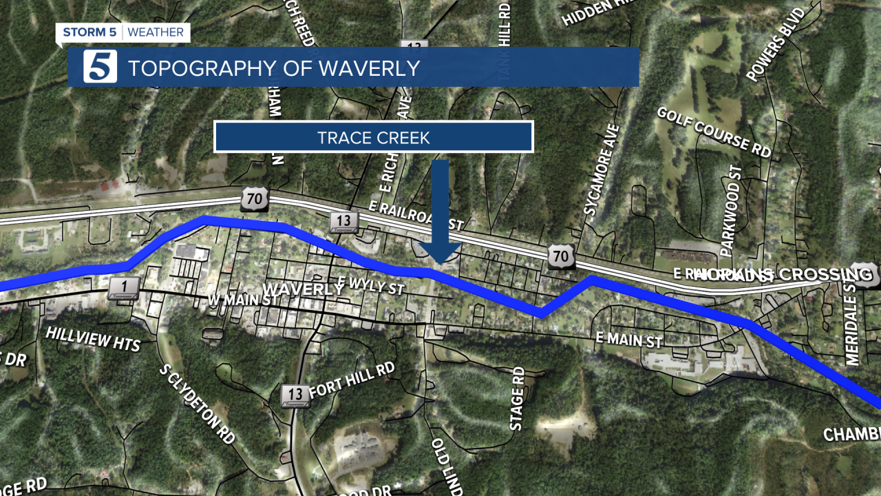
As the area flooded, debris began to collect along bridges essentially creating a dam, causing the floodwaters to backup even quicker.