


NASHVILLE, Tenn. (WTVF) — The weather roller coaster that is 2022 continues as another cold front heads towards the Mid-South bringing with it frigid temperatures and more chances for snow.
A winter storm warning is in effect for most of Middle Tennessee on Thursday from 4 a.m. until 8 p.m. Some counties in Kentucky are also under a winter storm warning.
A cold front will move Wednesday through Middle Tennessee and Southern Kentucky with cold air slowly moving in behind it. The cold air — plus an area of low pressure south of us that will usher in moisture from the Gulf — will bring the right ingredients for winter weather.

Thursday morning will start with a chance for a rain/snow mix along and south of Interstate 40 that will quickly changeover to all snow by mid-morning.


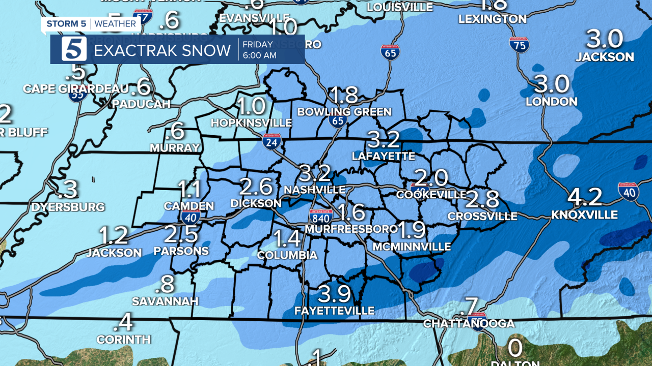
The snow will last into Thursday evening likely bringing several inches of snow to the region, with higher amounts for areas northeast of Nashville.
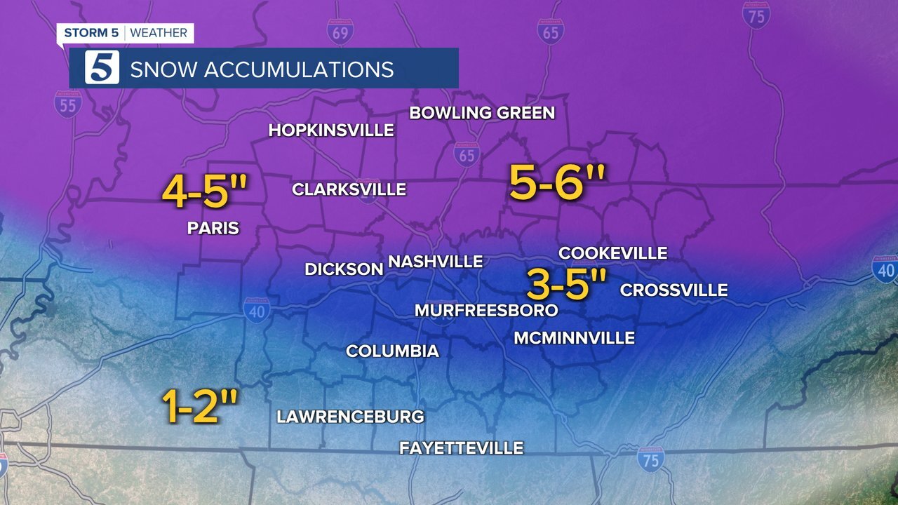
It will be several days before the area reaches temperatures above melting, so any snow that falls is expected to stay much longer than it did during the weather event this past weekend.
This is a complex forecast that has a number of variables that continue to change. Make sure you’ve downloaded our free Storm Shield App so you can stay connected and informed with this changing forecast.
