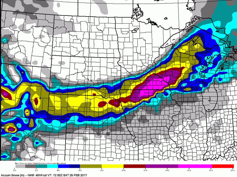
A major storm system is causing nearly every kind of weather across the country — snow, freezing rain, wind and severe thunderstorms just to name a few.
RELATED: Storm Shield app provides life-saving weather alerts
RELATED: SnowCast tells how much snow will fall at your location
The National Weather Service has already issued winter storm warnings and blizzard warnings from Wyoming to Wisconsin.

This storm's worst winter weather is going to occur where Iowa and Minnesota meet. That's where we'll see the biggest snowfall totals — possibly upwards of a foot or more — and strong, gusting winds that will likely create white-out blizzard conditions.
Wyoming, Nebraska and Wisconsin will get enough to dust off the snowblower the next day, too, but they’ll get spared the winds.

All the winter precipitation is falling behind this system where the colder air is taking over.
Ahead of the low, warmer air is in place, and that's setting the stage for strong to severe thunderstorms across the Midwest on Friday.

The main threat with Friday's severe storms is going to be strong, gusting winds as lines of fast-moving storms march across the Midwest. It's not uncommon for a tornado to spin up in this type of storm setup, either.
In addition to the strong winds and small chance for tornadoes, there may be isolated storms capable of producing large hail, too.
Following this storm, the eastern two-thirds of the country is going to feel a big drop in temperatures after tasting spring-like warmth for a week or more. It'll be a bitter reminder that winter's not finished yet, but at the same time, spring — and more thunderstorms — aren't far off.

