
October is here and we've begun the long march into the inevitable cold and snow of winter.
Some places in the United States have already seen snow. Mountain passes in Colorado were seeing snow halfway through September before fall even began.

Expectedly so, nearly all of Alaska was under some sort of winter weather alert last week. And this week, the Sierras in central California are under winter weather advisories with up to six inches of snow possible in some spots.

This isn't out of the ordinary, either.
Some of the highest elevations in the lower 48 states typically see their first snowflakes before October 1. Lower elevations, however, aren't far behind once October begins.
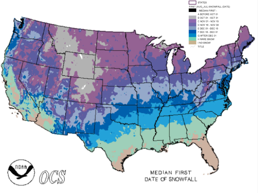
From there, it's usually early November when we start seeing snow pop up in the Northern Plains, Upper Midwest, and the Northeast. Parts of the Great Lakes can be thrown in here, too, since lake effect snow gets started around this time.
The chances for snowflakes flying only increases and moves farther south as the calendar flips closer to the end of the year.
DOWNLOAD the Storm Shield App for more than 20 winter weather alerts
It should also come as no surprise that the highest elevations and places where snow begins earliest see the most snow throughout the year.

Chances are we'll hear more and more about snow as we get closer to the first day of winter, but if the current El Niño sticks around, parts of the country may get a slight reprieve this year.
And just in case...
