


NASHVILLE, Tenn. (WTVF) — We're not out of the woods yet as the potential for strong storms will continue Friday afternoon.
A cold front will move across the region today. That will keep the chance for rain and thunderstorms with us this afternoon and tonight.
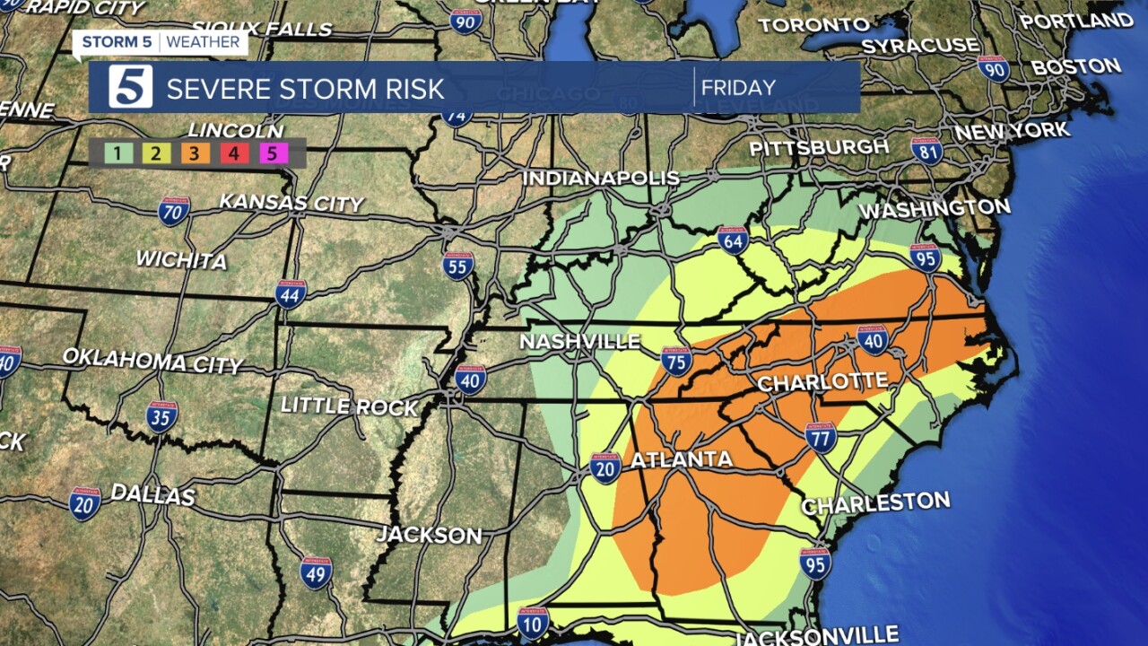
While we’re not looking for widespread severe weather, a few storms could be strong to severe. The primary threat is from damaging wind gusts and large hail, but an isolated tornado can’t be ruled out. The strongest risk, in orange on the map below, are to our south and east.
Behind this system, we could still see some spotty showers in the morning with slowly decreasing clouds. This will help keep highs in the 60s to near 70 Saturday, below our average high of 78.
Better weather is on the way for Mother’s Day: Sunshine and highs near 80.
