

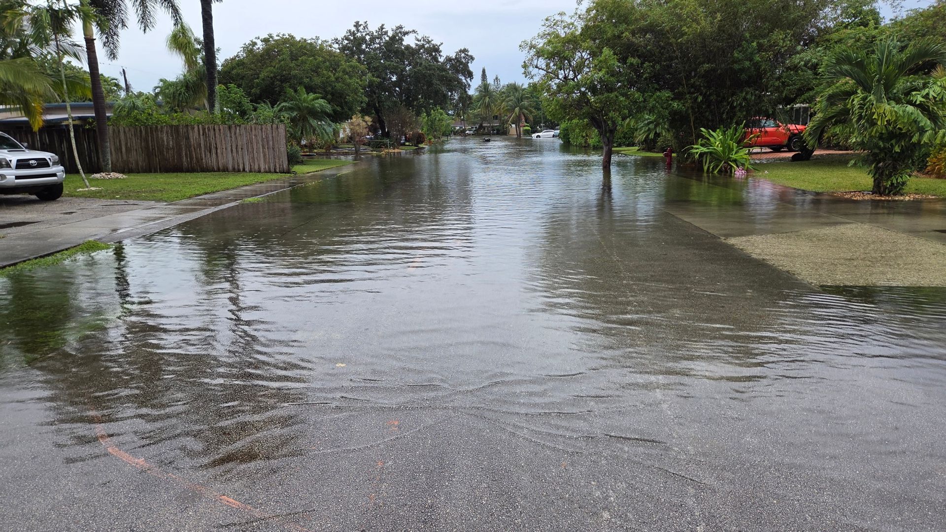


Torrential rainfall shut down roads, flooded homes and forced high-water rescues in southeast Florida overnight as a multiday flood threat unfolds along the state’s Atlantic coast.
Parts of the northern Miami metro area, including Broward County, suffered the most significant rainfall. Over a foot of rain — more than three Novembers’ worth — fell in mere hours in the Hollywood area, with some places getting walloped by more than 5 inches of rain per hour, the National Weather Service in Miami said.
Hollywood’s mayor declared a state of emergency and urged residents to shelter in place as the torrent closed parts of Interstate 95 and Florida’s Turnpike. First responders received more than 300 calls for service between 11 p.m. and 4 a.m., the Hollywood Police Department said.
The downpour caused the roof to collapse at the Temple Sinai in Hollywood, police said. No injuries were reported.
The deluge has also forced schools to shutter, including several campuses of Keiser University. All Broward County Public Schools were closed Wednesday due to flooding and will be closed Thursday as well, the school district said. A decision about Friday’s classes will be made based on weather and road conditions.
Broward County declared a state of emergency Wednesday, as did Fort Lauderdale. City officials said residents could protect their cars by parking them in the upper levels of a public parking garage for free.
Extreme rainfall like this is becoming more frequent as the world warms due to fossil fuel pollution. A warmer atmosphere can soak up more moisture, like a sponge, and wring it out in the form of gushing rainfall.
In the coming days, the biggest area of concern will shift north and include parts of the Space Coast that were inundated with historic rainfall and severe flooding earlier this month.
Some rivers are still high in those areas, which are vulnerable to flooding from the additional rain. Wind blowing onshore and high surf will also pound the Florida coast in coming days, producing dangerous rip currents and potentially major beach erosion.
After drenching Florida, this budding storm will head north, where it’s likely to throw a wrench in travel during the busy pre-Thanksgiving weekend. It will linger off the Southeast coast until Saturday, when it’ll begin to push farther north.
The storm’s East Coast impacts into early next week will depend on its path, which forecast models are still working to suss out.
Florida’s multiday deluge
Florida’s eastern coast faces three consecutive days of a Level 3 out of 4 flood risk through Friday.
A widespread 3 to 6 inches of rain is expected to fall across eastern Florida through Friday, with 8 to 12 inches or more possible in some areas along the state’s eastern coast. A foot of rain in some locations, like Daytona Beach, would mean four Novembers’ worth of rain fell in just a few days.
Pinpointing the exact communities that might endure those higher-end totals is challenging and will depend on where storms form and stall out with torrential rain for several hours.
Melbourne, Florida – the epicenter of the historic rainfall earlier this month – is in the highest flood threat area on Wednesday and Thursday. The city just had its rainiest day on record on November 2 after 11.5 inches fell there. Melbourne is about 7 inches shy of its rainiest year on record, which could happen during this week’s storm.
On Friday, the Level 3 of 4 flood risk stretches farther north to near the Florida-Georgia state line, as seen in purple below. Here, rainfall rates greater than 2 inches an hour are possible, which would add significantly to rainfall totals from the two previous days and increase the chances for serious flooding.
Wetter than normal periods are not a surprise in Florida this fall and winter as the super El Niño continues to strengthen, changing global weather patterns and increasing storm chances across the US Southeast.
Holiday travel threat could emerge
Forecast models are still sorting out exactly where the storm will go after Florida, but there are two favored scenarios at this time, both of which could impact travel starting this weekend. Last year, the weekend prior to Thanksgiving was one of the busiest travel periods of the holiday week, according to TSA screening data.
Scenario 1: The storm tracks near or into the Southeast coast this weekend and then darts into the Northeast by Monday, bringing a sloppy mix of rain, wind and possibly coastal flooding with it.
This track could cause airport delays and create treacherous travel on roads, including along the parts of highly traveled Interstate 95.
Scenario 2: The storm stays along the the Southeast coast, delivering rain, wind and coastal flooding to the region before heading out to sea, minimizing its impacts farther north along the East Coast.
Right now, it’s looking like the first scenario is most likely, but that could change as the forecast comes into focus later this week.
There’s also a medium chance the system could eventually transition into a fully tropical or hybrid storm if it remains over water long enough, according to the National Hurricane Center.
But, that possible designation makes little difference when it comes to impacts: the storm will bring strong winds, heavy rain and coastal flooding either way.
Kyle will be the name of the Atlantic hurricane season’s next storm.
The-CNN-Wire™ & © 2026 Cable News Network, Inc., a Warner Bros. Discovery Company. All rights reserved.
