


Update: The Storm 5 Alert for early Thursday has now expired.
Original story:
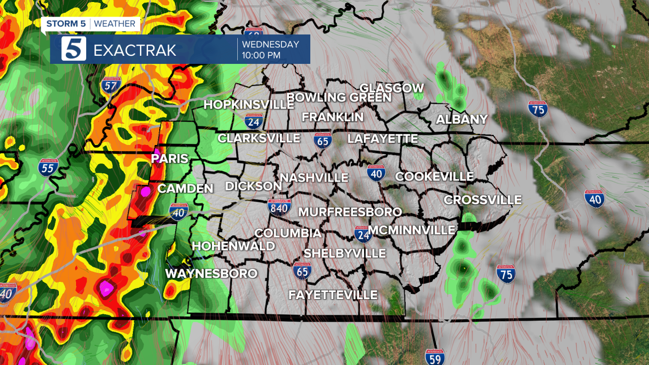
Another spring storm system will make its way through Middle Tennessee and Southern Kentucky overnight, promoting a Storm 5 Alert.
Strong to severe storms are forecasted, which could produce damaging wind, isolated flash flooding, hail and isolated tornadoes. The Storm 5 Alert will be in effect from 9 p.m. Wednesday through 7 a.m. Thursday.
Although the greatest threat is in West Tennessee, the storm system will move into the area overnight so it's important to make sure you are weather ready and have ways to receive weather alerts while you sleep.

Wind is expected to pick up on Wednesday afternoon and windy conditions will last overnight. Some heavy downpours are possible, which could lead to isolated flash flooding. Hail is also a concern.
While the threat is low, isolated tornadoes can't be ruled out.

Any chances for severe weather should be gone by the morning commute, but a few lingering showers, as well as a cloudy sky, will start your Thursday.

