
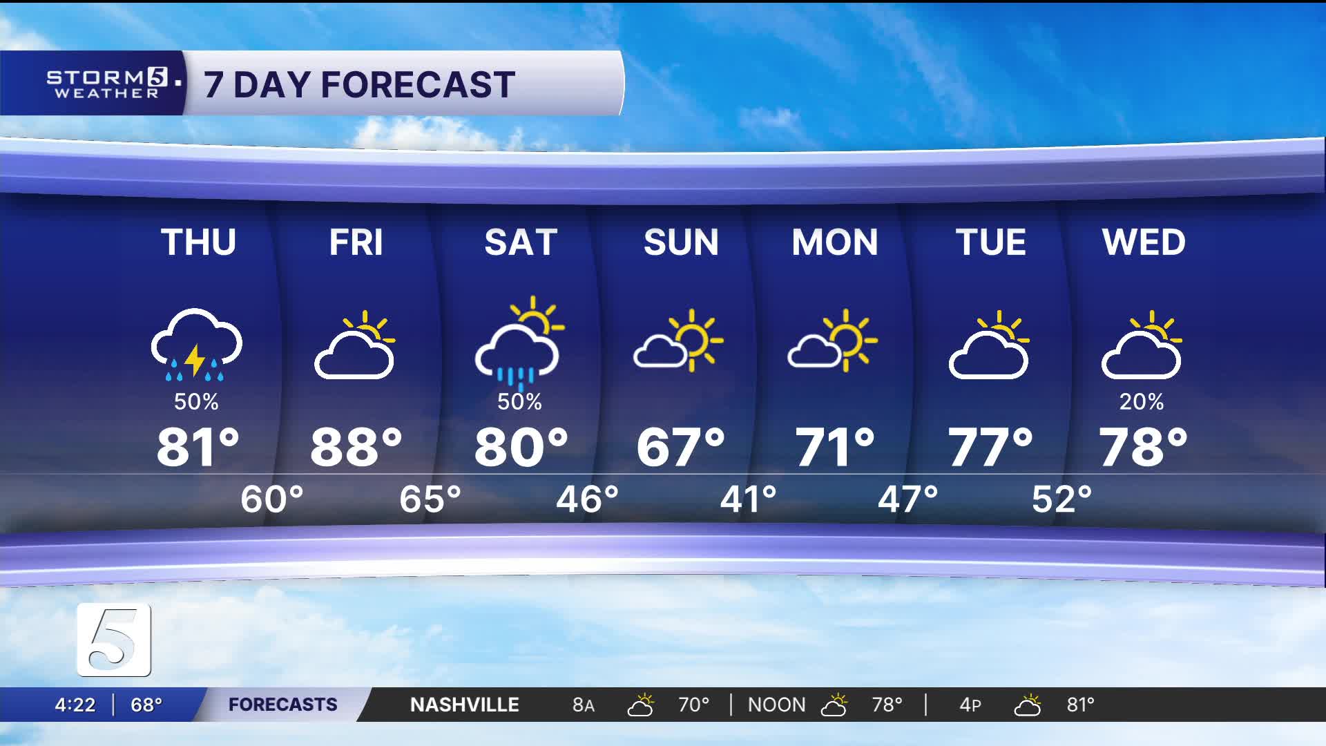


Low Storm Chance this Evening, Hot Tomorrow
Forecast:
Tonight: Showers / Storms Move Out |Low: 60| S 5-10
Tomorrow: Partly Cloudy |High: 88 | SSW 5
In Depth:
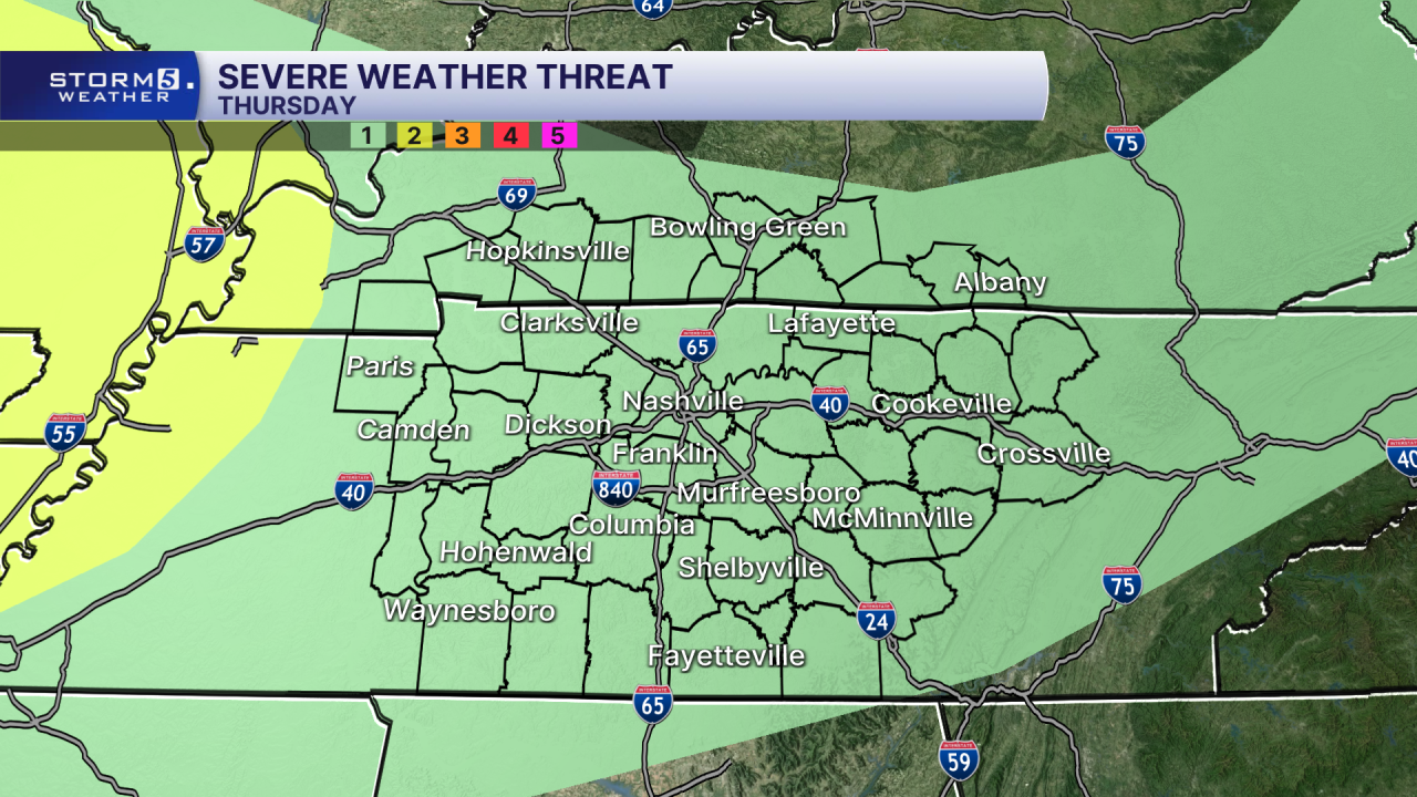
The possibility of rain returns to the region this evening, but it's not traveling alone. A few thunderstorms, even strong to severe, can't be ruled out. The good news is the chance for severe storms is overall very low. Everyone in the mid-south has been highlighted under a low end, 1 out of 5 risk.
The late evening and overnight rain won't significantly impact our temperatures. We'll be flirting with record highs on Friday with upper 80s expected, record is 90 degrees.

We're keeping a close watch on a cold front that'll be paying us a visit on Saturday. The good news is it brings the chance for beneficial rain with no chance for severe storms.
Unfortunately it won't be enough to make a major dent in our drought problem, but it's a step in the right direction.

Temperatures behind it fall into the 60s and 70s for early next week!
