
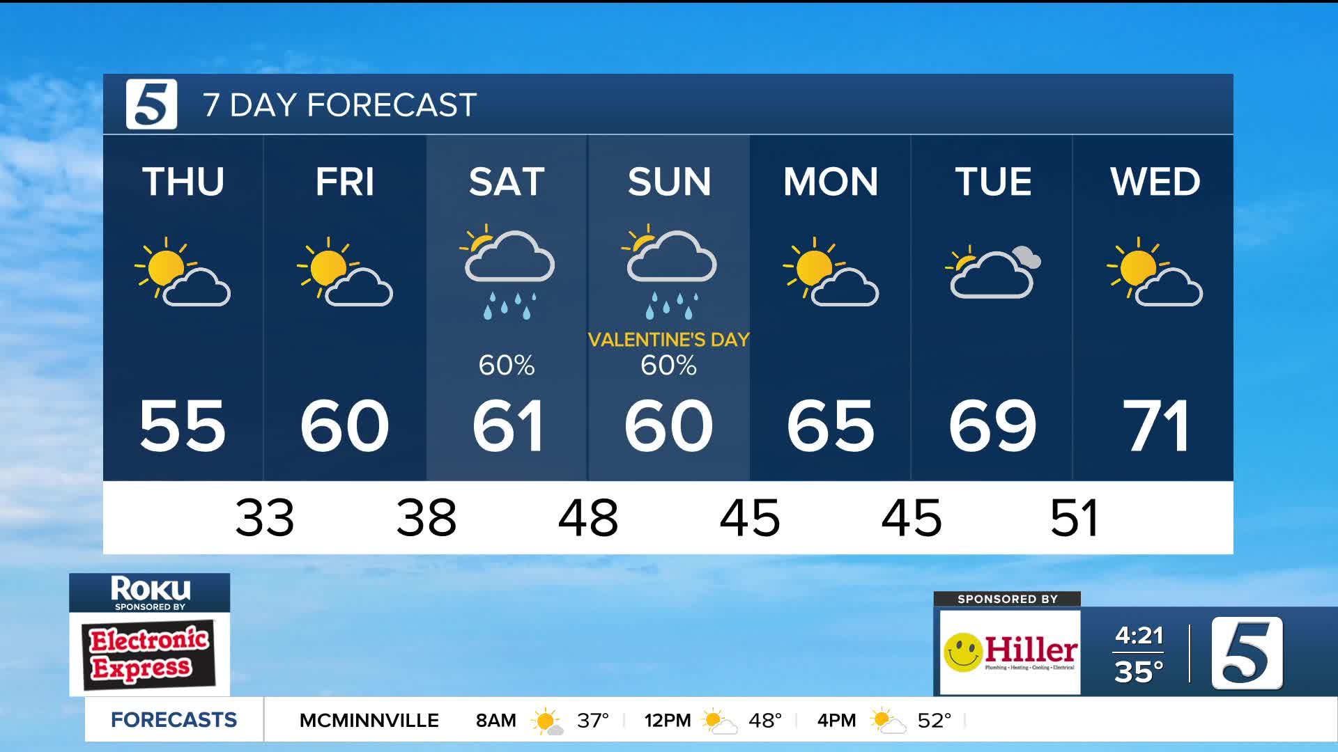


Mild Days Ahead with Weekend Rain Chances
Forecast:
Tonight: Mo. Clear then Pt. Cloudy |Low: 33| N-5
Tomorrow: Sun/Clouds Mix AM then Clouds Increase |High: 60| SE-5
In Depth:
It was another gorgeous day across Tennessee and Kentucky with lots of sunshine and highs in the mid 50s. This pattern continues thanks to an area of high pressure with a repeat of conditions tomorrow.

Rainfall returns to the region by this weekend, potentially spoiling your Valentine's Day plans. Make sure to grab an umbrella for you and your date!

Heavy rain will pick up Saturday evening, lasting overnight and into the early morning hours of Sunday. Things will begin to quiet down Sunday afternoon. Although we are not anticipating severe weather, a few rumbles of thunder cannot be ruled out early Sunday.
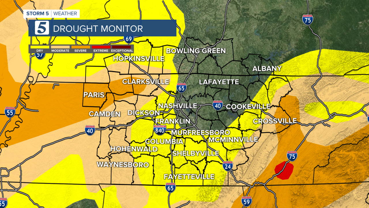
While the timing isn't the best, we do really need the rainfall. Overall 1-3 inches of rain will be possible thanks to this system which is very beneficial for our current drought concerns.
Make sure you spend today or tomorrow double checking that your storm drains and gutters are clear of ice storm debris.
As we look into next week, early spring weather returns with 60s and 70s.
