


WINTER STORM HEADED TO Middle Tennessee & Southern Kentucky
Forecast:
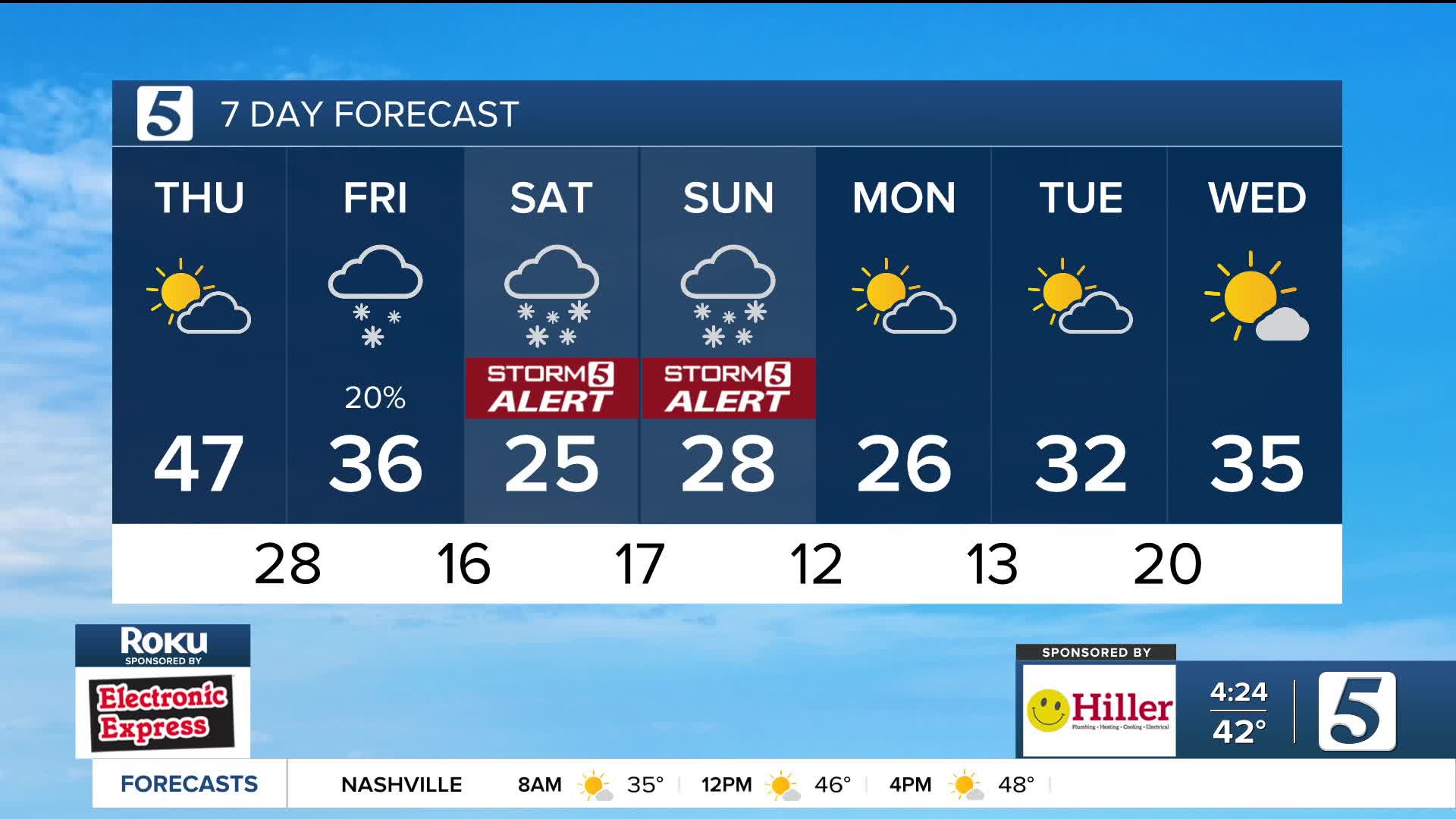
Today: Partly Cloudy | High: 48 | NNE 5
Tonight: Clouds Increase | Low: 27 | NNE 5
For the first time this winter, a significant storm is forecasted to impact areas from Texas to the Carolinas, leading to significant travel impacts and more.
TIMING: Overnight Friday Night - Sunday Evening
THREATS/IMPACTS: Heavy Accumulating Snow, Ice
Arctic air is moving into the Mid-South overnight Friday and staying through early next week. An area of low pressure to our south is pushing moisture into the region at the same time, bringing the chance for a wintry mix.

We'll begin to see snowflakes overnight Friday into early Saturday morning, transitioning into sleet and freezing rain by the afternoon. This pattern continues overnight Saturday and early Sunday. Snowfall will return Sunday afternoon before tapering off into the evening hours.
It’s important to make sure you have enough food to get you through the weekend, batteries for flashlights, etc. should you lose power, and keep your mobile devices charges in the event of power outages.
Continue checking back with the Storm 5 Weather Team as we continue to fine-tune the forecast as more data becomes available.
If you're able to, stay home over the weekend as the chances of roads in poor shape for travel remain high.

Into early next week temperatures stay very cold, making it hard for anything that does fall to melt.
