


Keeping an Eye on Friday Severe Chances
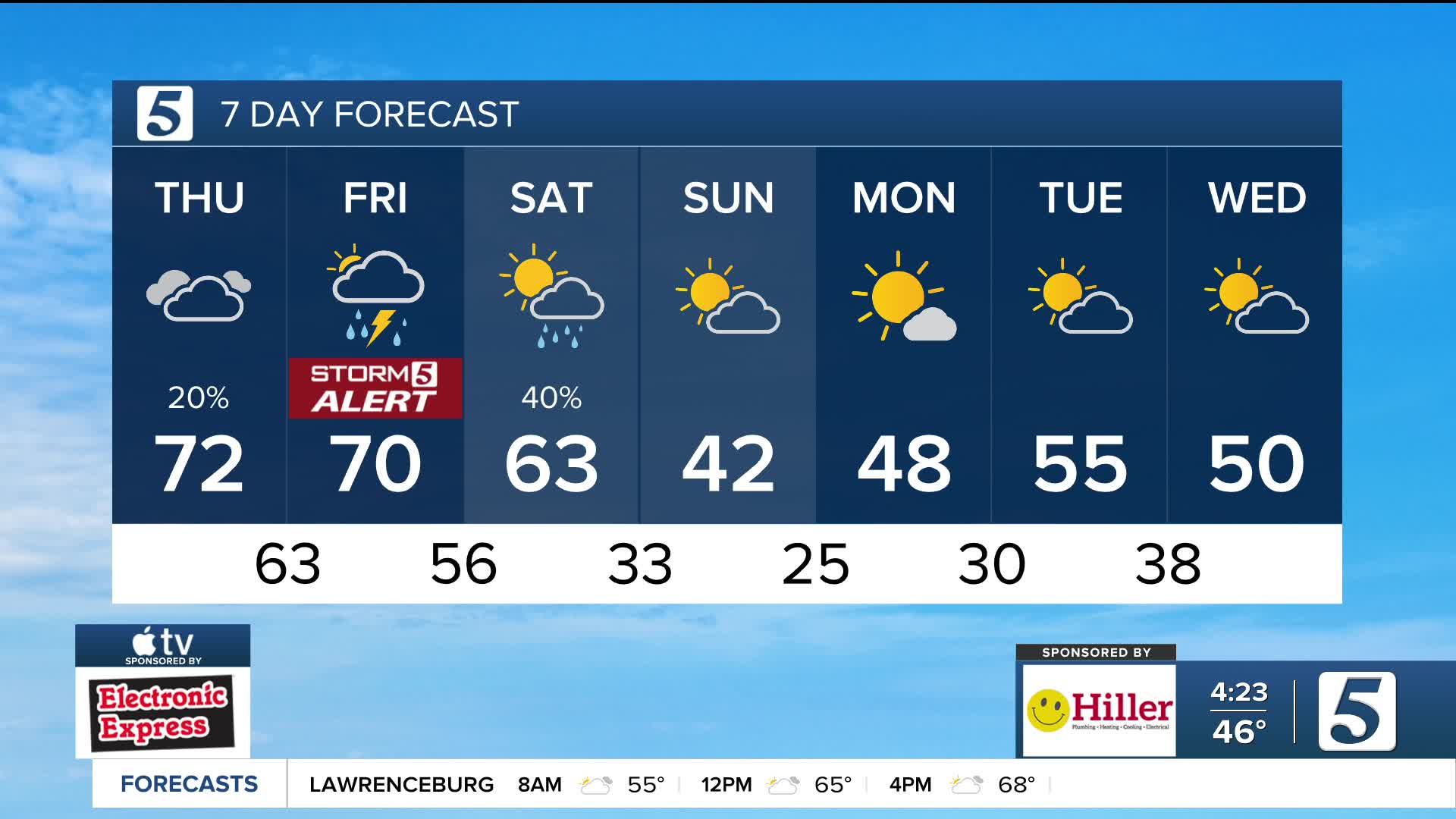
Forecast:
Tonight: Showers & Storms, Breezy |Low: 62| S 10-15, Gust: 30
Tomorrow: Widespread Showers, Sct. Storms |High: 71| S 10-15, Gust: 30
In-Depth:
Strong southerly winds are driving up our temperatures to near record warmth. The atmosphere is ramping up ahead of tomorrow's storm chances.

A Storm 5 Alert is in place for Friday as we track the potential for severe weather. Current projections suggest two rounds of rain and storms.
The first round looks to arrive around sunrise Friday and could create slowdowns during the morning commute. A temporary break in rain is possible during the middle of the day, followed by another round of storms developing Friday evening and continuing overnight through Saturday morning.
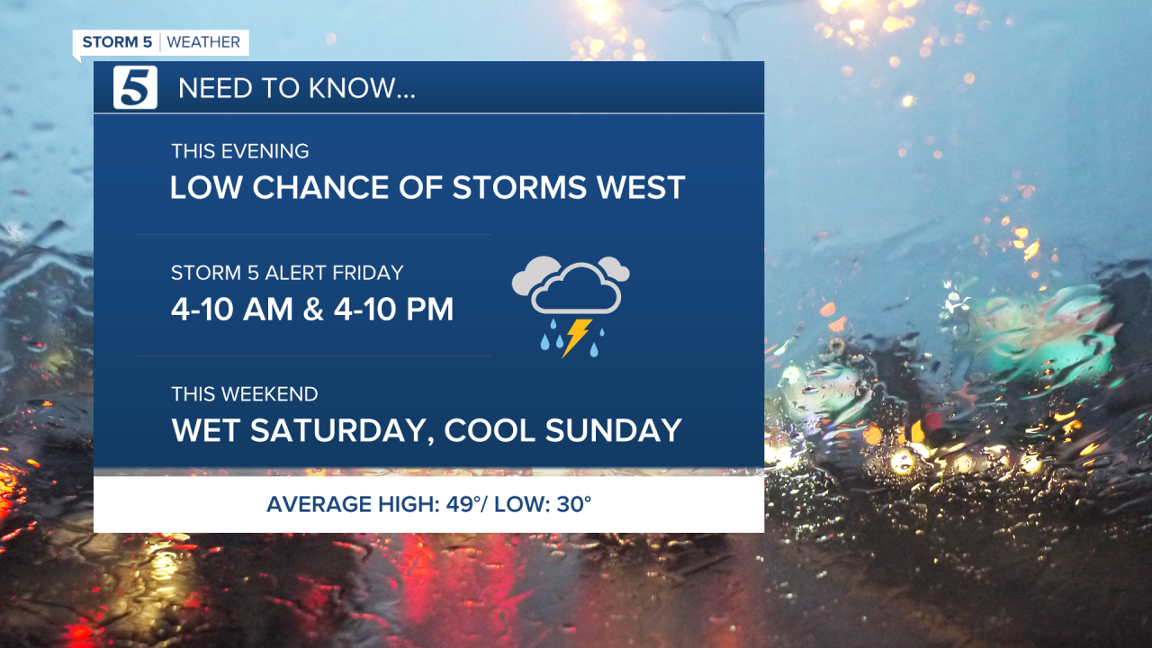
The Storm Prediction Center has placed Middle Tennessee under a Level 1 (Marginal Risk) for severe storms Friday evening. The main concerns include strong, damaging winds and localized flooding, while the tornado risk remains low.

Rainfall totals of 1 to 3 inches are expected across much of the area, with higher amounts approaching 4 inches possible in southeastern locations.
Once the rain moves out Saturday afternoon, much colder air will surge in behind it on gusty northerly winds. By Sunday, winter conditions return, and heavy coats will be needed once again.
