

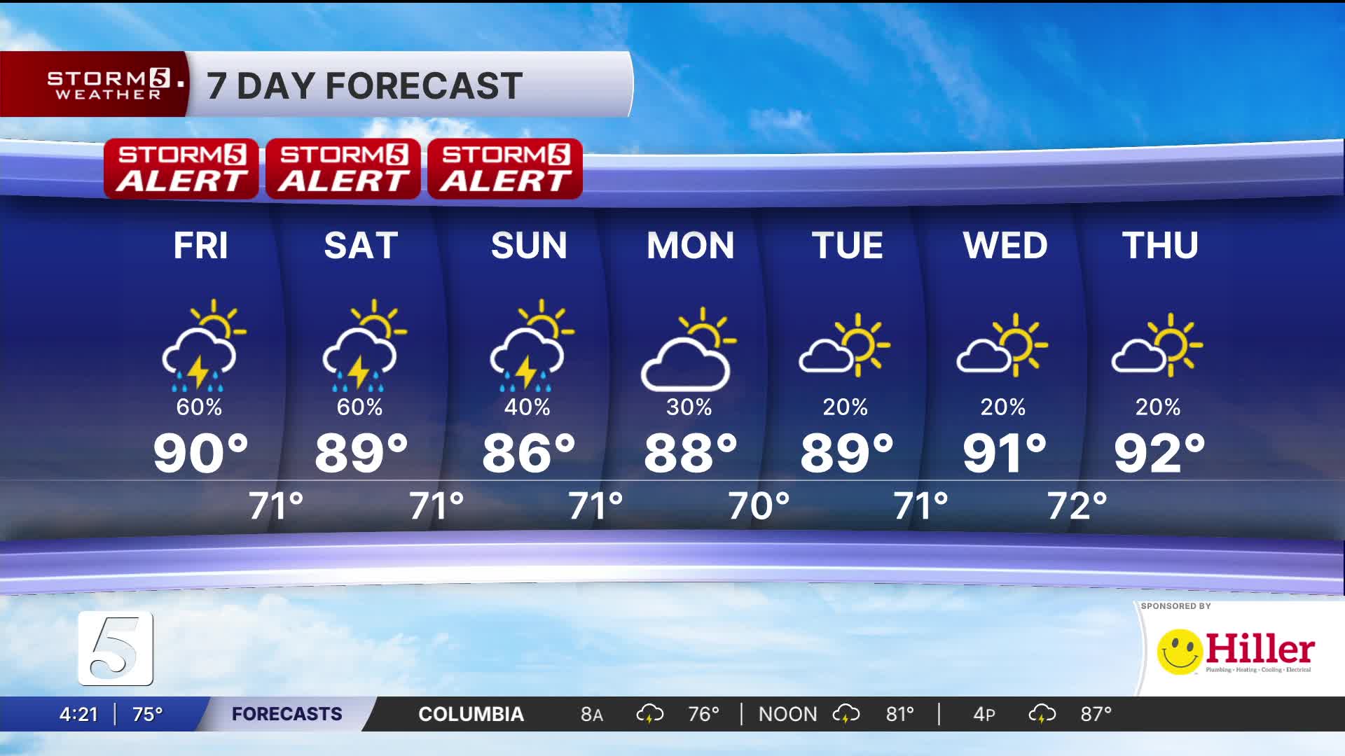


Flood Watch Through Sunday Evening
Locally Heavy Downpours Possible Today Through the Weekend
Forecast:
Tonight: Mo. Cloudy, Area Showers & Storms |Low: 71|SW 5-10
Tomorrow: Mo. Cloudy then Mix of Sun & Clouds, Area Showers & Thunderstorms |High: 89| SW-5
In Depth:

A slow moving frontal boundary has prompted a Flood Watch now through Sunday evening with 3-5 inches of additional rainfall possible during that period. Some locally heavier amounts can't be ruled out. The active, wet pattern doesn't just been the risk for flooding but also for severe storms.
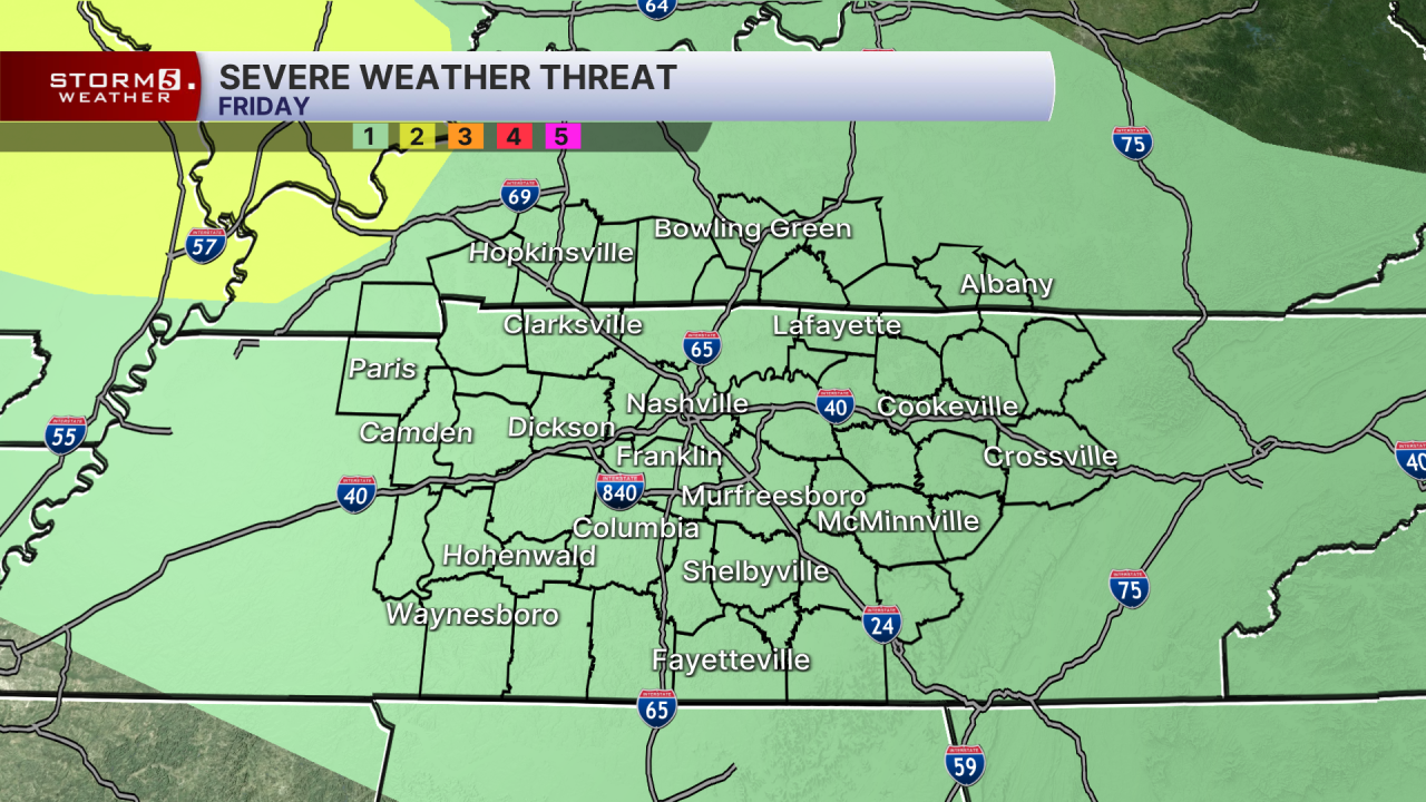
We're in a 1 out of 5 risk today (Marginal), for strong to severe storms late evening and overnight. Primary concern is damaging winds.

We do it again tomorrow but the risk is slightly higher for severe storms. A slight risk has been issued for the majority of the mid-state with a chance for damaging winds, small hail and a low tornado risk across our northwestern viewing area.
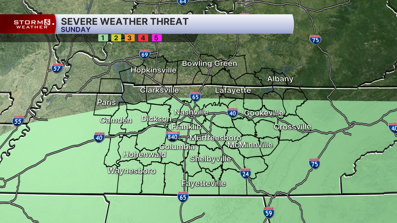
We still can't shake the pattern by Sunday with a continued chance of flooding and a low risk of severe storms.
