


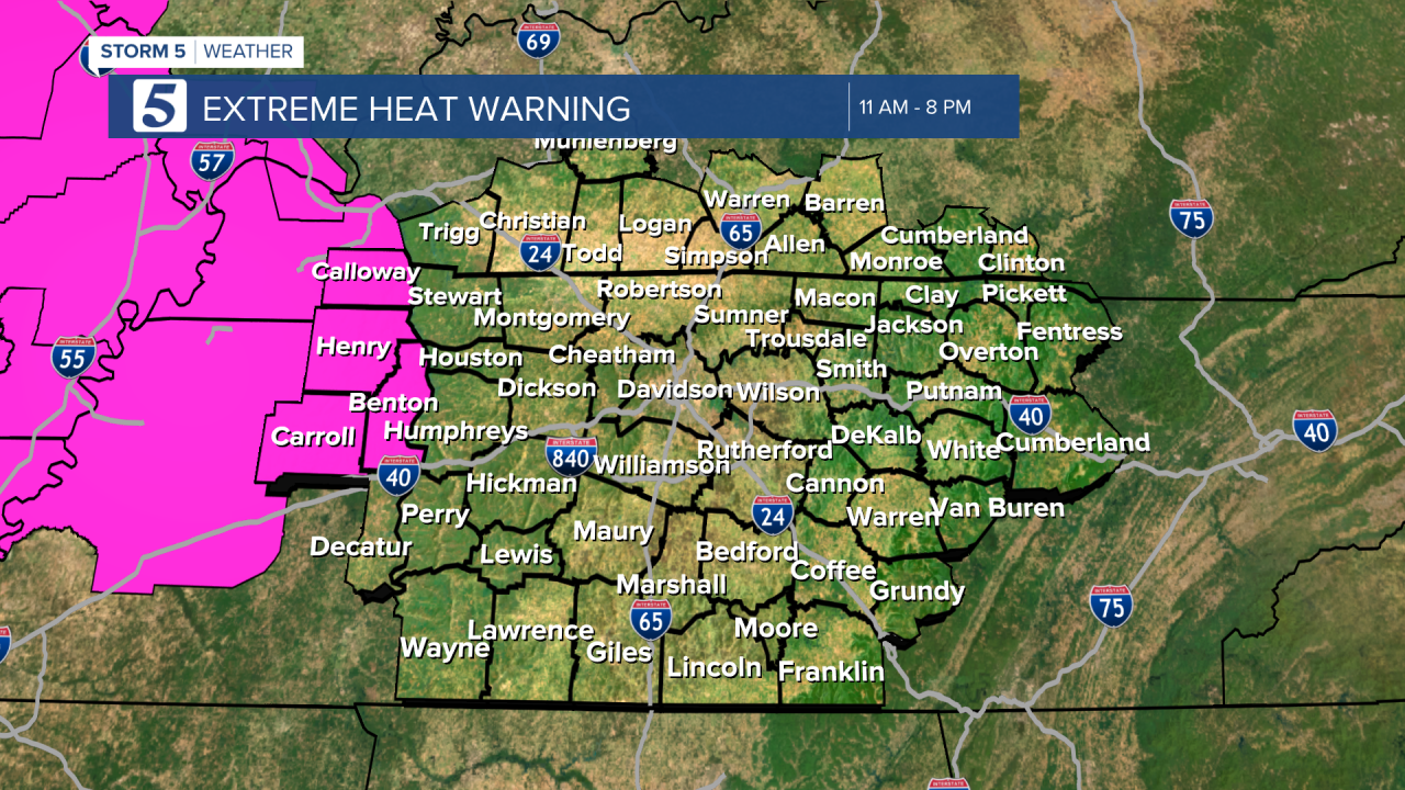
Heat Alerts Again Tomorrow
Forecast:
Tonight: Partly Cloudy & Muggy | Low: 75 | SW 1-6
Monday: Partly Cloudy, Hot & Humid w/ Pop-Up Storms | High: 97 | WSW 3-8
In Depth:
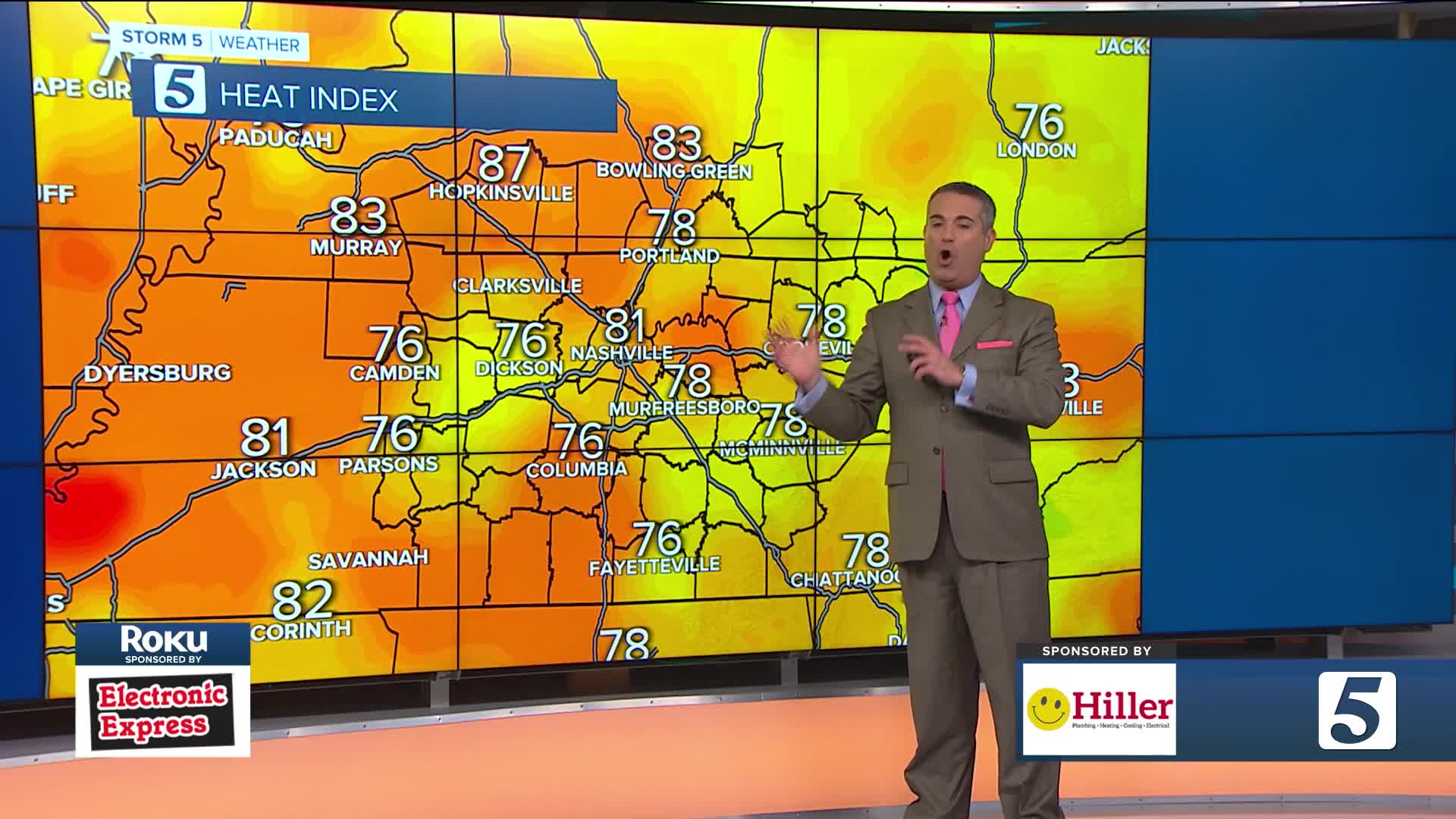
Although we're no stranger to the heat, it's been brutal! An excessive heat warning and heat advisory are in place until sunset tonight. Meaning it will feel like 105-110 degrees this evening.

WTVF
WTVF
As we head into the start of the work week, we re-rack and do it all again. Another heat advisory is already in place for the majority of the viewing region. Tomorrow also brings a low chance for severe thunderstorms during the afternoon. Flooding and gusty winds are the largest threats.

wtvf
