



NASHVILLE, Tenn. (WTVF) — Dangerously Hot, Severe Storms
Forecast:
Tonight: Warm & Muggy |Low: 75| Light
Today: Hot & Humid, 40% Shower & Storm Chance |High: 96, Heat Index: 105-112|NE-5
In Depth:
Scattered showers and thunderstorms are expected to continue throughout the evening, with some turning severe. Storms are anticipated to produce gusty winds, torrential downpours, small hail and localized flash flooding.
Storms will weaken quickly around sunset once they lose their energy. Warm, humid conditions will continue overnight with some patchy fog possible in the morning.
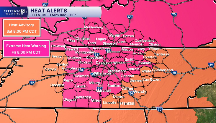
Temperatures tomorrow will be a few degrees cooler but it'll still be a toasty Independence Day. A Heat Advisory is in place tomorrow until 8 PM.

Scattered thunderstorms are once again expected to develop during the afternoon and early evening. While the overall severe weather threat is lower than today, a few storms could still produce gusty winds, heavy rainfall and lightning.
A few showers could continue after sunset, which may affect Fourth of July firework shows. We'll be keeping a close watch on radar.
The intense heat finally eases beginning next week as the heat dome weakens. We'll see highs return to the low 90s.
