


Keeping an Eye to the Sky this Evening
Forecast:
Tonight: Partly Cloudy & Muggy, Patchy Fog Poss. | Low: 68 | SW 0-5
Sunday: Partly Cloudy, 20% Chc. for a Storm | High: 84 | WNW 5-10
In Depth:
It was another active afternoon for us with continued thunderstorm chances. The good news is the Severe Thunderstorm Watch we had earlier was allowed to expire early.
The strongest and main line of storms has already exited the region. Thunderstorms still have the potential to form as we head closer to sunset. The overall severe risk is much lower.
More good news is our severe risk for Sunday has significantly decreased! Although isolated pop-up thunderstorms could happen, things are looking much better.
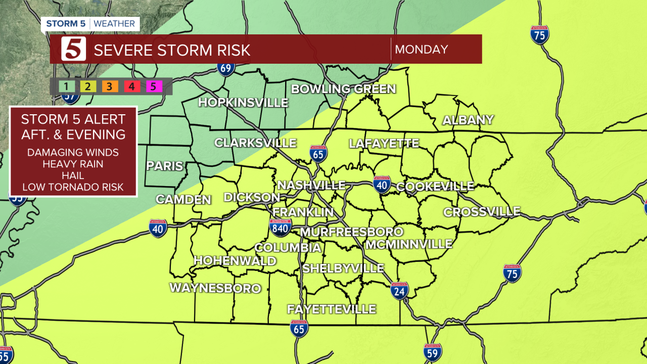
Active again as we go into Monday which has prompted a Storm 5 Alert. Similar to today and yesterday, the primary concern continues to be damaging winds and heavy downpours that could lead to localized flooding.
