


Storm 5 Alert Sunday Evening followed by a Hard Freeze
Forecast:
Tonight: Becoming Mostly Cloudy & Breezy | Low: 55 | S 5-15
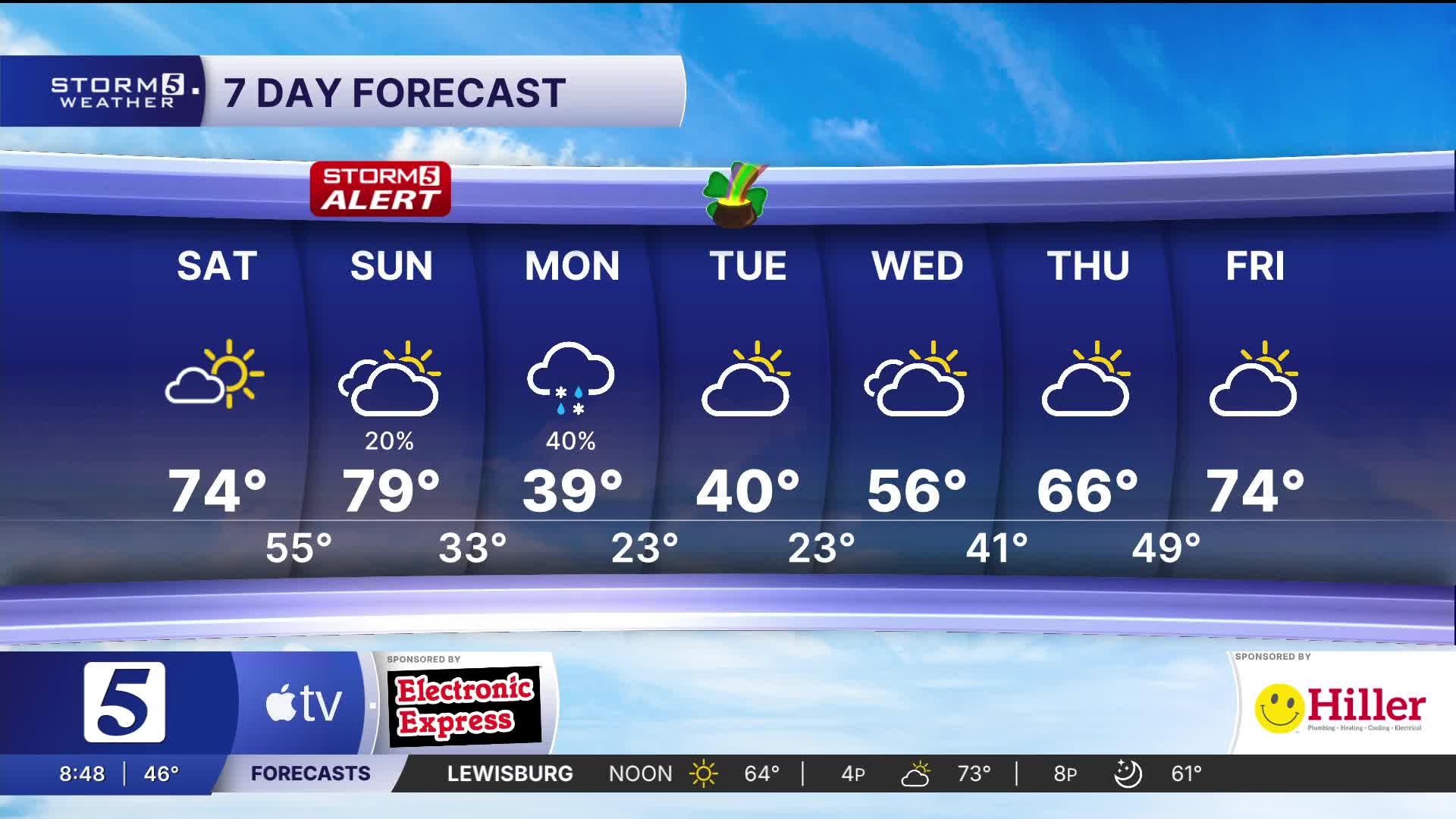
Sunday: Windy & Mild, Storm Chances Sunday Night | High: 79 | S 20 G 30+
In Depth:
Today shaped up to be a gorgeous day with highs in the 60s and sunshine. Overnight stays mild with lows in the mid 50s.
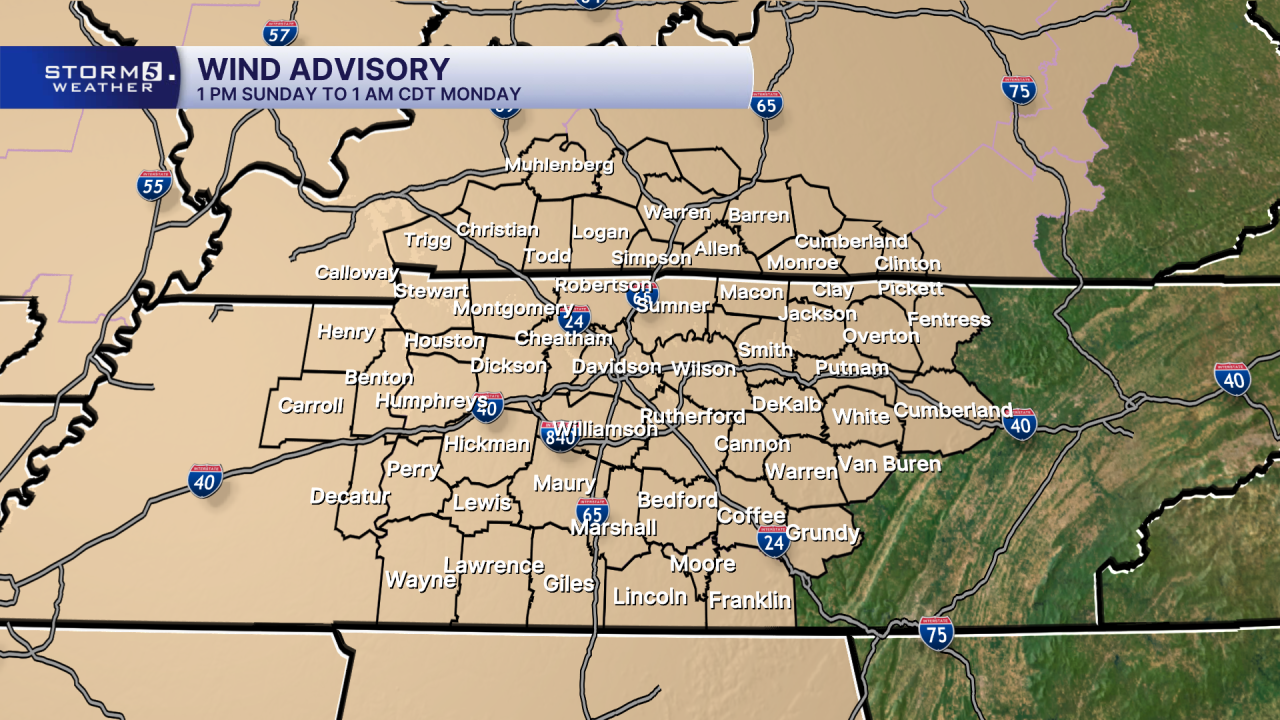
Tomorrow is the big day we're keeping a close watch on. A Wind Advisory will begin well ahead of the system arriving, at 1 PM. Winds outside of any severe risk could gust up to 40-45 mph.

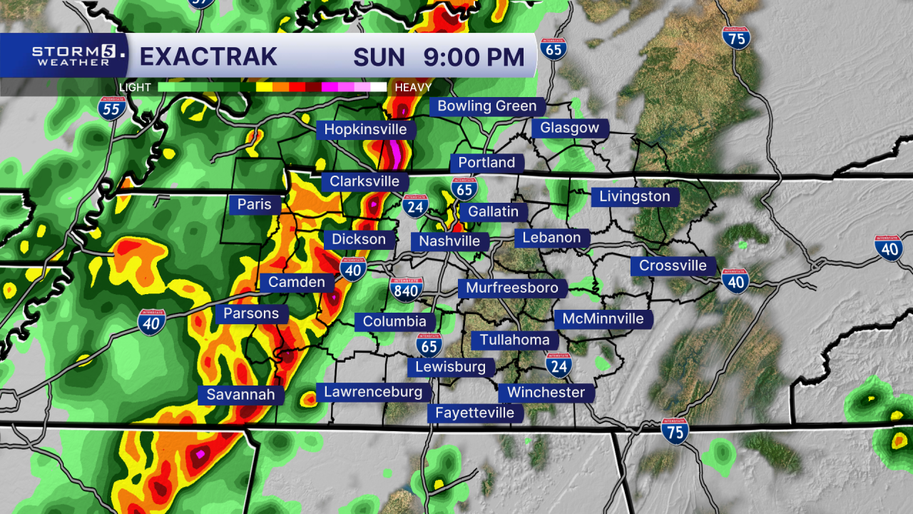
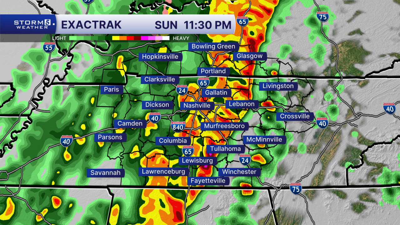
The cold front will arrive after sunset, bringing with it the chance for severe weather. A Storm 5 Alert will begin at 7 PM going through 2 AM. This will more than likely be a major wind event, but a quick spin-up tornado can't be ruled out.
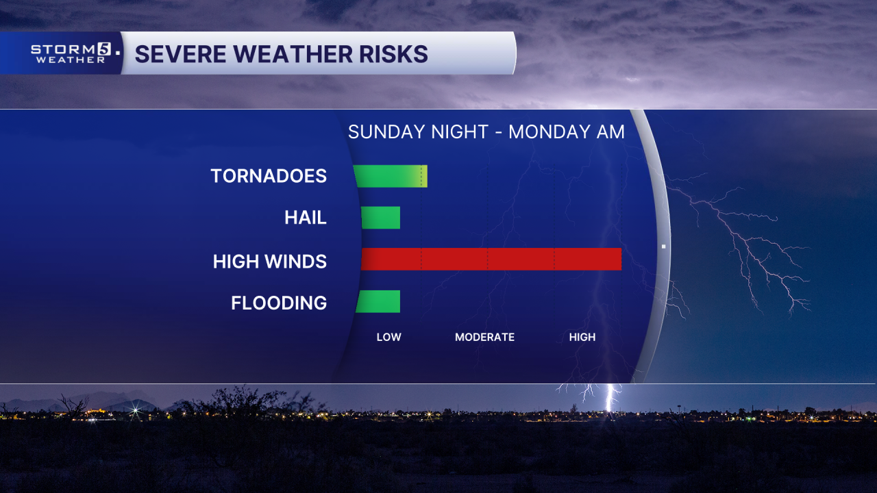
Between 10:00 and Midnight is when the line should move through the metro area, and exit the Plateau after 2:00 AM Monday morning.

Arctic air will quickly fill in behind the storms, dropping our temperatures from the mid 70s Sunday afternoon into the teens and 20s Monday overnight into Tuesday. A few snowflakes will even be possible early Monday.
A hard freeze will be possible, so make sure to cover any sensitive outdoor items.
Luckily the cold weather is short lived, with temperatures climbing by mid to late week.
