
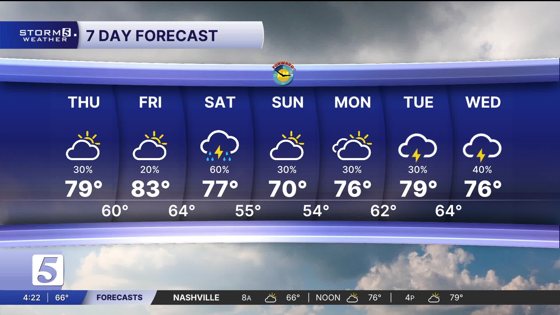


Very Warm Again Today, Tracking Saturday's Storm Chances
Forecast:
Tonight: Partly Cloudy, 20% Shower & Storm Ch. |Low: 61|S 5-10
Tomorrow: Mix of Sun & Clouds, Isolated Shower & Storm Chance North |High: 80| S 10-15, Gusts: 25 mph
Temperatures today have remained well above average in the mid 70s. A mixed bag of sunshine and clouds continue across the mid-state. Rain can't be entirely ruled out this evening but the majority of us will remain dry.
A low end Marginal Risk is clipping our northern most Kentucky counties.
Friday brings dry and hot weather. We anticipate our first 80 degree day of the season and it'll be the first one since October 18th of last year.
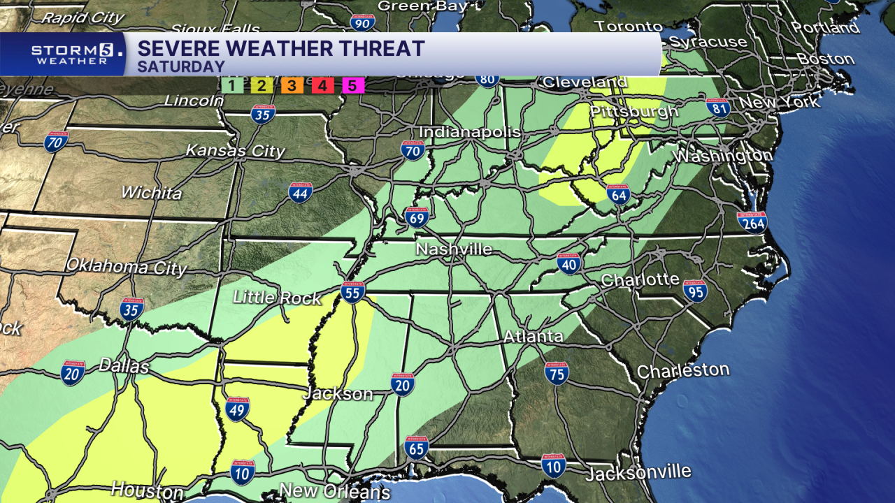
A pattern change arrives Saturday thanks to a cold front. All of Tennessee has been highlighted in a Marginal Risk with a low end chance of severe weather possible. Primary concern is strong, damaging winds and heavy rain.
