


Record Warmth Today, Iso. Severe Storms Tomorrow
Forecast:
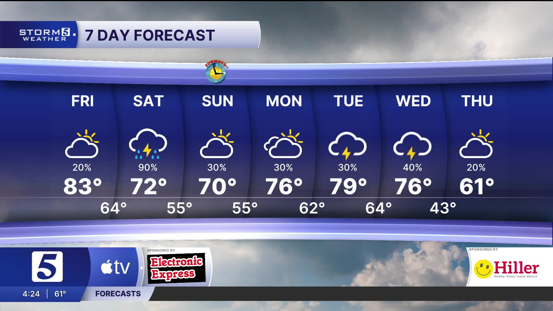
Tonight: Partly Cloudy, Breezy |Low: 65| S 10-15
Tomorrow: Area Rain & Storms, A Few Storms Could be Strong to Severe |High: 76|S 10-15, Gusts: 26 mph
In Depth:
Nashville saw record warmth today with a high of 85 degrees. Warmth continues through the evening with isolated pop-up showers possible.
Overnight we stay mild with overnight lows warmer than the average high for this time of the year.
A cold front tomorrow brings an early chance for isolated severe weather. We'll begin to see showers and storms beginning for our northwest counties between 9 AM and lunchtime and into the Nashville between 11 AM and 2 PM, then the Plateau between 2 PM and 5 PM.
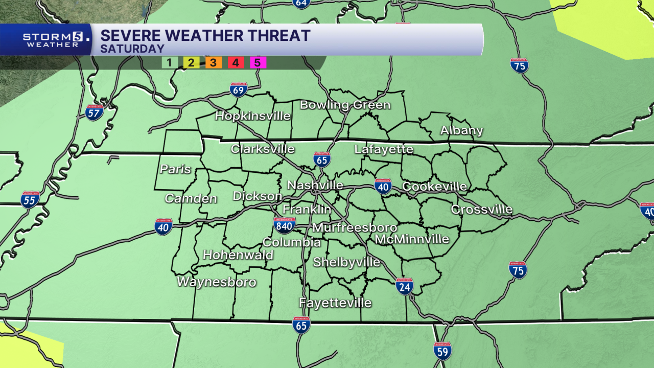
The primary threat continues to be strong, damaging winds along the leading edge of the front but a brief tornado and hail can't be ruled out but the risk is much lower.
Sunday is quieter with warm highs, some clouds and isolated showers. Our above average trend continues with more warmth throughout next week!
