


Unsettled Pattern on the Way
Forecast:
Tonight: Patchy Fog Possible | Low: 48 | Calm
Tomorrow: Sct. Showers, Low Severe Risk SW | High: 77 | SSW 5-10
In Depth:
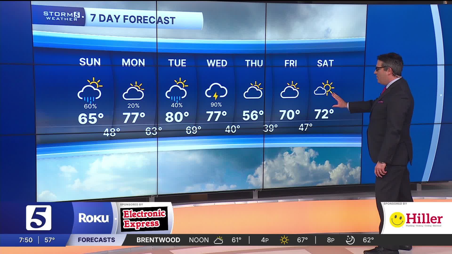
It was a calm end to the weekend with clearing skies and above average temperatures with highs in the mid 60s.
Much of Monday should stay quiet and warm. Temperatures will be very warm, in the mid to upper 70s. By the evening, a disturbance moving in from the west will bring an increasing chance for showers and thunderstorms.

Our severe risk is overall very low, but our southwestern counties like Lawrence and Wayne have been highlighted in a Marginal Risk (1 out of 5). The biggest concern is strong wind and quarter sized hail.
Tuesday we get a small break from our storm chances, with mostly dry conditions and more 70s.

Another strong system will push a cold front into the region on Wednesday. It brings our highest chance for storms this week. A few storms could become severe, with the main concern being winds. The risk is low but the Storm Prediction Center has already highlighted us in a Day 4 Outlook.
The front brings some cooler air for Thursday with highs in the mid 50s.
