


Stormy Tonight, Cooler Tomorrow
Forecast:
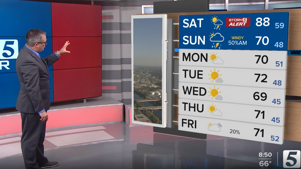
Tonight: Storm 5 Alert, Windy w/ Strong to Severe Storms | Low: 59 | WSW 15-20, Gust 25mph+
Sunday: Rain Ending, Clouds Decrease, Falling Temps, & Windy | High: 70 | WNW 15-20, Gust 25mph+
In-Depth:
A strong cold front will sweep through the NewsChannel 5 coverage area bringing the threat for strong to severe storms. Because of that we are calling for a Storm 5 Alert from 10pm Saturday until 3am Sunday.
All of the NewsChannel 5 coverage area has been outlooked for a threat of severe weather by the Storm Prediction Center.

While storms are a definite across the area, the chances for severe are not as certain. There is a lot more fuel for these storms to our west, with the fuel weakening a great deal as the front moves into the area. Regardless, it's still important to make sure you have multiple ways of receiving severe weather alerts just to be safe.
Our threats with storms overnight will mainly be damaging wind. But, the tornado threat - while very low - is not zero.

As mentioned, while severe weather is not a guarantee the chances for everyone to see rain and thunderstorms is. As the cold front moves across the area you can expect a line of storms ahead of it overnight.


While I cannot rule out a few showers for those of you planning to tailgate before Sunday's Titans game, I do expect rain to be gone by kickoff. However, remember your jacket as temperatures will fall into the 60s and a northerly wind will add to the chill in the area.

