


Sunny Weekend
Forecast:
Tonight: Wind Becoming Calm |Low: 41| N 5-10
Tomorrow: Sunny |High: 62 |Light
In-Depth:
Storm 5 Alert This Morning to Mid-Afternoon
A line of showers and storms will move across the Mid-South today. Some of the storms could be strong to severe. Damaging wind gusts is the biggest threat, but tornadoes, hail and locally heavy downpours area possible.
The tornado threat is higher east of I-65 as the line move through our eastern counties during the early to mid afternoon. That has prompted a Tornado Watch for most of our area.

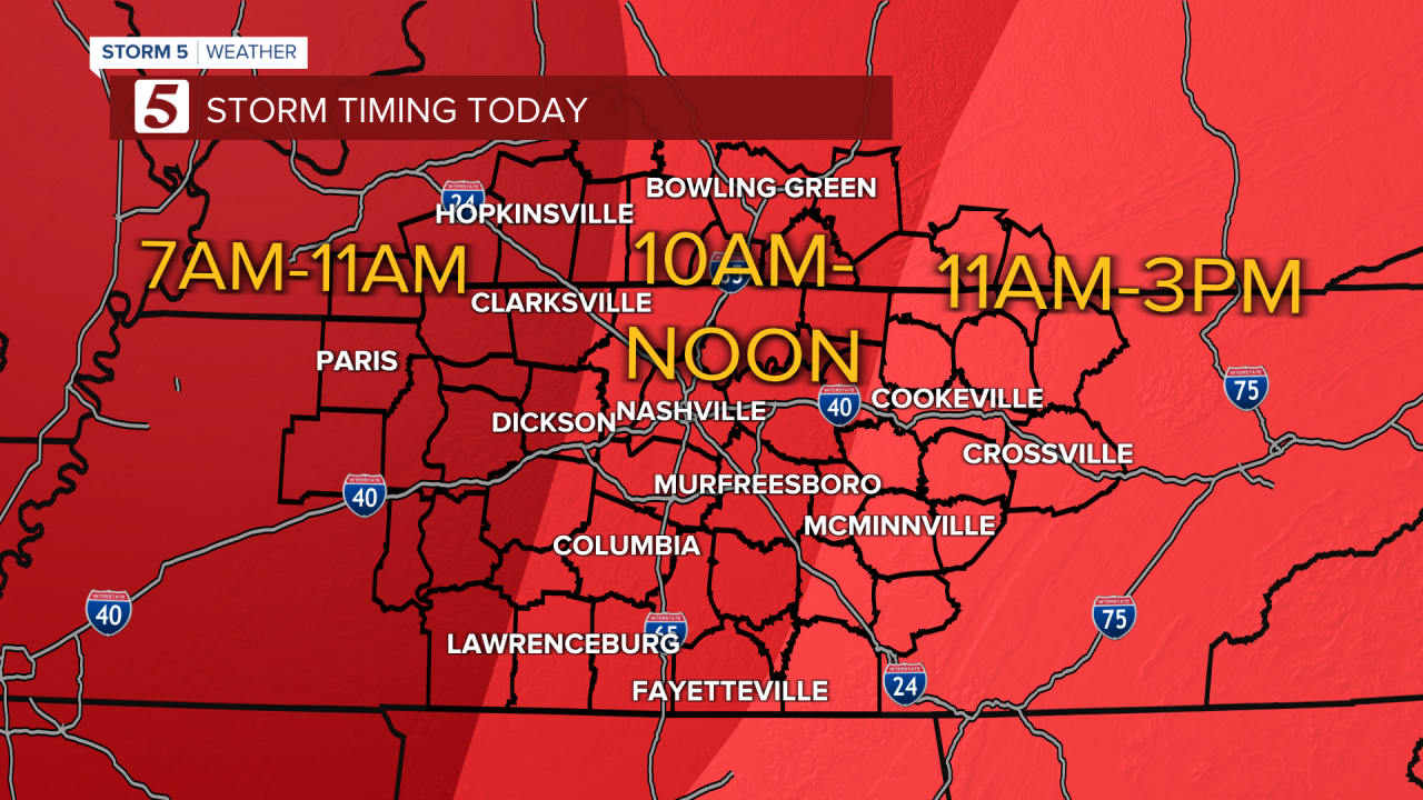
As this line moves into the eastern counties in the afternoon, the daytime heating could add to the instability of this system. That's why
there is a higher threat for severe weather east of I-65, and that is where there will be a higher tornado threat as well. To be clear, ALL OF US in the NewsChannel 5 viewing area needs to STAY WEATHER AWARE until the system has passed over you.

In addition to the severe weather threat, it will be a very windy day. For the first time since 2020, Middle Tennessee is under a High Wind Warning where wind gusts could reach 45-60 mph. It's only the 4th time on record for a high wind warning in the mid-state. Winds will gradually die down overnight.

