


Midweek Warm-up Brings Rising Storm Threat by Friday
Forecast:
Today: Mo. Cloudy, Scat. Showers & Storms |High: 78| SW-5
Tonight: Mo. Cloudy |Low: 61| SE-5
In Depth:
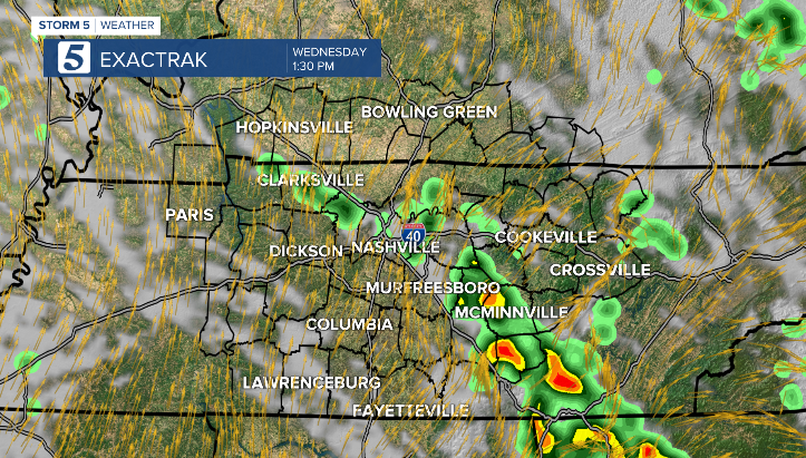
Our unsettled weather pattern continues. This afternoon will bring another chance for scattered showers and storms, though coverage won't be as widespread as yesterday. Afternoon highs will reach the mid to upper 70s.

Wednesday will kick off the warmup, with temperatures beginning to climb and a few afternoon showers still possible.
Thursday will be the driest day of the week. However, any storms that develop could become strong to severe. Breezy winds will push temperatures into the upper 80s, with heat indices feeling like the mid 90s.

Friday will be a warm and unsettled day. Due to increased instability, some storms could turn strong to severe. As a result, we’ve issued a STORM 5 ALERT. The main concerns are damaging wind gusts and large hail. While the tornado threat is low, it is not zero.


