
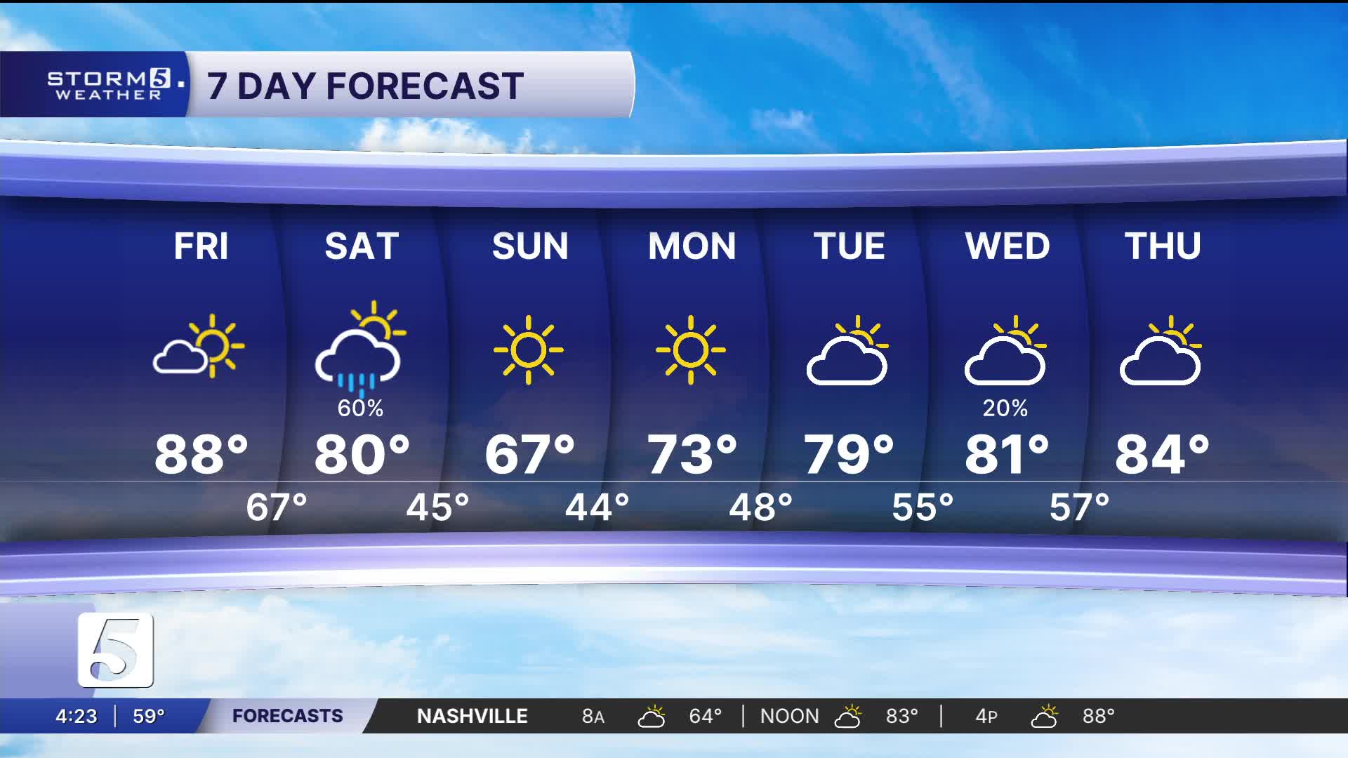


Heat Spike Before a Cooldown
Forecast:
Tonight: Mostly Clear |Low: 63| S 5-10
Tomorrow: Mostly Cloudy, Sct. Showers |High: 79 | SSW 10-15 to WNW 10
In Depth:
Another April scorcher today with highs returning to the mid to upper 80s. Conditions are much quieter today thanks to a dominating high pressure, with only a handful of clouds hanging around this afternoon and evening.

A cold front is expected to move through the mid-south during the day Saturday. It'll bring scattered showers and a few storms, mainly during the afternoon and evening. While we can't rule out early day showers, most of the activity will be behind the front.
The good news is, severe weather is not expected. Our instability is limited, but it's something to keep a close eye on.
This won't be a drought busting, but we could pick up a quarter of an inch to three quarters.
Behind the front, temperatures will drop significantly. Overnight lows Saturday and Sunday will fall into the low to mid 40s. Sunday will be noticeably cooler.
It's short lived as we fall back into a dry, warming trend by early next week.
