

Warm & Windy to Finish the Work Week, Cold Front this Weekend
Forecast:
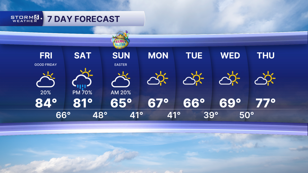
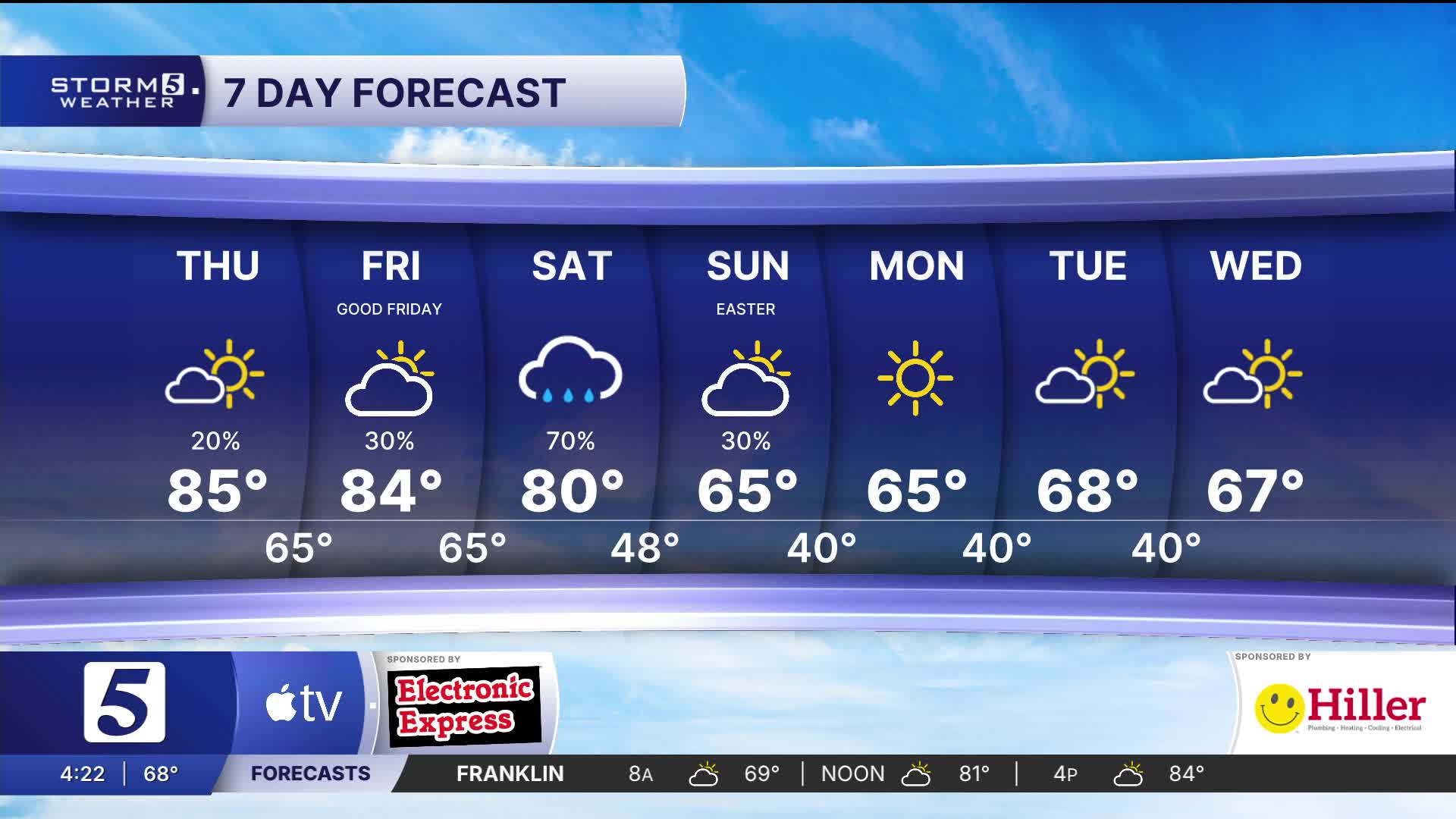
Tonight: Isolated Shower & Storm Chance |Low: 65| S 5-15
Tomorrow: Morning Clouds and spotty showers, afternoon sunshine| High: 84| S 15-20, Gusts: 30 mph
In Depth:
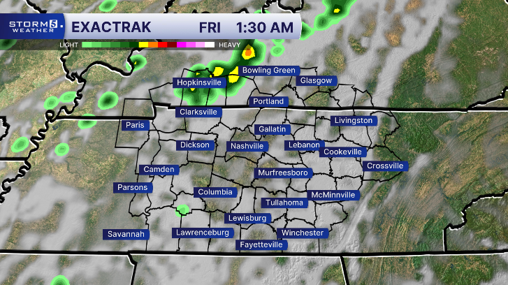
Overnight, spotty showers move in from the west and a few may last into the Friday morning drive.
After spotty morning showers, skies clear tomorrow afternoon as temperatures once again warm into the 80s. Those breezy southerly winds we have been dealing with continue into our Friday as well.

Saturday starts out dry, then a cold front will move through the region, bringing our best chance for more widespread rain along with a few embedded thunderstorms. Our severe threat remains on the low side... however, we cannot rule out a few strong storms.


Thankfully, the cold front will move out Easter Sunday morning, allowing for a dry afternoon with temperatures closer to the seasonal 60s.

The workweek will feel cool, but it’s actually close to seasonal, with morning lows in the upper 30s to low 40s and afternoon highs in the 60s.