

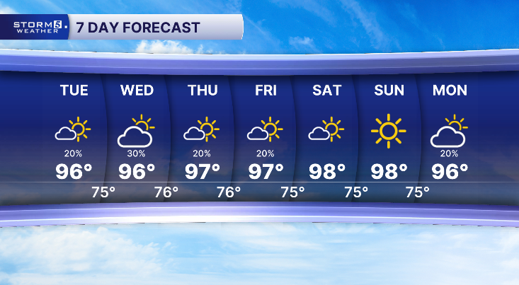


Heat Advisories for Several Days
Forecast:
Tonight: Partly Cloudy & Slightly Muggy, Few Storms East I-65 | Low: 75| SW 5-10
In Depth:
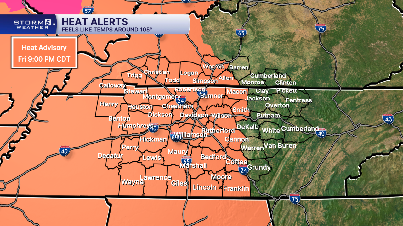
Please stay heat safe this week. Currently, Heat Advisories are out for much of the NewsChannel 5 coverage area, as "feels like" temperatures are forecast to be around 105-110 degrees. As of now the Heat Advisory goes until 9pm Friday, but it would not be surprising to see it extended into the weekend.
Overnight, there will be a chance for some showers and thunderstorms to move in east of I-65. Some could produce gusty winds and heavy downpours. As this complex moves southward, it will fizzle out.
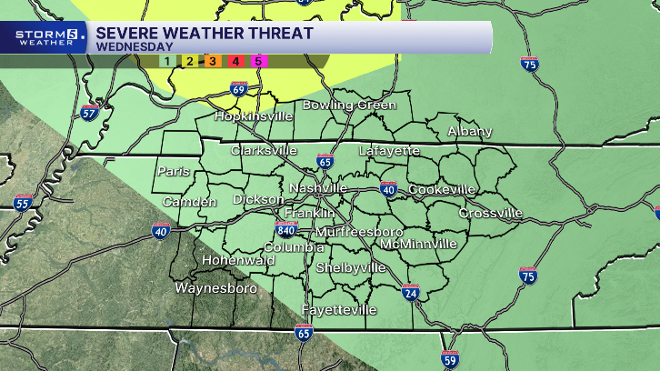
We will have another chance for showers and storms Wednesday. The Storm Prediction Center has put the majority of Tennessee and Kentucky under a 1 out of 5 risk. The main concerns are damaging wind gusts and heavy downpours that could lead to flooding due to slow-moving storms.
However, the main concern is focused on the dangerous heat and high humidity for the extended period.
