


Sct. Storms this Evening
Forecast:
Tonight: Partly Cloudy, Somewhat Muggy, Patchy Fog Poss. | Low: 71 | S 1-6
Sunday: Partly Cloudy, Repeat of Saturday | High: 90 | S 5-10
In Depth:
Another hot, humid and stormy evening is expected across the region. Rain chances will be hit or miss but any storms that do form, will produce very heavy downpours in a short amount of time.
Localized flash flooding is the big concern today. A few stronger storms could also produce wind gusts between 40 and 50 mph and frequent lightning. While widespread severe weather is not expected, gusty storms could bring down a few tree limbs and lead to scattered power outages.
Once the sun sets this evening, storms will begin to quiet down.

Sunday brings a lower chance of rain, along with lots of heat. Any storm tomorrow will be capable of producing heavy rain, localized flooding, gusty winds and frequent lightning.
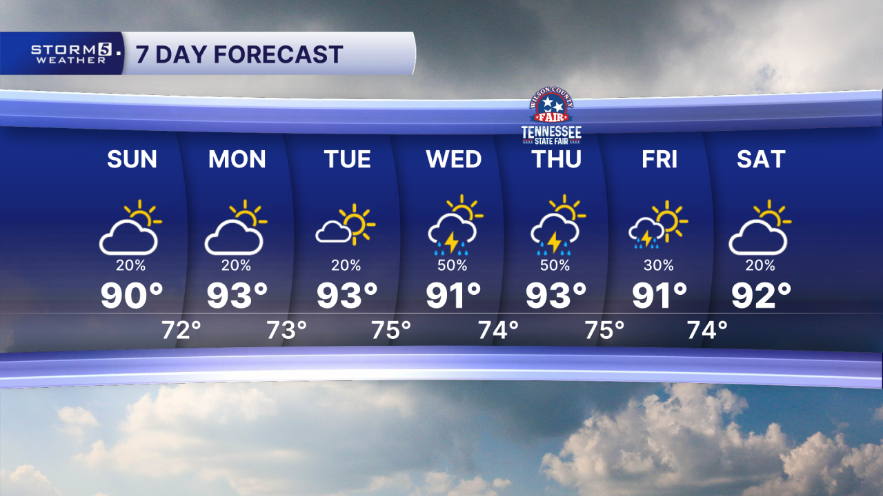
Temperatures will climb into the low to mid 90s, thanks to an early week high pressure that builds. Heat indices will reach the low triple digits.
