


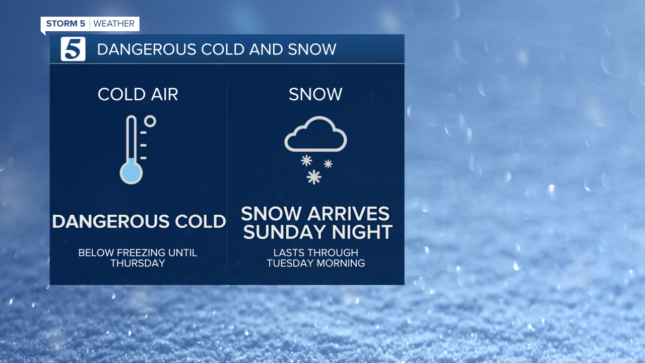
Below Freezing Temps Until Thursday
Forecast:
Today: Unseasonably Cold w/ Increasing Clouds, 20% Chc. for Snow by Dinner | High: 26 | NW 5-10
Tonight: Snow, Heaviest South of I-40 | Low: 16 | NNW 3-8
MLK Day: Snow Continues, Heaviest South of I-40 | High: 23 | N 3-8
In-Depth:
We'll have dangerously cold morning lows Tuesday and Wednesday morning with sub-zero wind chills, as well as accumulating snow starting around sunset Sunday and continuing through most of the day Monday.
Dangerously cold air is spilling into the Mid-South and by tonight the threat for accumulating snow is expected prompting us to call for a Storm 5 Alert effective tonight through Wednesday morning. The Storm 5 Alert is for both snow and cold.
A Winter Storm Warning will go into effect at 5:00 p.m. Sunday evening and last until 9:00 a.m. Wednesday morning.
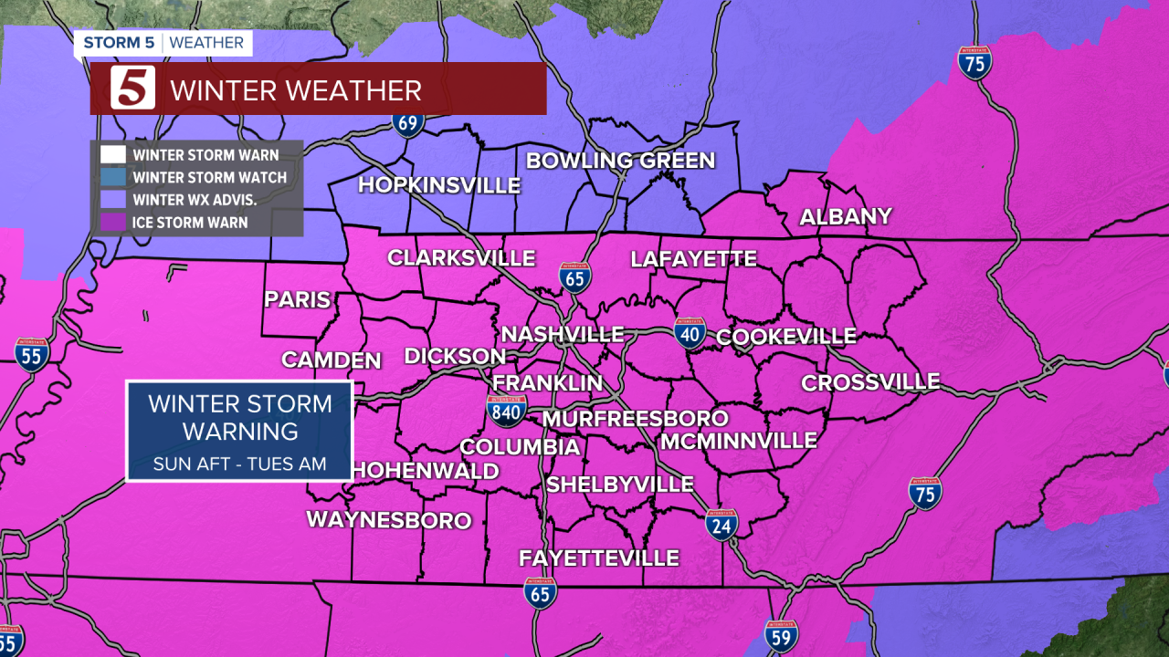
A Winter Weather Advisory in Southern Kentucky will go into effect Sunday and last until 6:00 AM Monday morning, or Tuesday morning depending on your specific county.

Forecast models have varied in totals with some not showing much and others showing extreme snow amounts. With dry air at the surface, it will probably be around midnight tonight when we see snow really begin over Nashville. Once it gets going it will be a steady snow, heavy at times. Areas along and south of I-40 have the potential to see the most accumulation.
There will likely be pockets within the 2 to 5 inch range that over perform and could see more than 6 inches. For our Southern tier, some pockets may see as much as 7 to 8 inches.


