

Possible Record Warmth
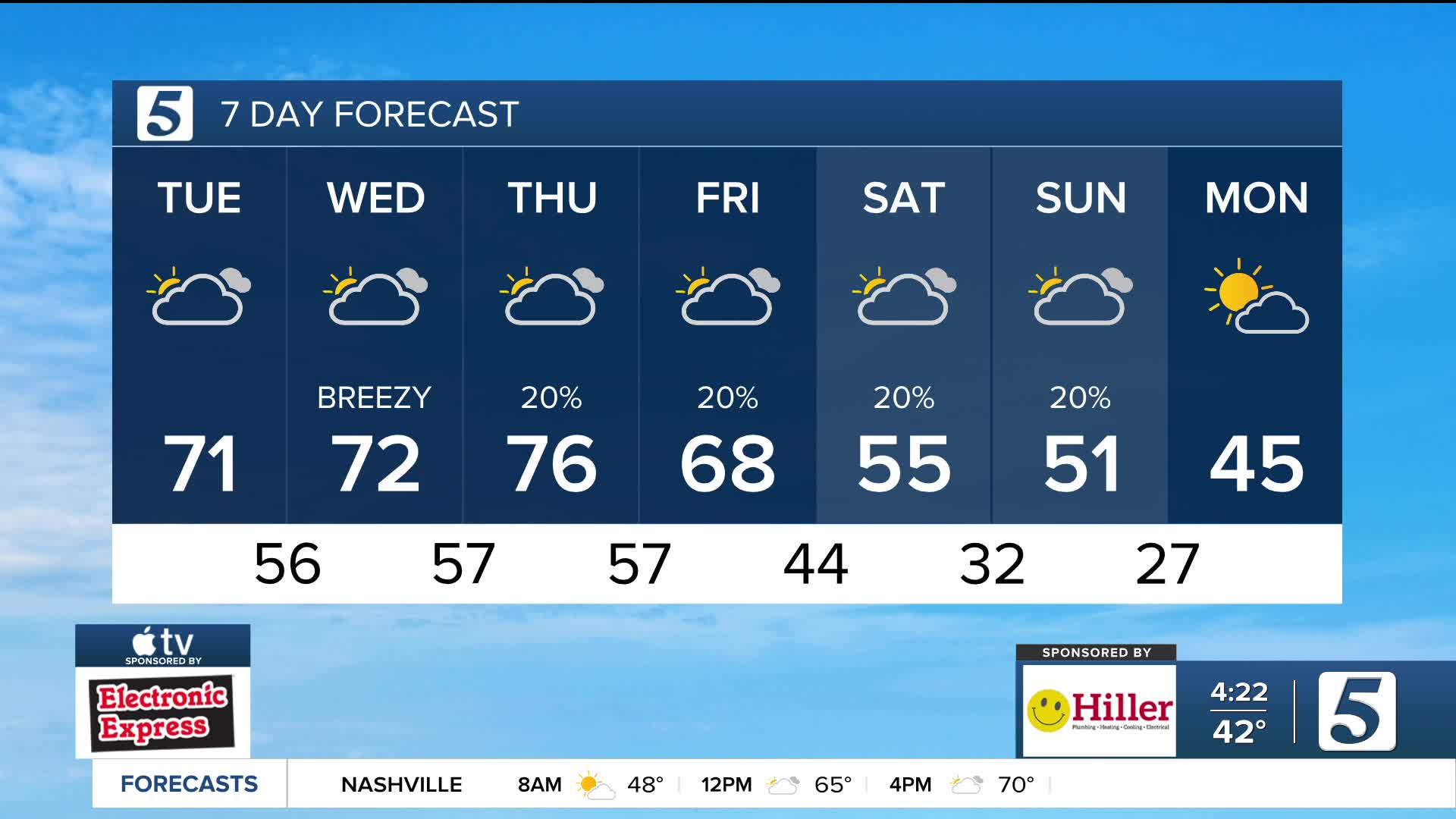
Forecast:
Tonight: Mostly Cloudy & Breezy | Low: 57 | S 10-20, Gust 25 mph+
Wednesday: Mostly Cloudy & Breezy | High: 71 | SW 10-15, Gust 25 mph+
In-Depth:
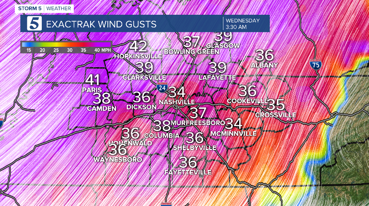
Tonight, the winds stay pretty rambunctious. We’re talking gusts in the 25- 35 mph range. Because of that strong breeze, temperatures won’t fall much at all. In fact, tomorrow morning’s lows will be where our afternoon highs should be this time of year. Yes, you heard that right. We’ll wake up in the low to mid 50s ... and our average high for this time of year is around 54 degrees!
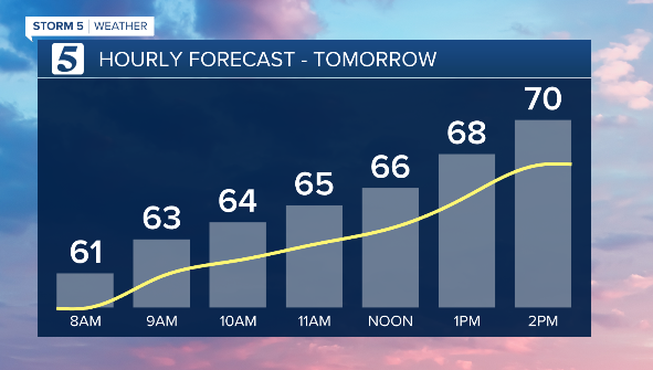
By tomorrow afternoon, we’re right back into the low 70s.
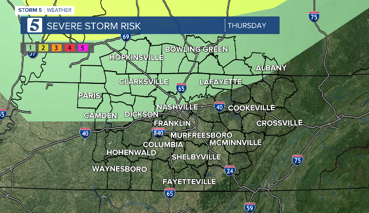
Thursday starts off cloudy and warm, but we’ll see some afternoon clearing. That will lead to increasing instability ahead of an evening cold front. Temperatures could soar into the upper 70s ... and we may even challenge a few records. Thursday night, that cold front moves through. With the added instability, a few storms could turn strong to severe. The good news? This does not look like a widespread severe weather event. In fact, most spots stay dry. But any storm that does develop could briefly become strong/severe.