

Gusty Winds and Evening Storms
Forecast:
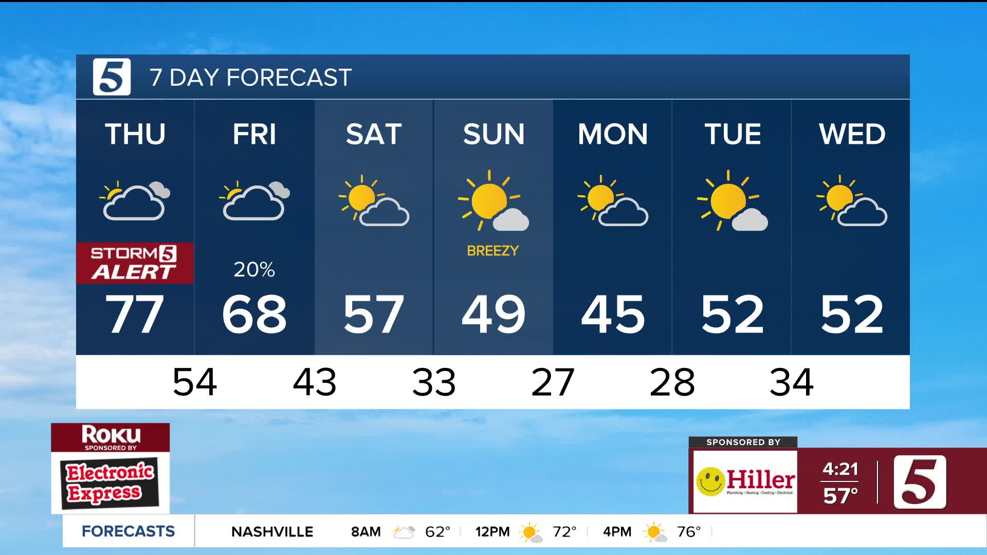
Tonight: Sct. Storms, Clearing |Low: 51| W 10-15, Gusts 30 mph
Tomorrow: Mix of sun and clouds |High: 65|W 5-10
Tonight, a cold front will move through the region bringing showers and a few storms . An isolated strong to severe storm is possible with gusty winds the main concern. The Storm Prediction Center has issued a Level 1 out of 5 for most of the area.


Even outside of any storms, winds will remain gusty up to 40 mph overnight. Gusty winds may cause weakened trees to fall on power lines and lead to power outages. This won't be anything like the ice storm, but it is a good idea to keep devices charged just in case.

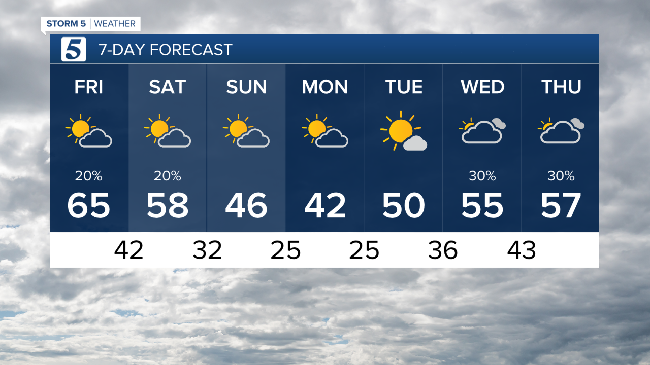
Friday morning we wake up to temperatures in the upper 40s and lower 50s with partly cloudy skies. Winds will be lighter tomorrow with highs a bit cooler, topping out in the mid 60s. Friday evening, spotty showers and storms will develop along the Alabama border, with the potential for an isolated strong to severe storm.

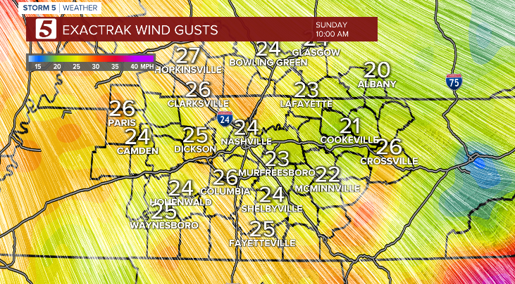
Sunday will be sunny, breezy, and chilly.
By Monday and Tuesday morning, we’re expecting low temperatures to drop into the 20s.