
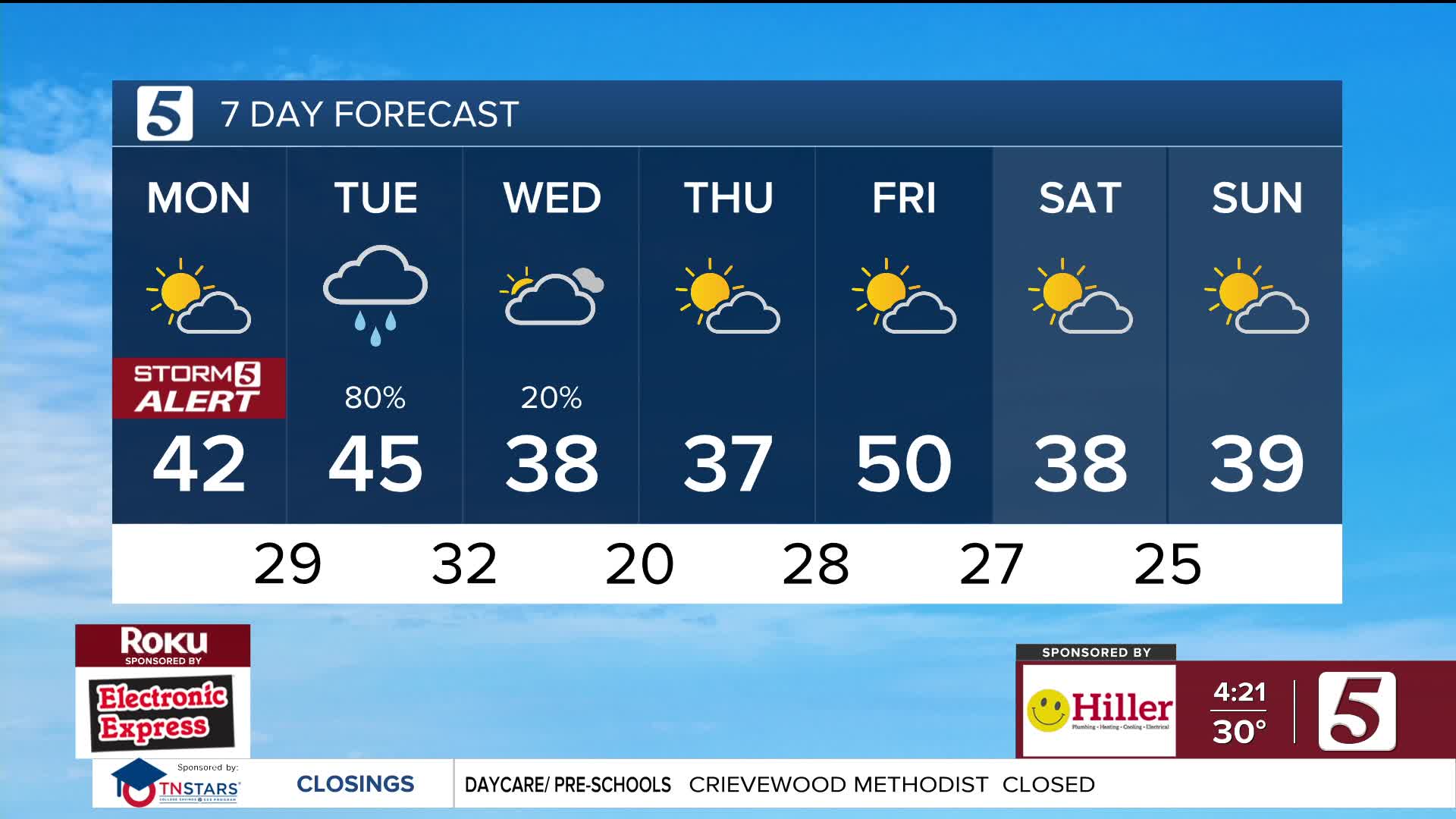


Highs in the 40s Tuesday with widespread rain showers
Forecast:
Tonight: Mostly Cloudy | Low: 31 | SW 5-15
Tomorrow: Cloudy, rain showers move in midday | High: 47 | S 5-15
In-Depth:
Overnight, cloud cover will increase, helping keep morning lows around freezing.

Showers will move across Middle Tennessee and southern Kentucky, with temperatures rising into the low to mid-40s... closer to the low 50s near the AL/TN state line. The warmth and rain will help dissolve snow and ice. It won’t completely fix road conditions, but it will certainly help.

On Wednesday, another blast of cold air moves in, with wind chills dropping into the 20s.

Thursday morning will be the coldest, with temperatures in the teens to low 20s.

Friday will be the warmest and most seasonable day of the week, with highs in the low 50s.

