

Our Next System Arrives Wednesday Morning
Forecast:
Tonight: Clouds Increase, Showers Move In |Low: 43| S 5-15, Gust: 25 mph
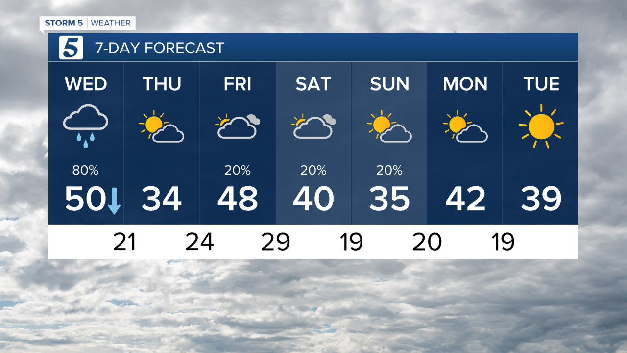
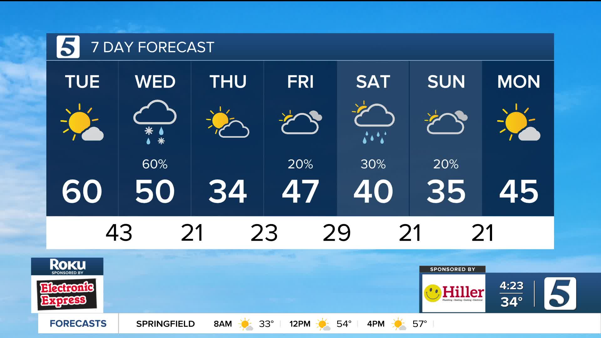
Tomorrow: Morning rain, brief evening snow mix east |High: 50|S/N 10-15, Gust: 25 mph
In Depth:
Today was our warmest of the week with highs in the mid 60s and lots of sunshine. Buckle up, because we are on the down slope of the temperature roller coaster tomorrow into Thursday as winter returns
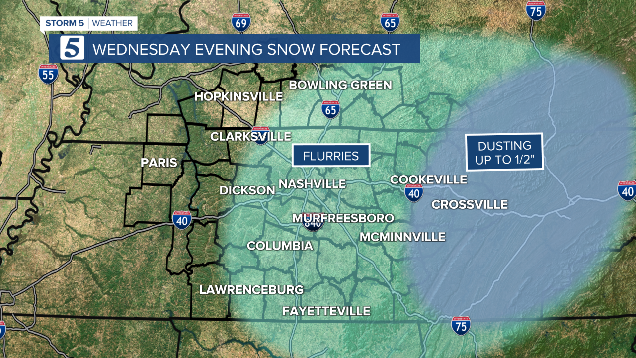
Wednesday morning we wake up to temperatures in the 40s and light rain. Rain tracks southeast through lunchtime as cold air moves in behind it. Temperatures will fall as we see a change to snow, mainly for areas east of I-65.
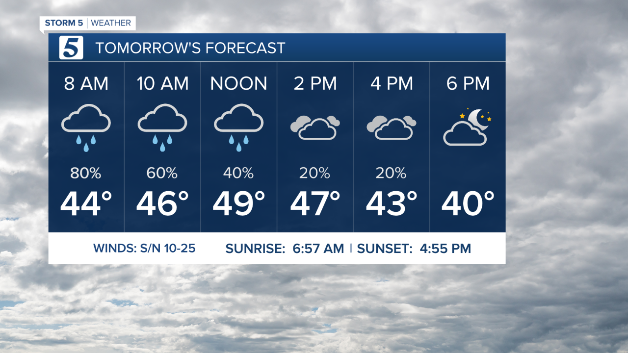
No major impacts are expected, with minimal accumulations ranging from a dusting to around 1/2 inch in eastern areas. Flurries are possible across the Mid-State during the afternoon and evening hours.
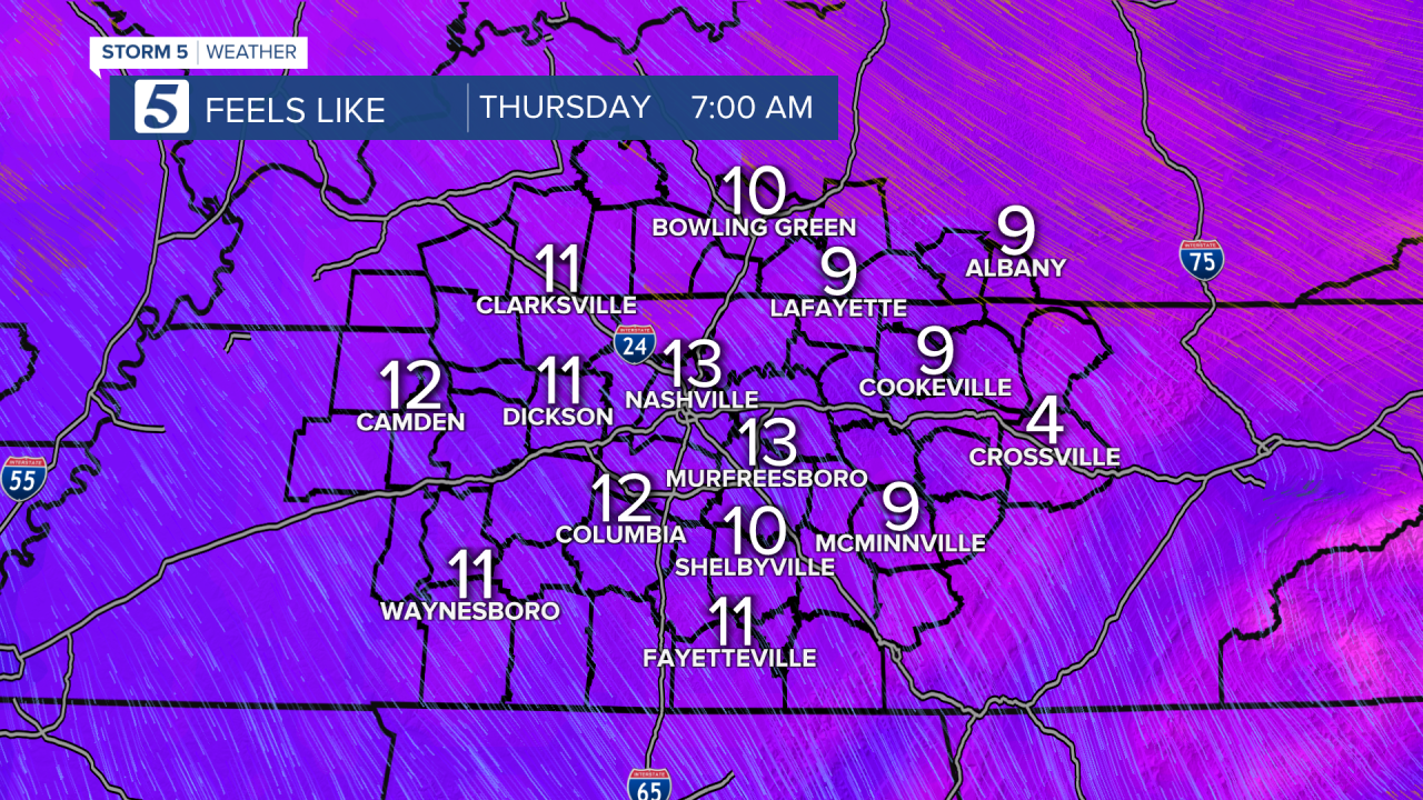
Bundle up Thursday as we start the day with wind chills in the single digits and teens! Strong northerly winds will keep us feeling like the 20s into the afternoon hours. Areas west of I-65 should see a mostly sunny Thursday, while cloud cover may be a little slower to clear east of I-65 keeping the potential for a few flurries around.
This weekend, another blast of cold air will move into the region, dropping Sunday afternoon highs into the low 30s and making it feel more like the 20s.