
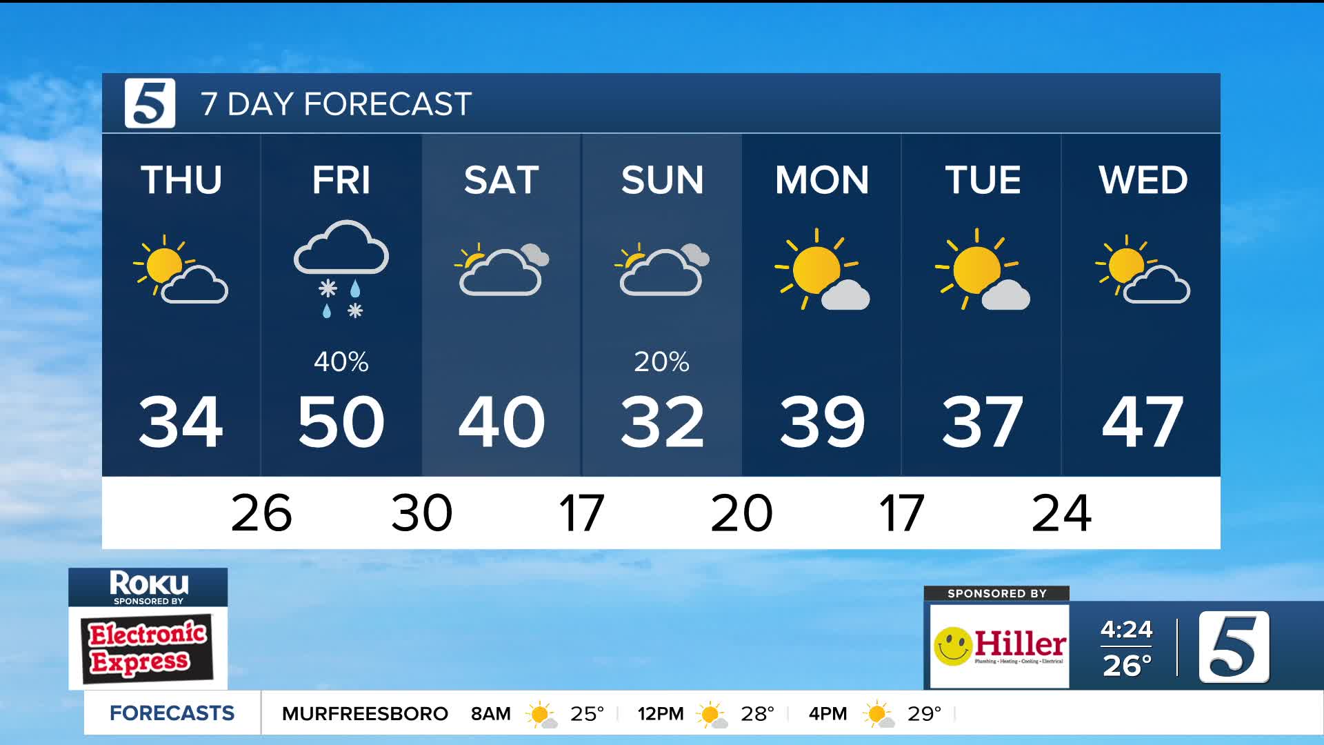


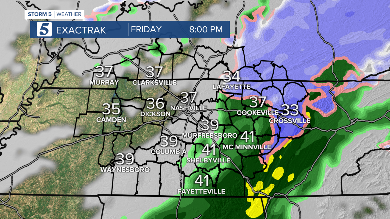
Another round of light rain to wintry mix Friday afternoon into the evening.
Forecast:
Tonight: Partly Cloudy |Low: 26| S 5-10
Tomorrow: Afternoon light rain to a wintry mix|High: 50| S 5-15
In Depth:
Another cold night on the way with temperatures falling into the mid 20s, before they begin warming back up towards sunrise thanks to southerly winds. Clouds will also increase and a few flurries are possible before sunrise. Temperatures warm to near 50 Friday before our next system moves in. Light rain will develop early afternoon and track east.
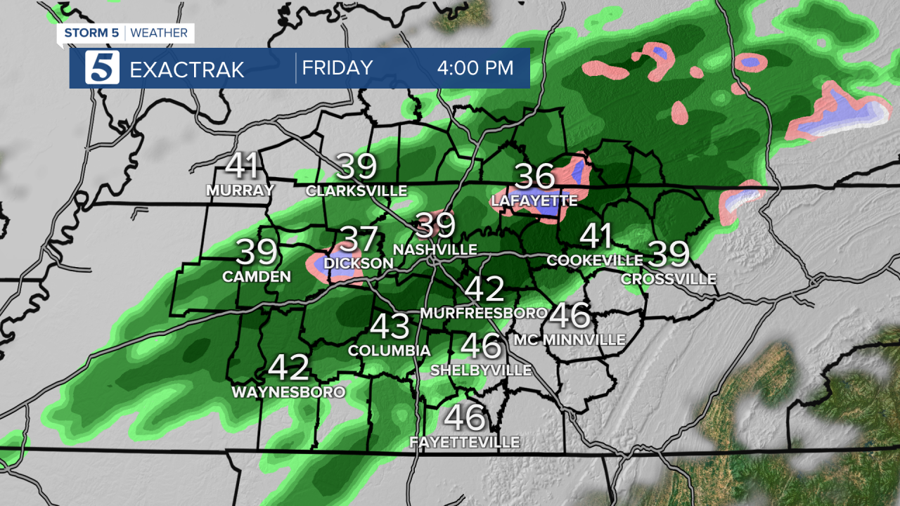
As colder air arrives, some sleet and wet snow are possible, especially east of I-65. This looks to be a low-impact event, with accumulations anticipated to be less than an inch across the plateau. Locations along the KY/TN state line could see a light dusting up to 1/4".
We start Saturday with cloudy skies and maybe even some flurries into the midday hours, then clear out for afternoon sunshine. It's a cold weekend with highs back near freezing Sunday and wind chills in the 20s.

