


Warm week ahead
Forecast:
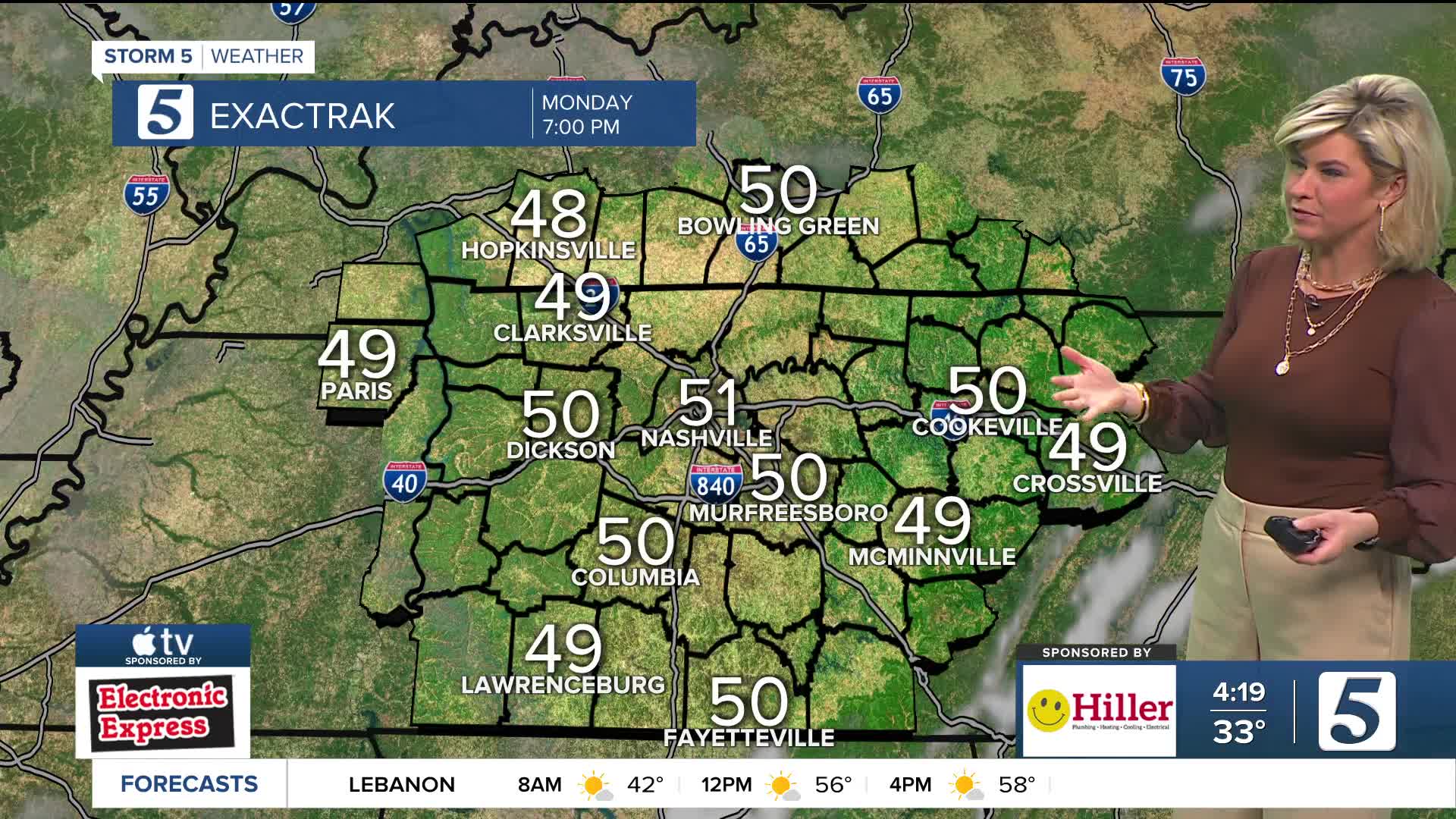
Tonight: Increasing Clouds |Low: 50| SW 5-10, Gust: 20 mph
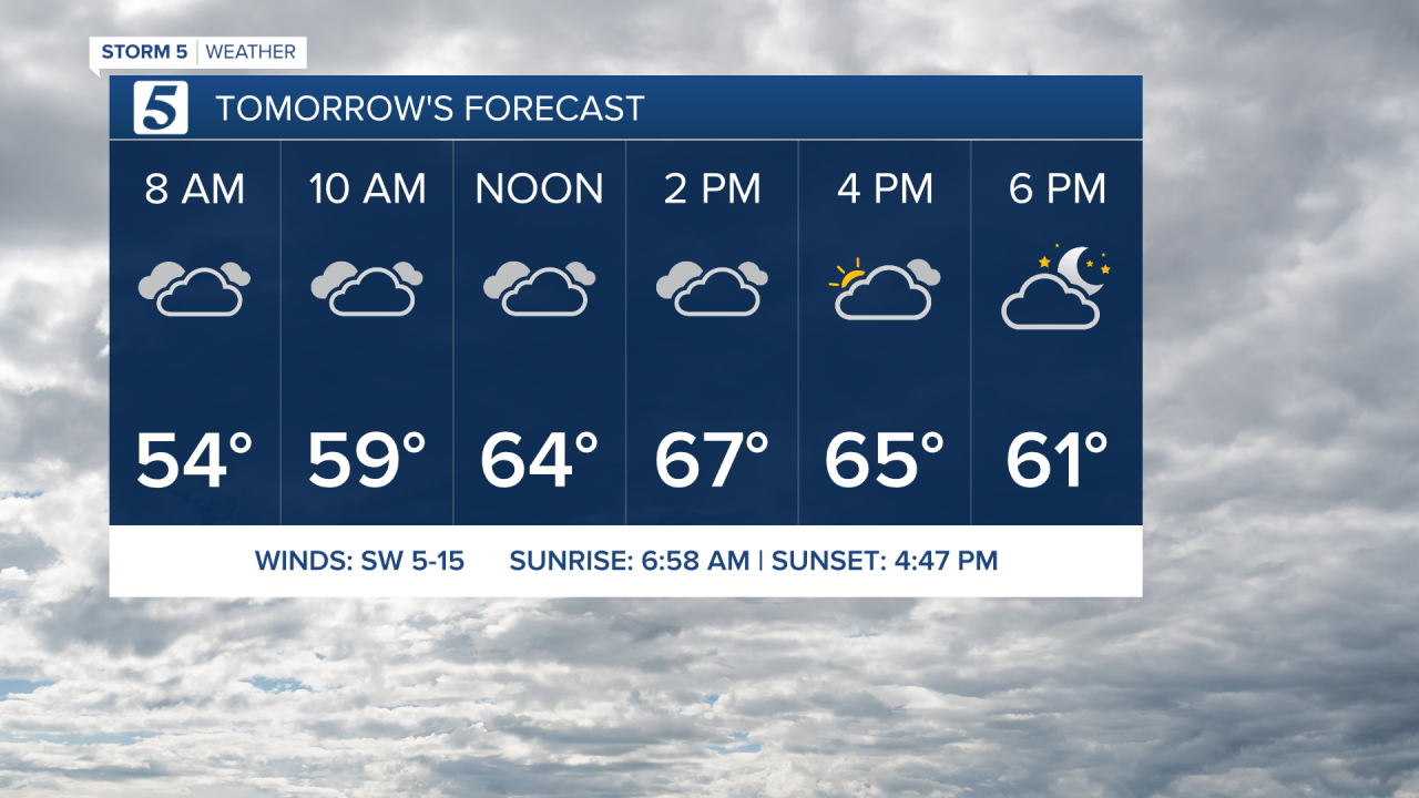
Tomorrow: Mostly Cloudy, Isolated Showers| High: 62| SW 10-15, Gust: 25 mph
In Depth:
A warm week ahead as temperatures continue to climb, running nearly 15-20 degrees above average. We near record highs by Thursday and Friday in the low 70s. Clouds will move in overnight and stick with us tomorrow with a little sunshine from time to time. Isolated showers are also possible as we go through our Tuesday.

Rain chances increase Thursday into Friday ahead of our next strong cold front. We are watching the potential for strong to severe storms Friday. The Storm Prediction Center has already highlighted areas west of I-65. We will continue to refine the timing and impacts of this system as we get closer. Please stay tuned to the latest forecast for updates.

The next 7 days look more like early Spring than January! Behind the cold front Saturday, temperatures will return to normal, near 50 with partly cloudy skies.

