

Above normal temperatures continue
Forecast:
Tonight: Mostly Clear, patchy fog developing |Low: 47| Light winds
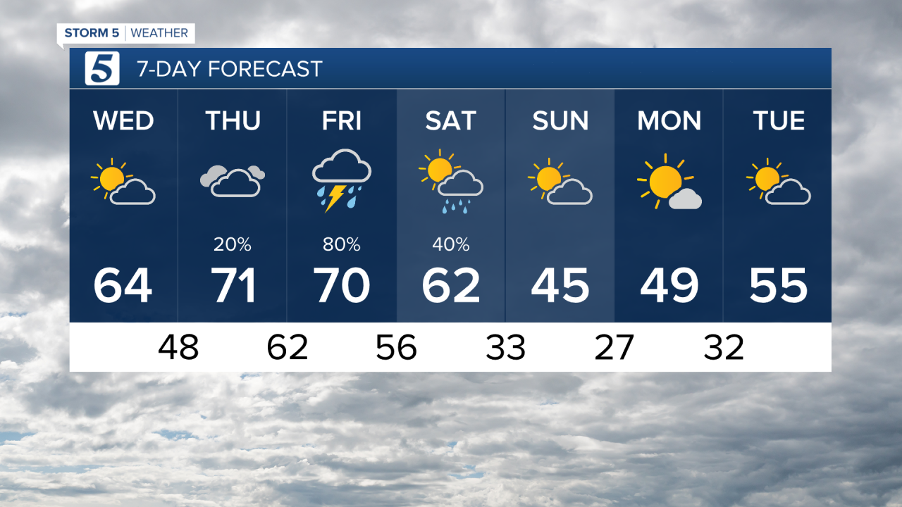
Tomorrow: Mix of sun and clouds| High: 64| W - 5 mph
In Depth:
After a gray morning, skies cleared as temperatures warmed into the mid 60s this afternoon. Patchy fog will develop overnight into Wednesday morning and may be dense in some areas. The fog will clear out mid morning giving way to mostly sunny skies and another mild afternoon with highs near 64.

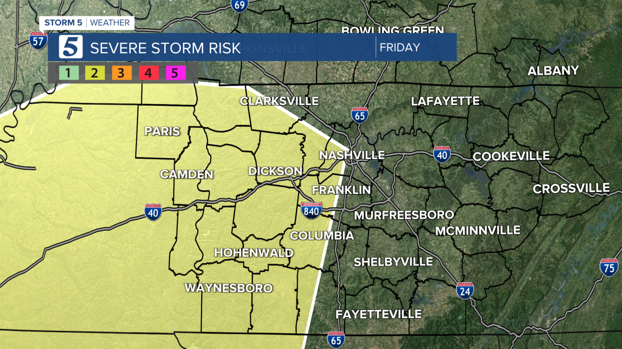
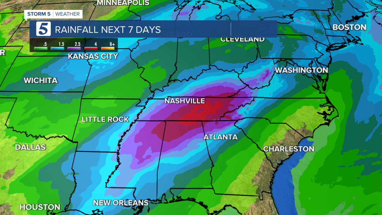
Temperatures continue to warm Thursday and Friday nearing the record high of 71 both days. We are tracking our next system which will return widespread rain to the Mid State starting late Thursday night, throughout Friday, and into Saturday morning. Some storms Friday afternoon and evening could be strong to severe with gusty winds and flooding the main threats. A couple inches of rain are possible across the area. Please stay up to date on the forecast.
We are back to seasonal temperatures starting Sunday, with mornings near freezing and afternoons in the upper 40s.