


Cloudy, Warm, and Windy Thursday, Storm 5 Alert Friday
Forecast:
Tonight: Increasing Clouds |Low: 50| SE 5-10
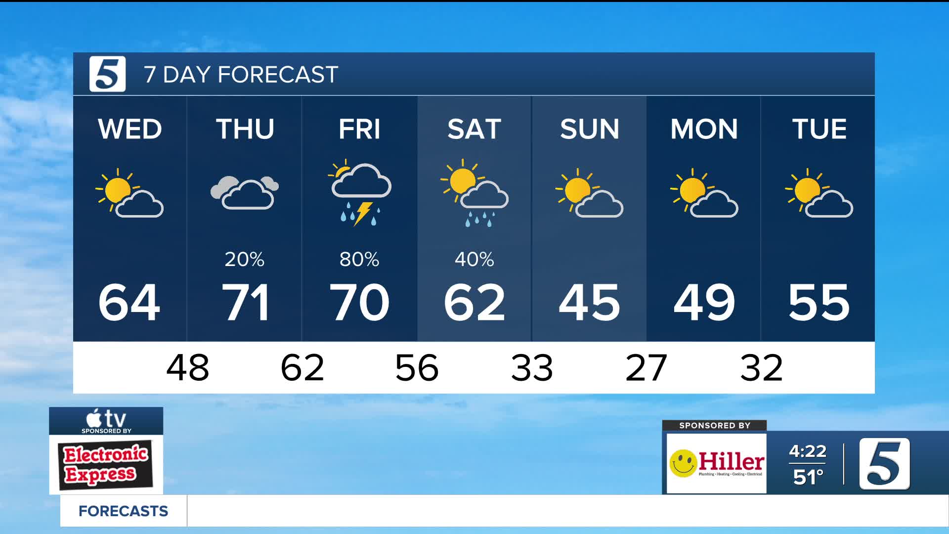
Tomorrow: Mostly Cloudy, Breezy |High: 72| S 10-15, Gust: 30
IN-Depth:
Clouds increase overnight as southerly winds begin to pick up. Those southerly winds remain breezy tomorrow with gusts to 30 mph, helping to boost temperatures to near record highs. If we hit the 72 degrees forecast, this would set a new record for the day. Most of us stay dry tomorrow, but a spotty shower is possible.

A Storm 5 Alert has been issued Friday due to the threat of severe storms. We are watching the potential for 2 rounds of rain and storms. The current timing, has the first wave arriving near sunrise Friday and could slow down the morning drive. Right now, it looks like we will get a break in the precipitation during the midday hours, before the second round moves in during the evening and overnight. Please stay up to date on the forecast as timing may still shift.


The Storm Prediction Center has parts of the Mid-State highlighted in a level 2, Slight Risk of severe storms for Friday evening. The main threats are damaging winds, and flooding, with a low tornado threat.

Please remember: Turn Around, Don't Drown. Never try to drive through water covered roads as it is very hard to estimate how deep the water is and you could put yourself in a life threatening situation. Widespread 1"-3" rainfall are possible across Middle Tennessee with higher amounts in southeast areas closer to 4"+.

After the rain clears out Saturday afternoon, cold air pours in on strong northerly winds. We are back to winter reality on Sunday, you will want the heavy coats again!

