

Extreme Heat Warning Until Friday for the Mid-State & Kentucky
Heat Advisory for the Cumberland Plateau
Forecast:
Tonight: Warm & Muggy, Isolated Shower & Storm Early |Low: 78| SE-5 then Light and Variable
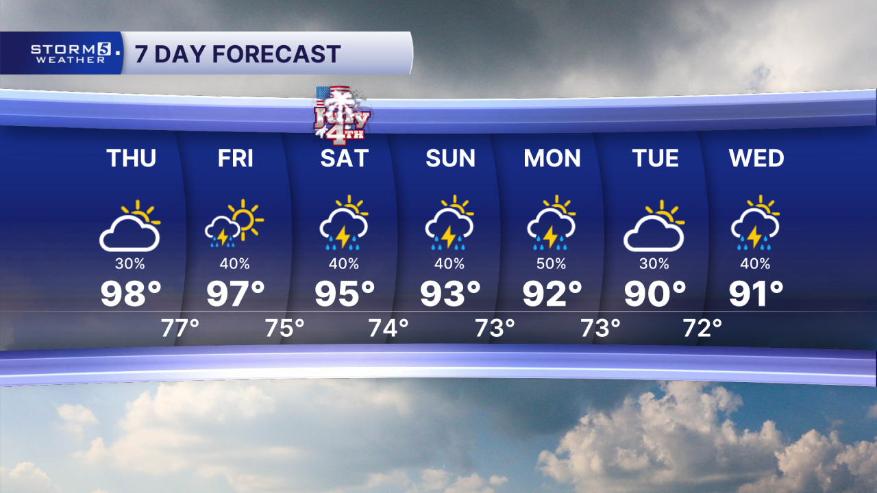
Tomorrow: Hot & Humid, 40% Shower & Storm Chance |High: 98, Heat Index: 105-112|NE-5
In Depth:
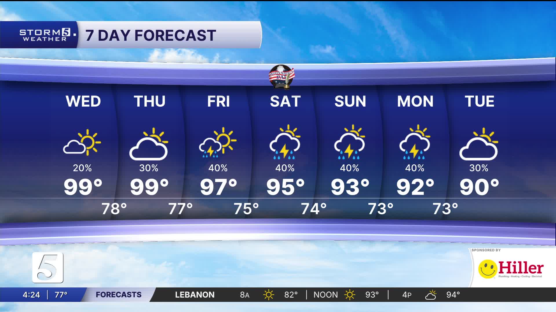
The high pressure heat dome will continue to dominate the weather for the eastern half of the country. Afternoon highs will continue to reach the mid to upper 90s with the heat index reaching from 105 to over 110 degrees. For now, the entire area remains under heat alerts through at least Friday evening.

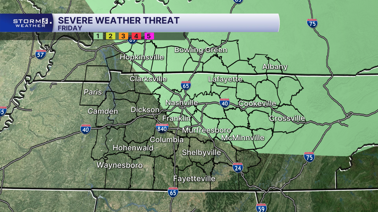
As high pressure begins to slide east, we will see a few showers and storms bubble up in the afternoon and evening hours. A couple of those could be strong to severe. The primary threats are damaging winds and locally heavy downpours. Once the sun sets, any precipitation will come to an end each day.

We will continue to dodge rain through the holiday weekend with feels like temperatures 100-105. Temperatures return to seasonal, around 90, as we head in to next week.