


Our Southern Summer Continues
Forecast:
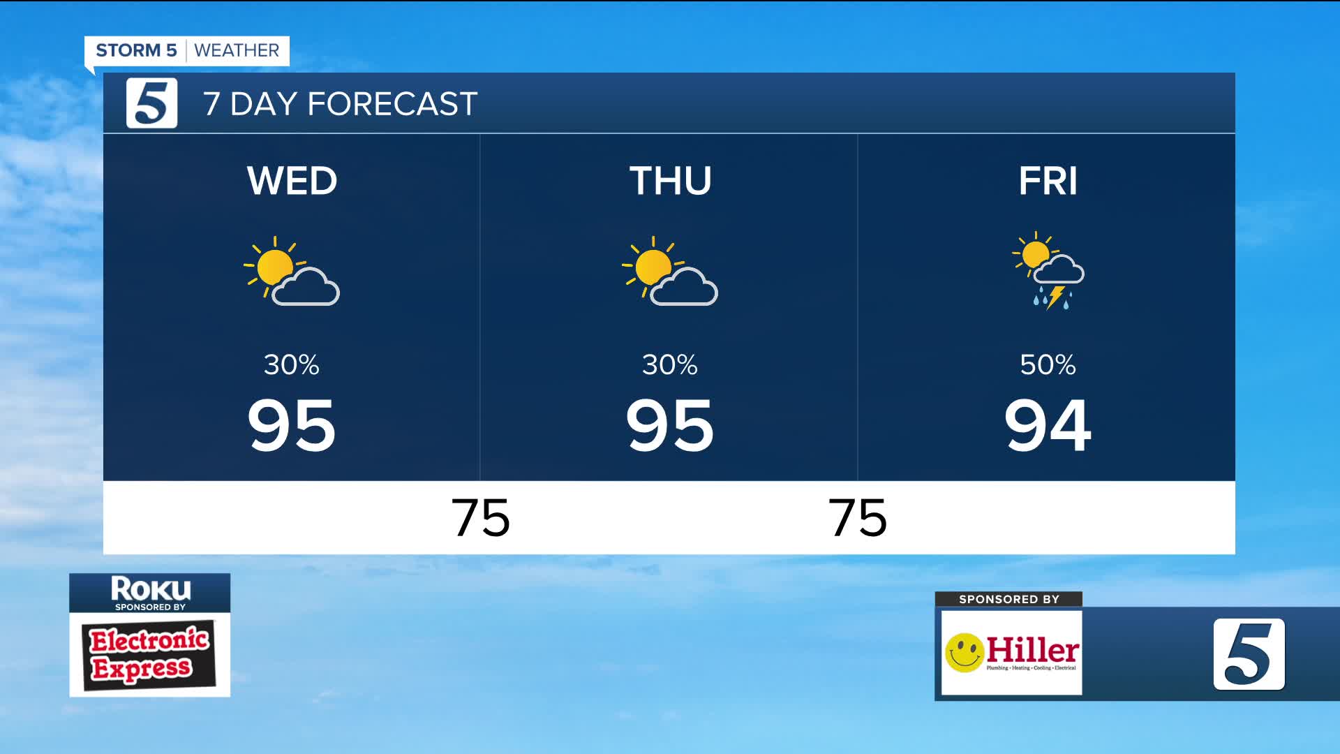
Tonight: Partly Cloudy | Low: 75 | S 1-6
Thursday: Partly Cloudy w/ Pop-Up Storms | High: 95 | SSW 3-8
In Depth:
Pop-up storms have returned this evening across the area. Nothing widespread, but these small but mighty storms are packing a punch. The good news is the overall severe risk is incredibly low.

wtvf
Tomorrow brings the return of a heat advisory. It's in place for over half of the viewing region from lunch to supper time tomorrow. Heat indices could peak above 105 degrees.

wtvf
We struggle shaking both the storm and brutal heat as we look into the rest of the work week and weekend.
