
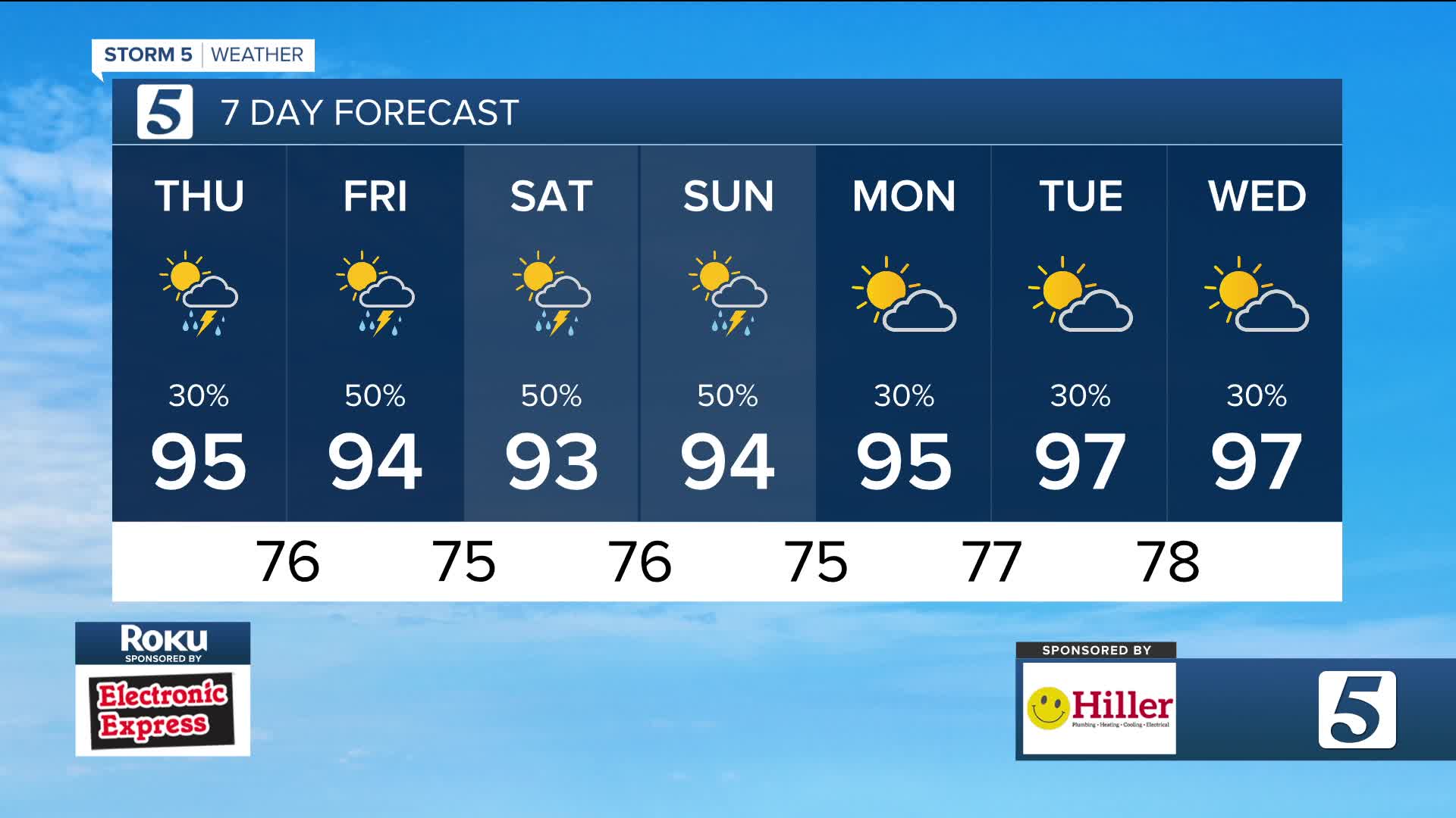


Heat Builds, Storms Follow
Forecast:
Tonight: Partly Cloudy | Low: 76 | S 5
Thursday: Partly Cloudy w/ Pop-Up Storms | High: 93 | SSW 5
In Depth:

wtvf
We're stuck in a pattern of humidity, heat and scattered storms. The rain chances have been feast or famine. While some have recently seen flash flood warnings with over 3 to 4 inches of rain falling in 24 hours, other haven't seen a drop.
The heat advisory today continues until right before sunset as heat indices will surpass triple digits.
A low end severe risk is possible through this same time frame, especially for those along and north of I-40.
The end of the work week brings more 90s and storm chances. We'll keep a close watch on next week as highs near 100 degrees.
