


Another Unsettled Afternoon
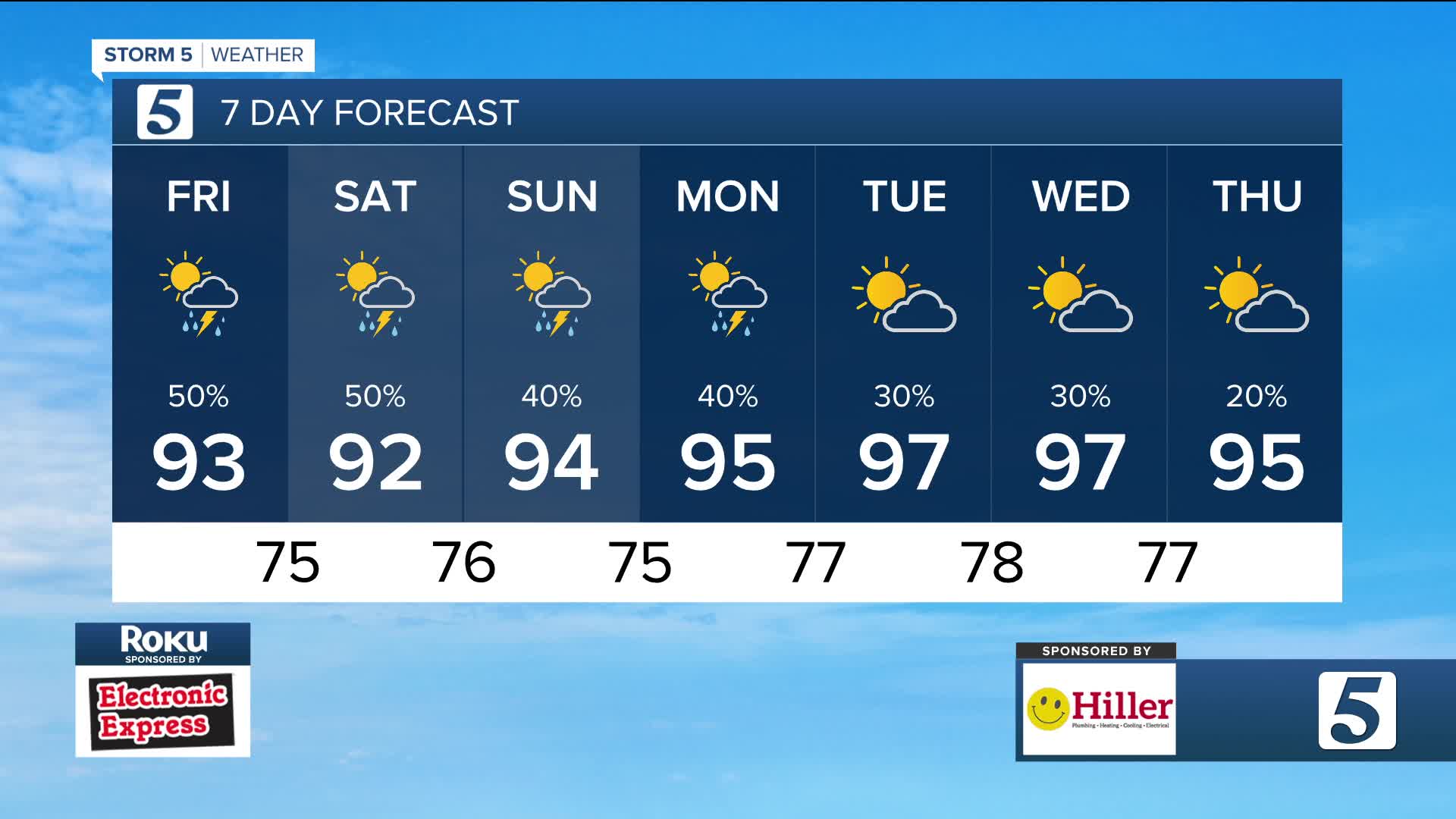
Forecast:
Tonight: Partly Cloudy | Low: 75 | S 5
Tomorrow: Partly Cloudy w/ Pop-Up Storms | High: 92 | SSW 5
In Depth
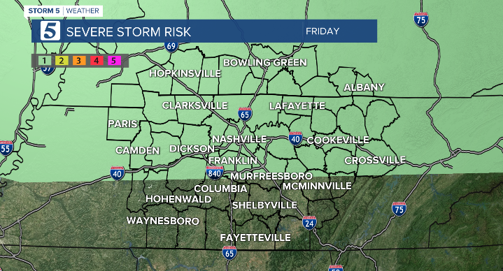
Many are ready for a break from this steamy pattern but summer is in full swing with no sign of slowing down soon. Severe weather continues to be possible today. The overall chance is low, but not zero! If any storms do organize, the concern will be wind and heavy rain leading to flooding.

A heat advisory has been issued for a handful of our Kentucky counties until dinner time with conditions possibly feeling like 105 degrees or more.

Looking ahead to next week, expect a warm-up as temperatures climb into the mid to upper 90s, with slightly lower chances for rain.

wtvf
