

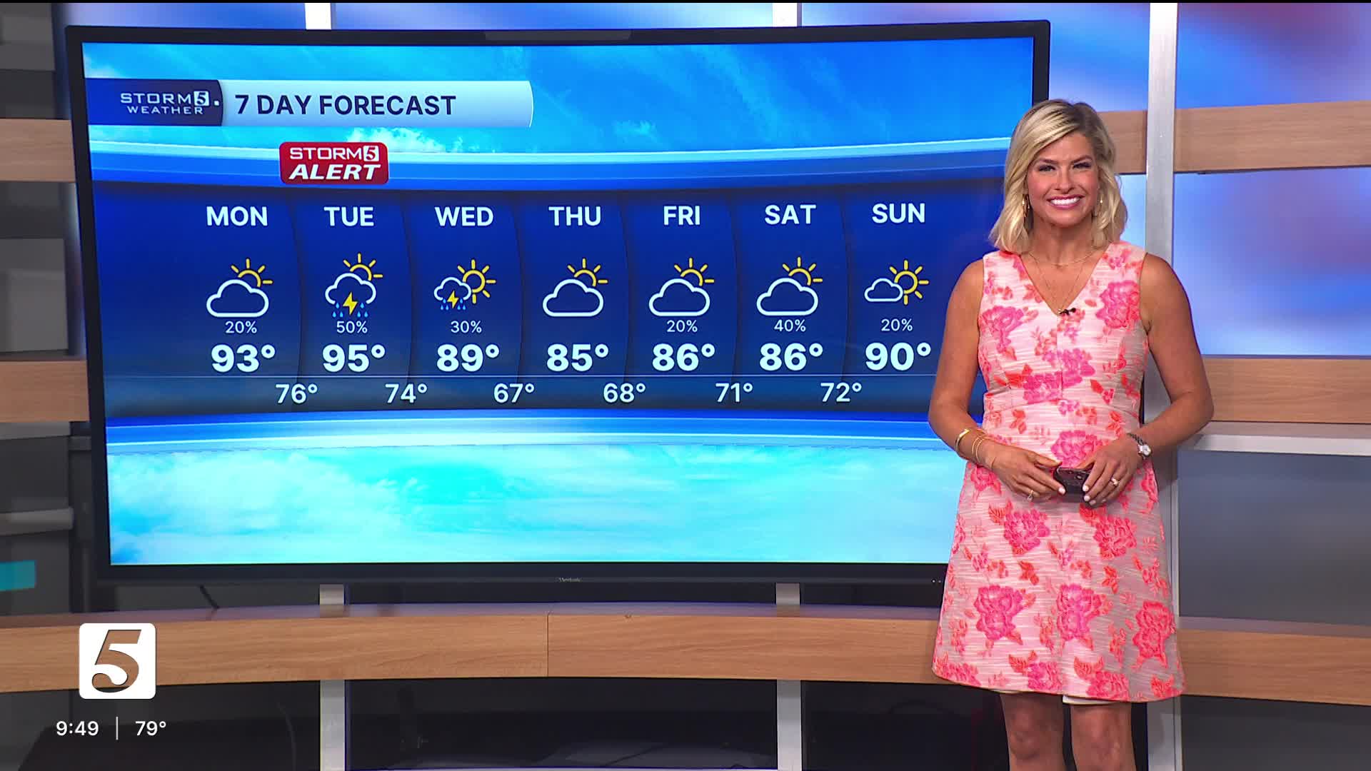


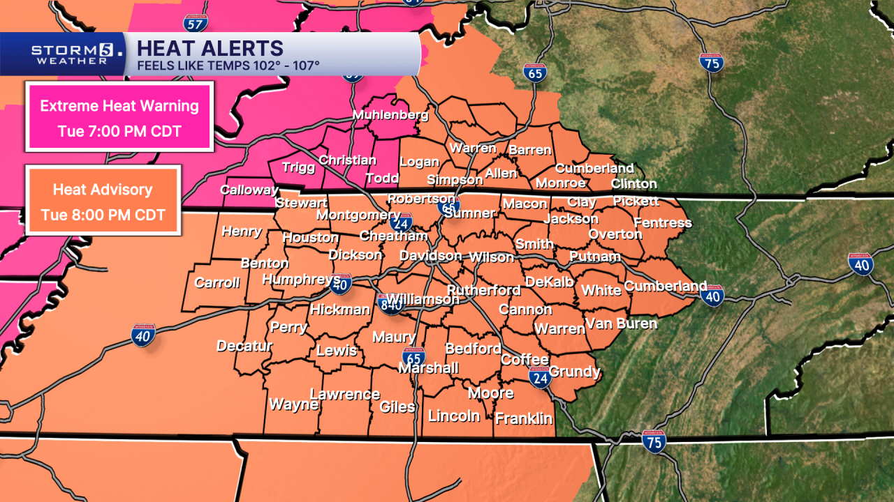
Heat Alerts Until 8pm Tuesday
Storm 5 Alert Tuesday Night
Forecast:
Tonight: Warm & Muggy, Partly Cloudy Sky | Low: 76 | SW 0-5
Tuesday: Partly Cloudy, hot, and breezy with sct'd storms, higher chance Tuesday Night | High: 95, Heat Index: 105-111 | SW 10-15
In Depth:
Intense heat returns for the start of the week. With high humidity levels in place, most of the area will be under a Heat Advisory today until Tuesday evening. Heat Index values will range from 105-112 degrees.
There is a cold front on the way Tuesday night, and that will bring area rain and thunderstorms. Some of the storms could be strong to severe. That has prompted a Storm 5 Alert from Tuesday afternoon into the early morning hours of Wednesday. All of the NewsChannel 5 coverage area is outlooked for a risk of severe storms by the Storm Prediction Center for Tuesday night.
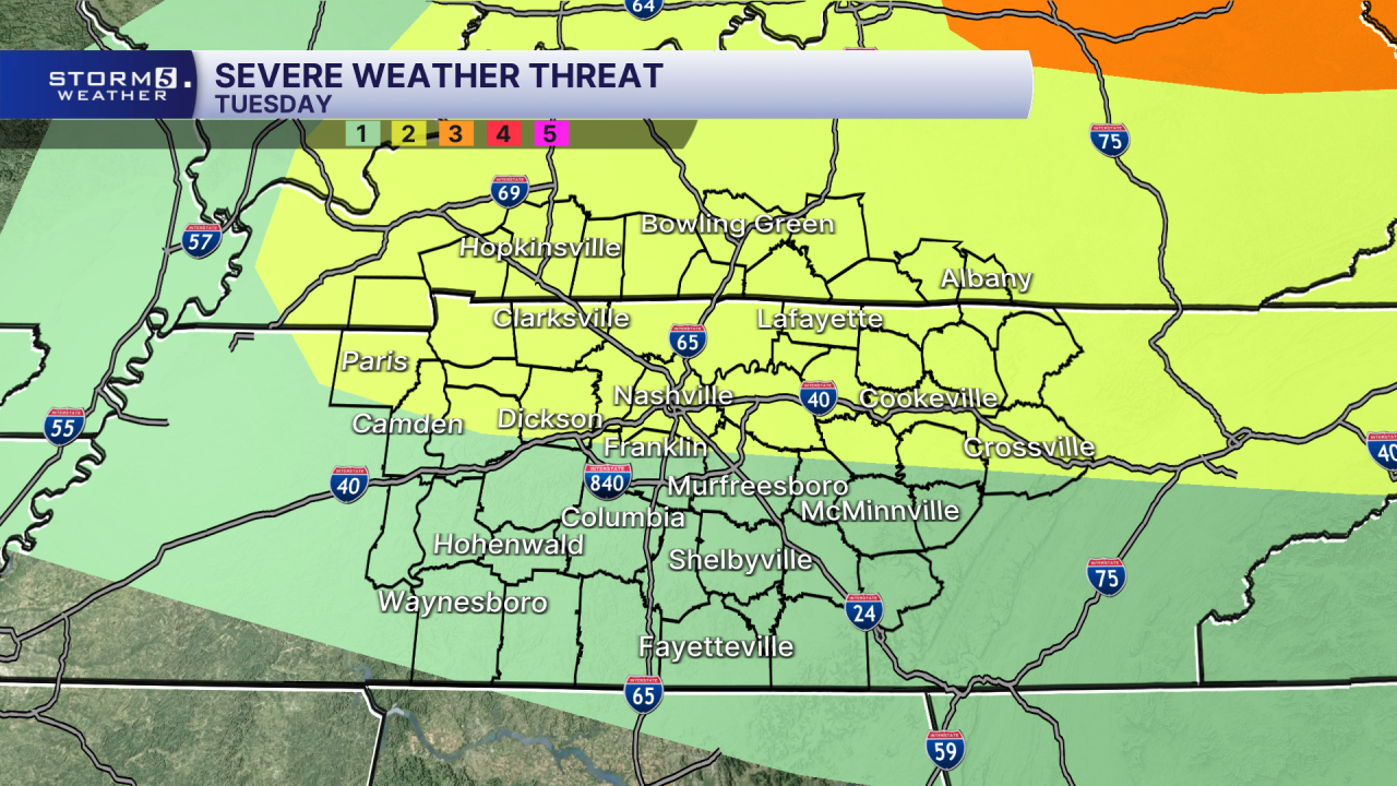
The main concern with storms Tuesday night will be damaging wind and heavy downpours that could lead to flash flooding. There is also a low end threat of an isolated tornado with storms.

