

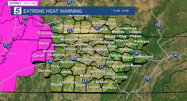
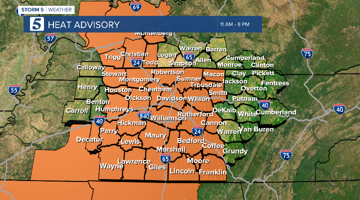
Heat Alerts Continue
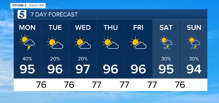
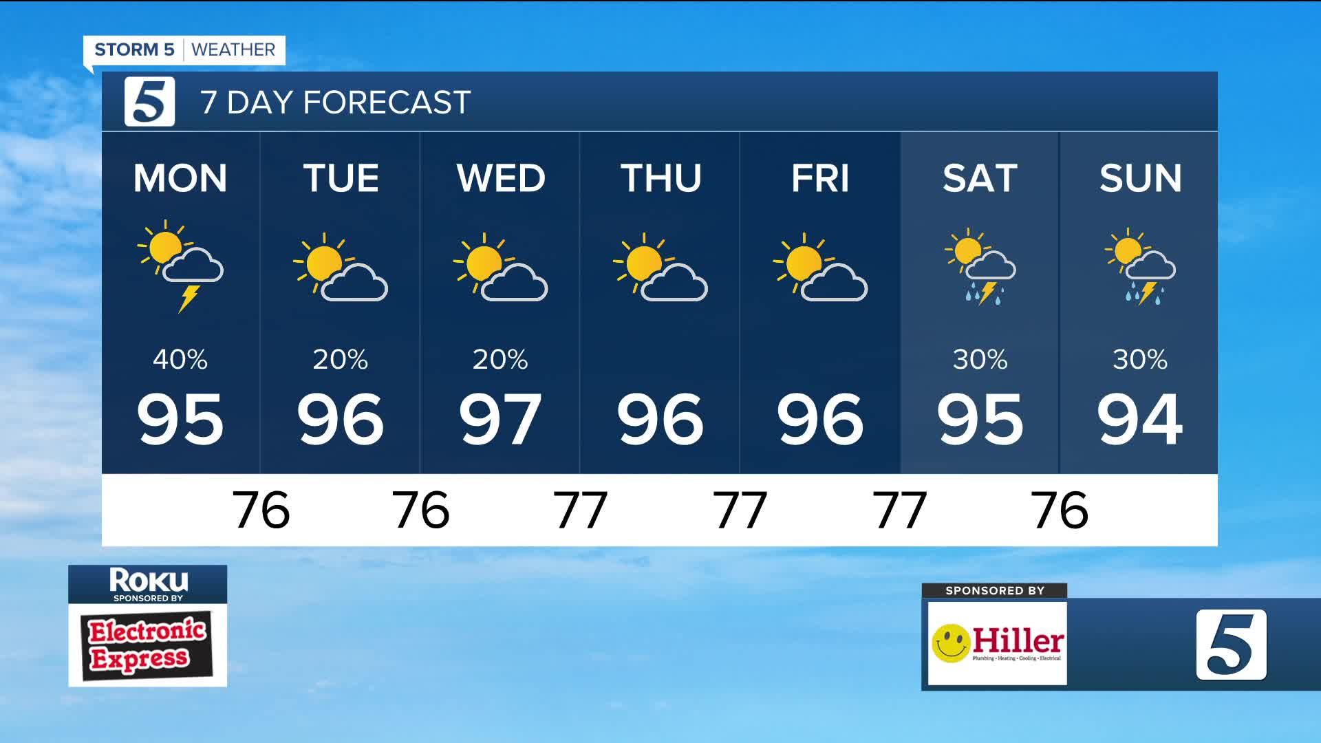
Forecast:
Monday: Partly Cloudy, Hot & Humid w/ Pop-Up Storms | High: 95 | WSW 3-8
Tonight: Partly Cloudy & Muggy | Low: 75 | E 1-6
In Depth:
The Heat Persists Across Middle Tennessee and Southern Kentucky!!
The relentless heat continues this afternoon, with both Heat Advisories and Excessive Heat Warnings in place across much of Middle Tennessee and Southern Kentucky.
What’s the difference?
- An Excessive Heat Warning is issued when heat index values are expected to reach 105–110°F for several consecutive hours.
- A Heat Advisory is issued when the heat index is expected to reach 100–105°F for an extended period.
These alerts are expected to remain in place through most of the workweek, so precautions should be taken to avoid heat-related illnesses.
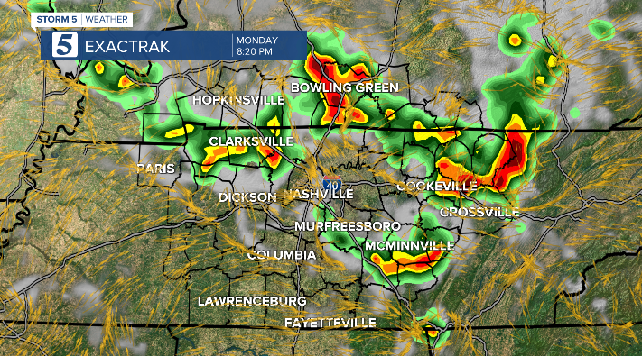
Some relief may arrive in the form of scattered showers and thunderstorms later today. A few of these storms could be strong, producing cloud-to-ground lightning, heavy rainfall capable of causing localized flooding, and gusty winds. Where storms develop, they will help temporarily cool temperatures, offering brief relief from the intense heat.
Tomorrow, rain chances will decrease, but heat index values will continue to climb during the afternoon hours.