
Weather

Actions

July 21, 2026: Storm 5 Alert - Dangerous Heat + Strong / Severe Storms

Nikki-Dee morning weather: Tuesday, July 21, 2026
Posted
and last updated

Storm 5 Alert This Afternoon Through Evening

Forecast:
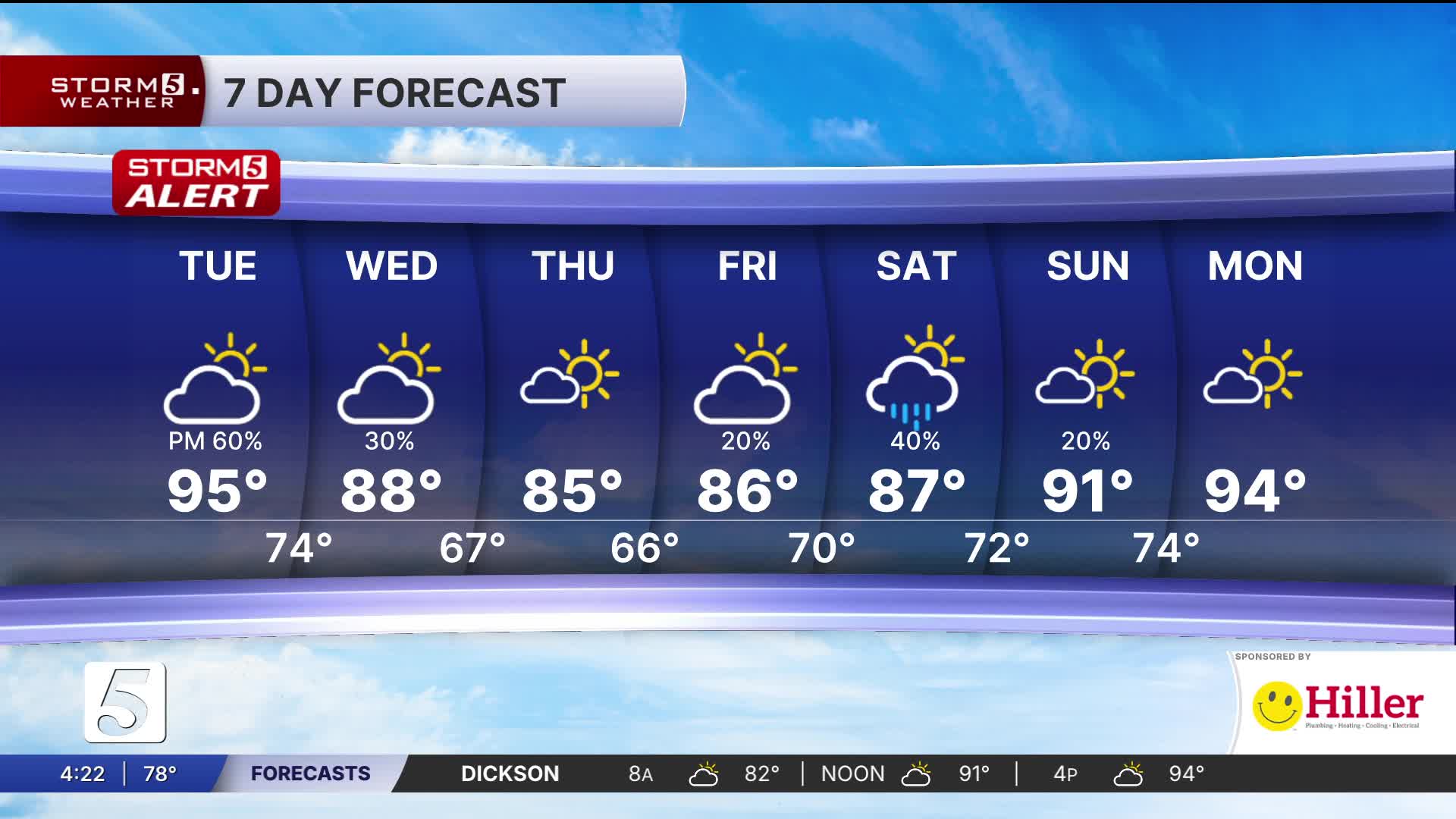
Today: Partly Cloudy, hot, and breezy with sct'd storms, higher chance late afternoon & evening | High: 95, Heat Index: 105-111 | SW 10-15
Tonight: Sct'd showers and storms| Low: 76 | N 10-15

In Depth:
Hottest Day of the Week Followed by Overnight Severe Storm Threat
It's going to be hotter than yesterday! In fact, today will be the hottest day of the week, with afternoon highs climbing into the low to mid 90s. But it's not just the air temperature you'll notice ... We have high dewpoints which will make it feel even hotter.

Everyone across the area is under either an Extreme Heat Warning (heat index of 110°+) or a Heat Advisory (heat index of 106°+) through this evening. If you have to be outdoors, take frequent breaks, stay hydrated, and check on those who may be more vulnerable to the heat.

As we head toward sunset, a cold front will begin moving along the Kentucky-Tennessee state line before pushing south overnight. Showers and thunderstorms will develop along the front and move into Middle Tennessee through the overnight hours and into early Wednesday morning.

While that timing isn't ideal, it's important to stay weather-aware as there is the potential for severe storms and flash flooding. The soil can only absorb so much water. Once it reaches that point, any additional rainfall quickly runs off into creeks, streams, roads, and other low-lying areas, increasing the risk of flash flooding.

Other risk includes, damaging wind gusts, and a brief spin-up tornado cannot be ruled out, especially for locations north of I 40.

The good news is that conditions improve behind the front. Wednesday will be noticeably cooler than today, although it will still feel somewhat humid with a few lingering showers possible.

By Thursday, we'll get a taste of early spring. Much lower humidity, refreshing dew points, and afternoon highs in the low to mid 80s will make for a much more comfortable end to the workweek.