

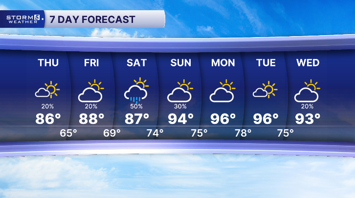


A Refreshing Break from the Heat
Forecast:
Tonight: Mostly Clear |Low: 65 | Light
Today: Mo. Sunny, Less Humid |High: 86| N 5
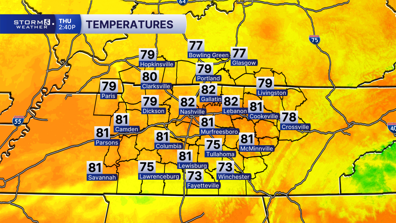
After days of heat and storms, we're finally getting a break through the rest of the work week. A cold front has pushed south into Alabama, bringing relief from the toasty temps. Aside from a few lingering sprinkles near the Tennessee/Alabama border, most areas are dry.
Some patchy fog could develop late tonight, mainly near water, and across the Cumberland Plateau.
Friday will stay mostly dry with partly cloudy skies and afternoon highs in the mid to upper 80s.

Rain and thunderstorms are expected to return early Saturday as another weather system moves though. The highest chance for rain will be during the morning, with showers and storms gradually tapering off later in the day. Severe weather is not expected but heavy downpours could lead to localized flooding.
Drier weather returns Sunday, along with hotter highs!
