

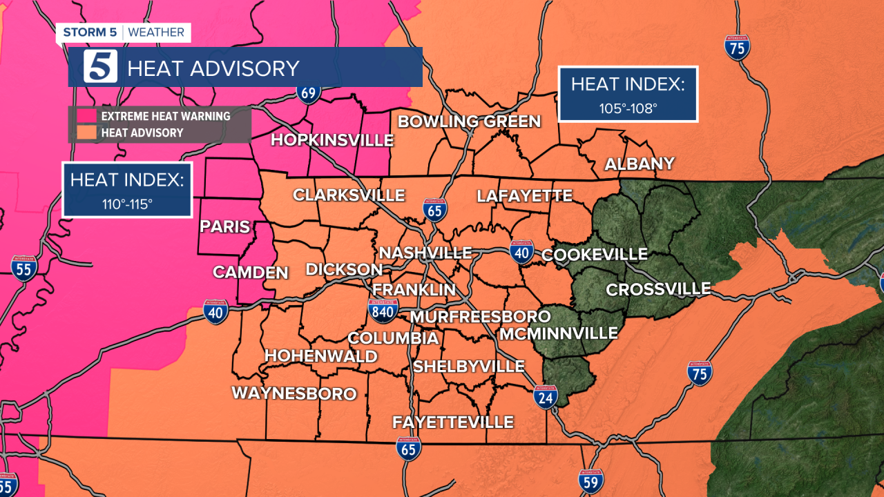
Heat Advisory for Middle Tennessee & Part of Kentucky
Extreme Heat Warning for West TN & Western Kentucky
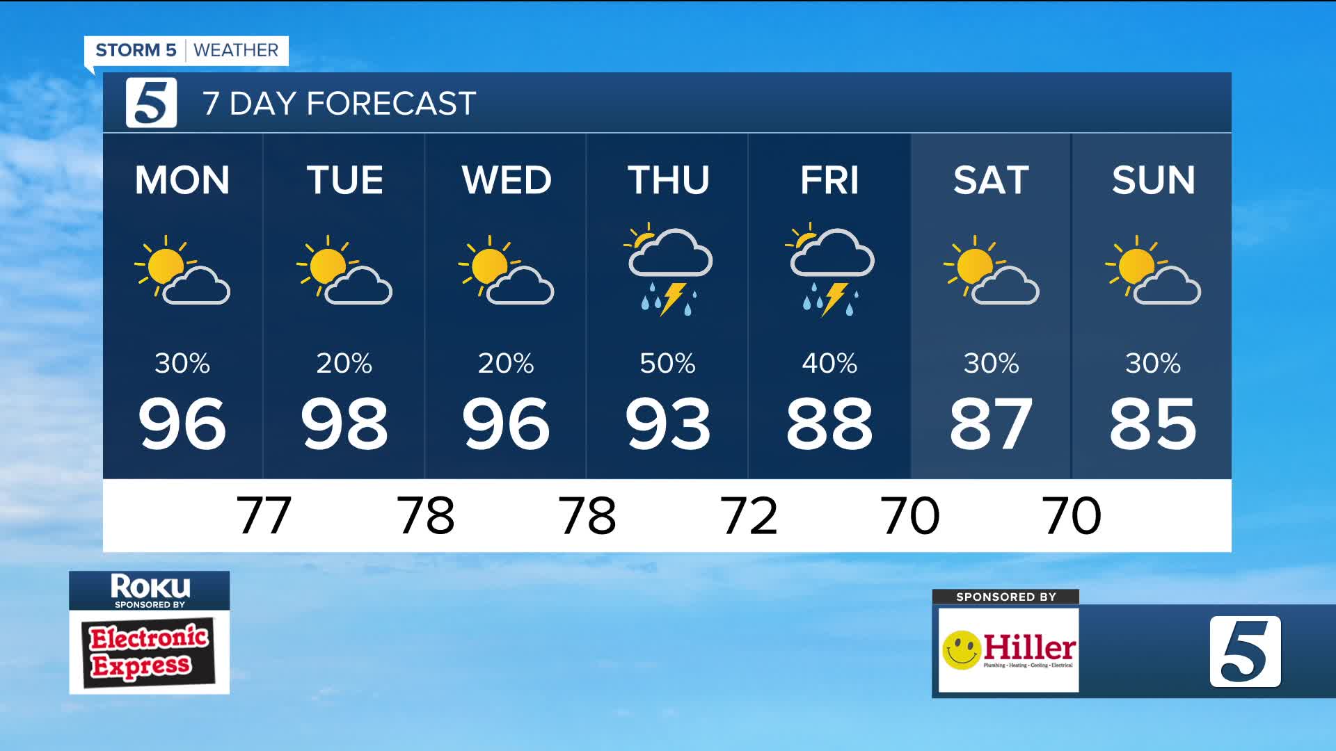
Forecast:
Tonight: Pt. Cloudy, Few Showers/Storms Early |Low: 77|
W-5 then Light & Variable
Tomorrow: Hot & Humid, 20% Shower & Storm Ch. |High: 98,
Heat Index: 105-110, Higher in West TN |N-5
In Depth:
The high pressure heat dome will re-assert itself over the region
this week, and that means our afternoon temperatures could
flirt with 100 degrees a couple of days. That has prompted Heat
Advisory and Extreme Heat Warnings for most of our area for a
couple of days.
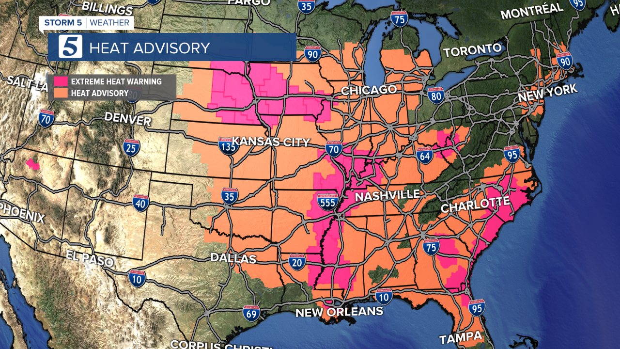
Heat alerts cover most of the eastern U.S.
Heat relief is in sight! A cold front will increase our rain and storm chances
for a few days by Thursday with highs in the 80s by Friday.