STORM 5 ALERT TODAY
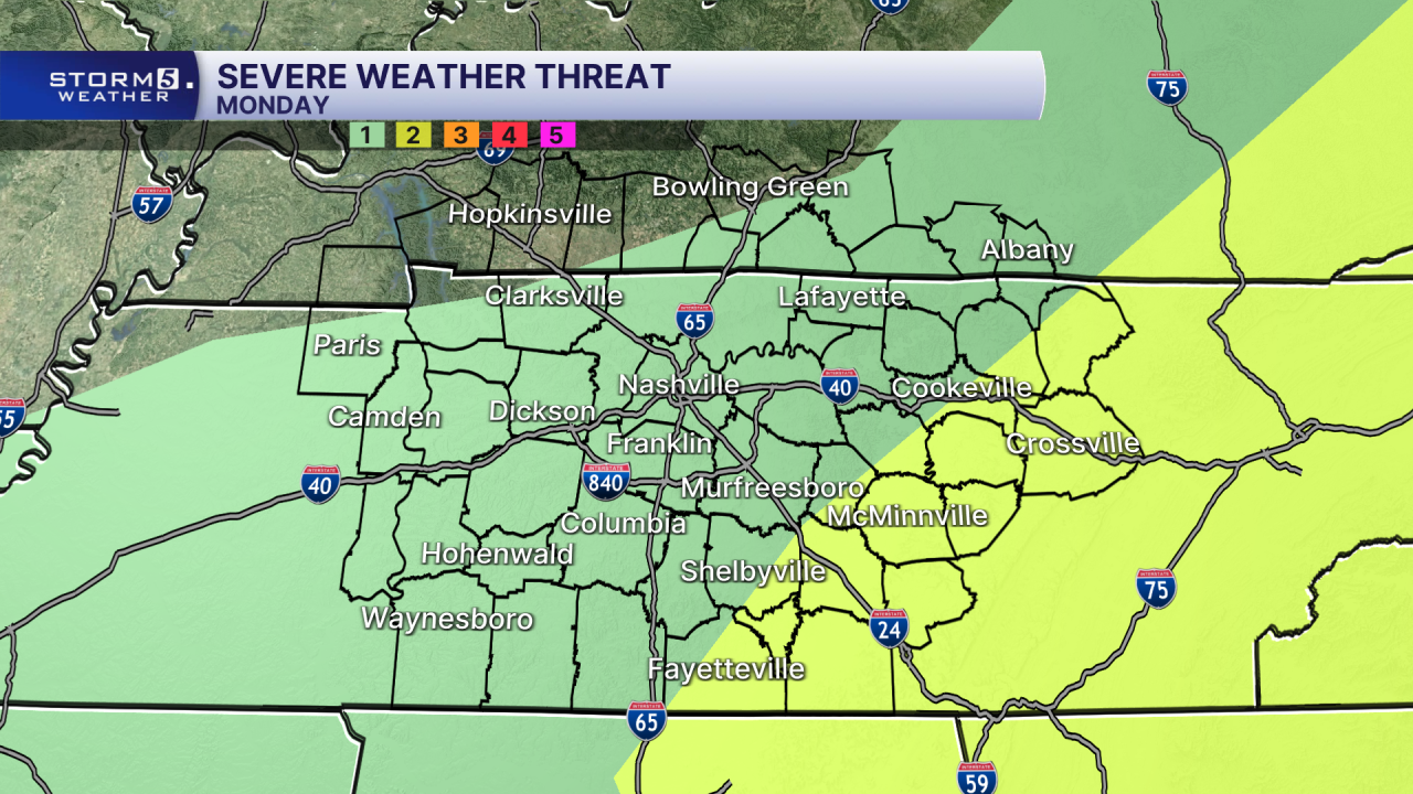
THREATS/IMPACTS: Damaging Wind, Heavy Downpours, Low Threat for Small Hail, Isolated Tornadoes
We are watching a cold front to our North that will bring rain and storms to the area today. The latest model updates, keep a bulk of the overnight convection in West Tennessee, with scattered showers over the mid-state through mid morning.
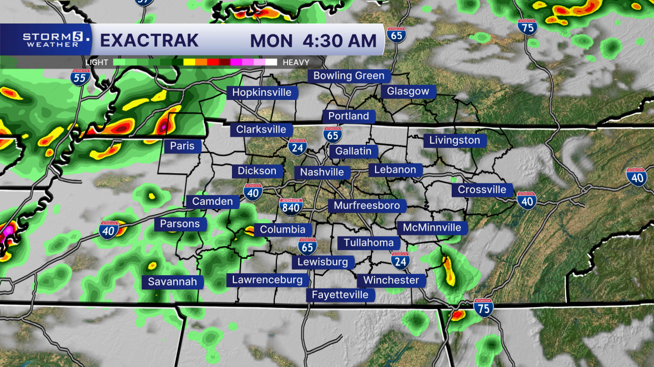
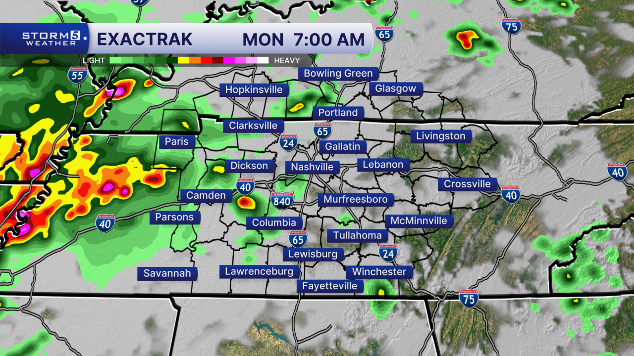
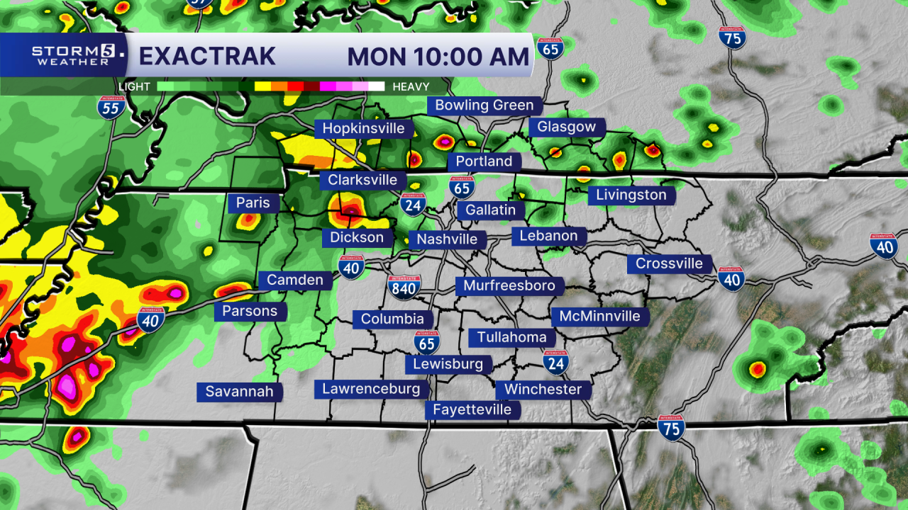
We are expecting a squall line to develop in Western TN around midday and track east into the evening hours. Making for a bumpy evening drive across the area.
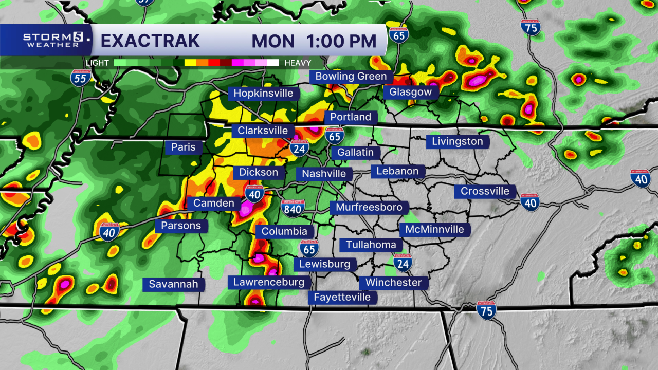
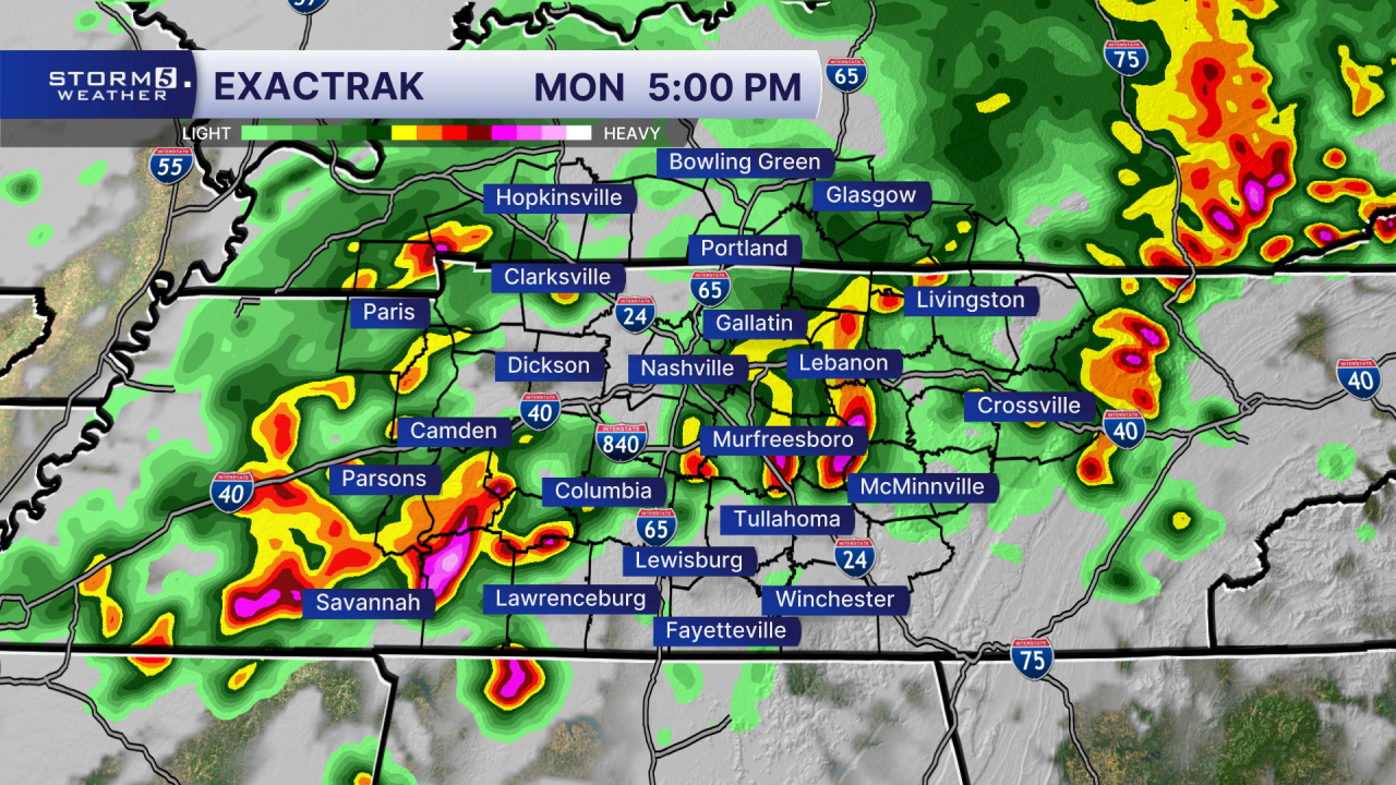
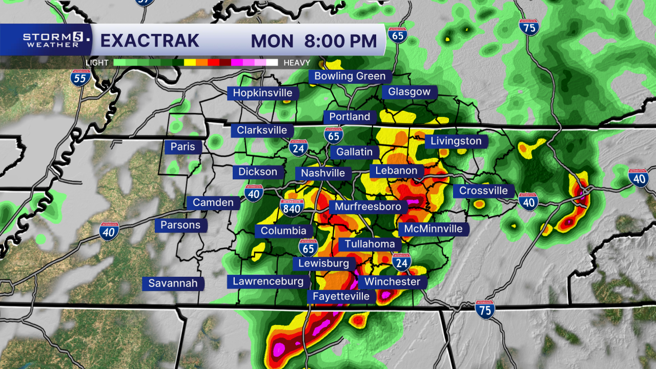
The primary threats are damaging straight-line winds and heavy downpours. The threat for small hail and a brief spin-up tornado cannot be ruled out, though both are considered extremely low probability.
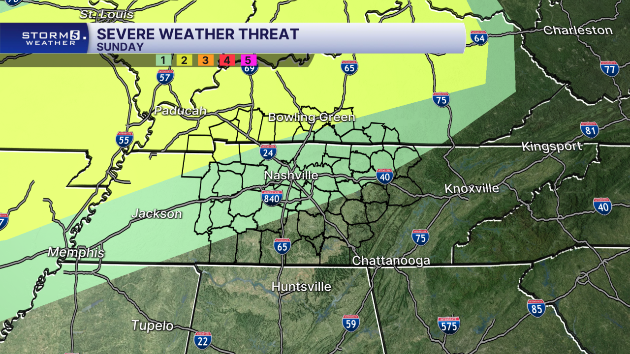
As with any severe weather threat we urge you to have multiple ways to receive severe weather alerts overnight. A weather radio is one option. Storm 5 WeatherCall is another, delivering text messages or phone calls to subscribers who are in the path of dangerous weather. The service also includes a GPS option, allowing travelers to receive alerts on the go. Storm 5 WeatherCall is subscription-based at $15 per year, or just over $1 per month.

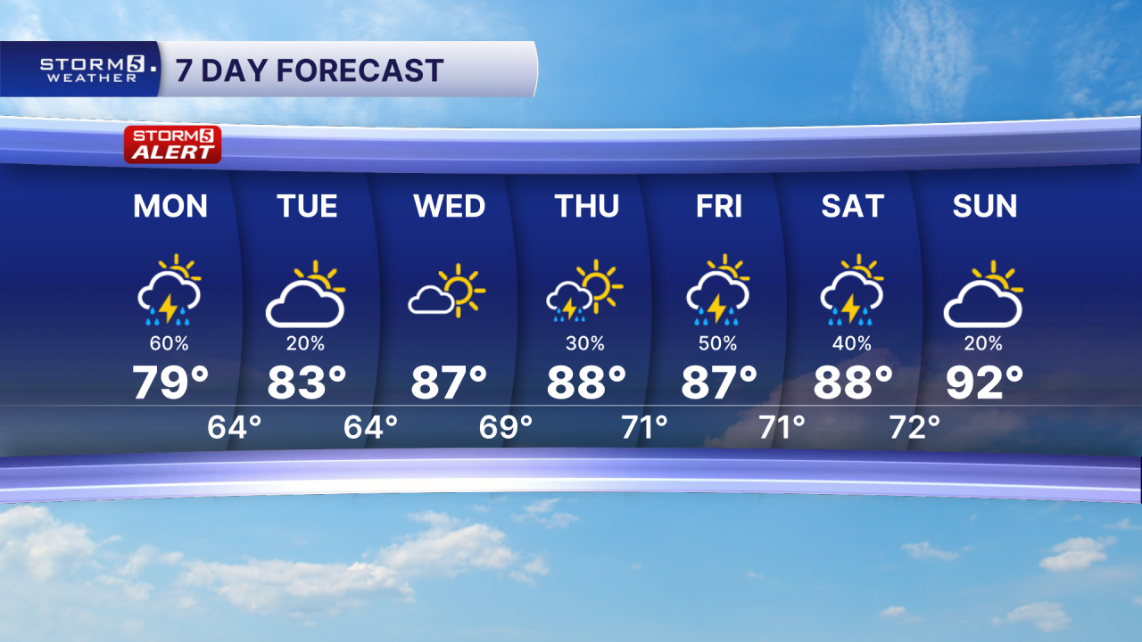
Tuesday is looking beautiful with partly cloudy skies and cooler temperatures. Temperatures warm back into the upper 80s starting Wednesday with rain chances increasing late week.