


Slow-Moving Storms Could Cause Flooding
Forecast:
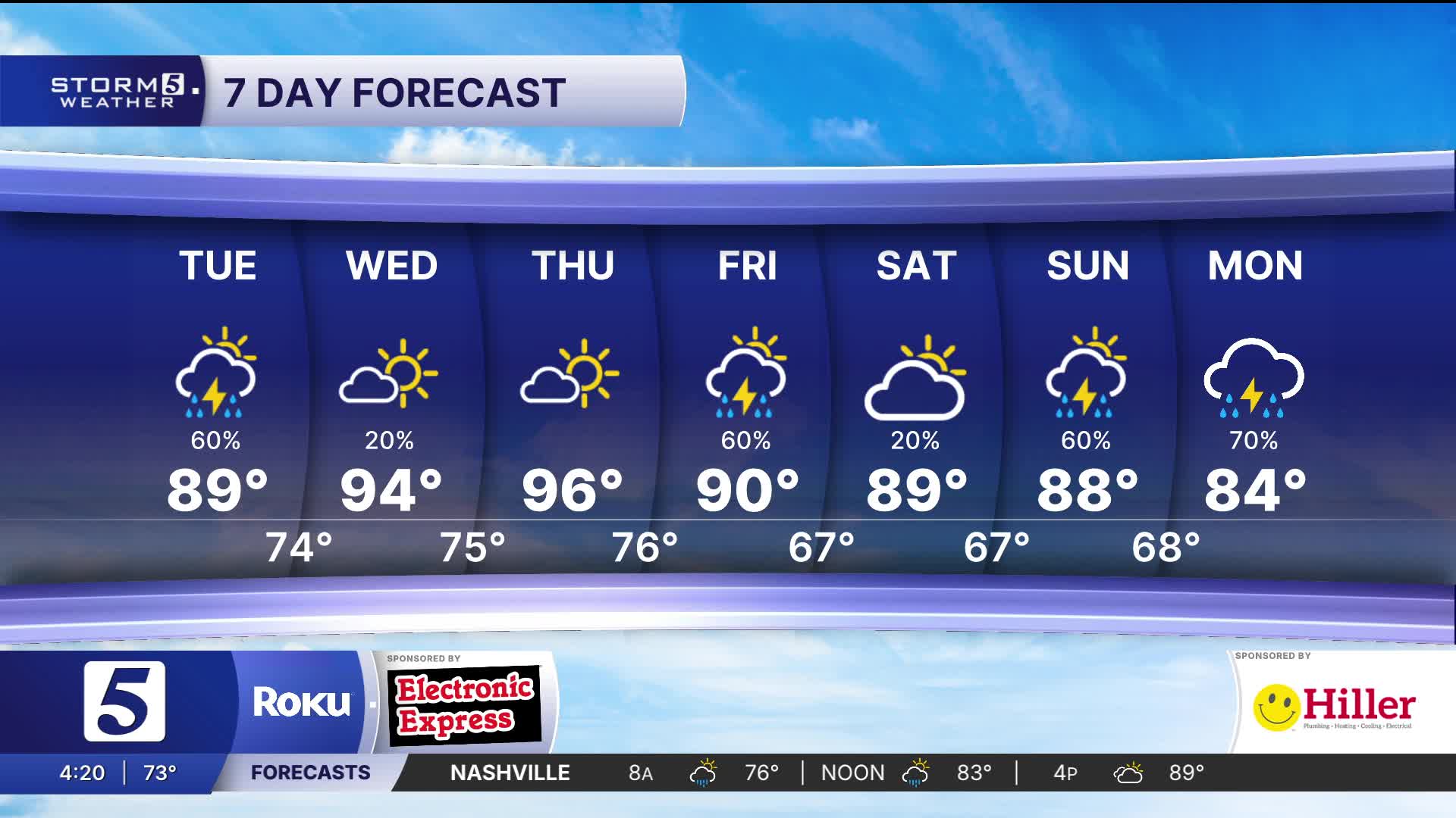
Today: Mix of Sun & Clouds, Scattered Showers & Storms |High: 89| SW 5-10
Tonight: Warm & Humid, Scattered Showers & Storms |Low: 74| S 5-10
In Depth:
We have another hot, humid, and wet day ahead. Showers and thunderstorms will move across Middle Tennessee and Southern Kentucky , like yesterday, some of these cells will be slow movers, dumping large amounts of rain, causing potential flash flood issues. Hence, why we have a Flood Watch through the afternoon.

As far as other severe issues, we cannot rule out a few strong / severe storms, damaging winds will be the primary threat with locally heavy downpours and frequent lightning.

Today (North & West), Wednesday, and Thursday, the heat index will feel like 100+ degrees.

A cold front will move through Friday, bringing another chance for showers and thunderstorms.

Temperatures will drop back into the upper 80s by Saturday.
